Weather
Calm Weather Won't Last Long In Tucson, With Storms Possible Before The Weekend
A quieter start to the week in the Tucson area will give way to a changing forecast by late Wednesday and Thursday.

TUCSON, AZ — Tucson's mild start to the week has an expiration date, according to forecasters.
Lighter winds and warming temperatures are on the way, but a late-week storm system could bring showers to southern Arizona before a drier, warmer weekend arrives, according to the National Weather Service in Tucson.
The first half of the week looks quiet. Winds will be noticeably calmer than they were over the weekend, though some afternoon gustiness is still expected east of Tucson.
Find out what's happening in Tucsonfor free with the latest updates from Patch.
Skies were clear across southern Arizona early Monday, and temperatures are expected to warm to near normal by Tuesday and hold there for much of the week.
Wednesday is when things start to get interesting. Moisture is expected to increase from the south as a storm system approaches southern California and northern Baja.
Find out what's happening in Tucsonfor free with the latest updates from Patch.
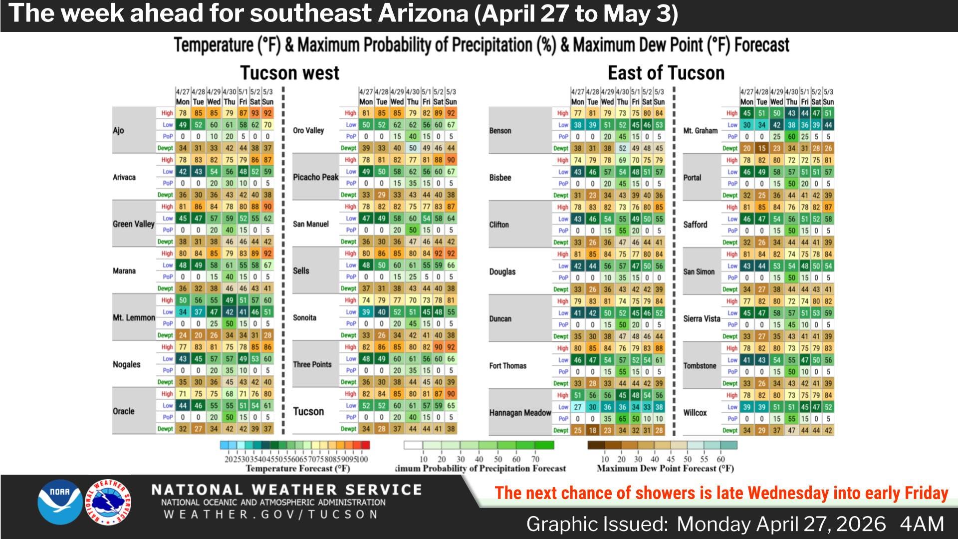
Late Wednesday could bring the appearance of rain without much actually falling, as most precipitation is expected to evaporate before reaching the ground. A few sprinkles are possible after sunset, though forecasters have tempered expectations for Wednesday night into Thursday morning.
Thursday is the most uncertain day of the forecast. Shower chances are expected to climb to 20 to 45 percent in valley areas and 25 to 60 percent in the mountains.
A few thunderstorms can't be ruled out as a mid-level cold pool moves through, and lingering light showers are possible in eastern areas into Friday.
The weather service noted the forecast for Wednesday and Thursday will continue to evolve as the system gets closer.
Get more local news delivered straight to your inbox. Sign up for free Patch newsletters and alerts.