Weather
Category 5 Hurricane Polo Could Send Rain, Dangerous Surf To Battered SoCal
Polo rapidly strengthened into a rare Category 5 hurricane Tuesday. Forecasters warned it could bring "extremely dangerous" impacts.


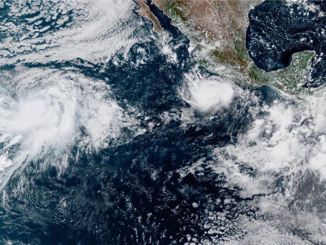
LOS ANGELES, CA — Hurricane Polo rapidly strengthened into a rare Category 5 storm off the coast of Mexico Tuesday morning, raising the possibility of another round of large surf, dangerous rip currents and tropical moisture in Southern California later this week.
Exactly what Polo will mean for the region remains highly uncertain, however, and National Weather Service forecasts do not currently call for widespread rain in Southern California.
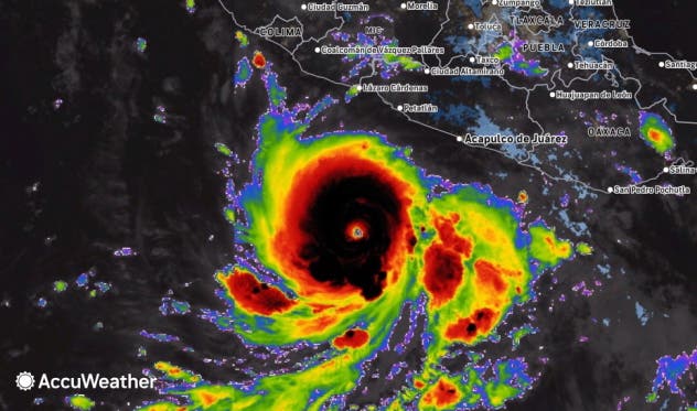
As of Tuesday morning, Polo had maximum sustained winds of 165 mph and was drifting north at about 2 mph off southwestern Mexico, according to the National Hurricane Center, which warned the storm could bring "extremely dangerous" impacts to Mexico.
Find out what's happening in Los Angelesfor free with the latest updates from Patch.
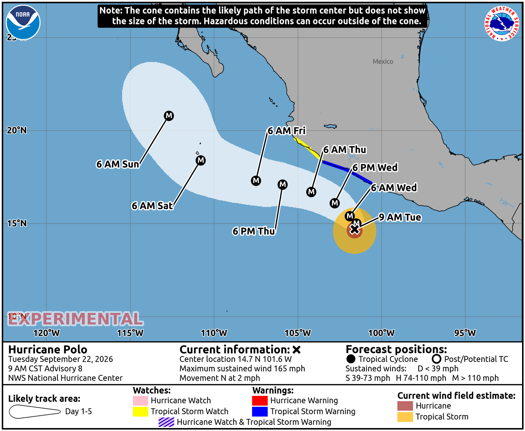
The storm is expected to turn toward the northwest Wednesday, with its core forecast to remain offshore as it tracks near southwestern Mexico over the next several days, dumping up to 8 inches of rain over parts of Guerrero and Michoacán through Thursday, creating a risk of life-threatening flooding and mudslides.
Impact For SoCal
The National Weather Service said Polo and another cyclone, Tropical Storm Odalys, could send another round of swells toward the region by early next week, potentially producing large surf and dangerous rip currents along south- and southwest-facing beaches.
Find out what's happening in Los Angelesfor free with the latest updates from Patch.
Increasing mid- and high-level clouds could also arrive ahead of the tropical systems, forecasters said.
The potential rough surf comes after repeated southern swells have already taken a toll on parts of the coastline this year.
Laguna Beach, Dana Point, Carlsbad and Malibu have declared local emergencies or issued warnings amid coastal erosion and sand loss associated with recent tropical storm-driven surf. Those same beach communities are especially vulnerable to swells from Hurricane Polo.
Hurricane Marie most recently generated powerful waves and helped bring unusually warm and humid tropical air into Southern California earlier this month.
National Weather Service meteorologist Dave Munyan told Patch that there's a huge deal of uncertainty based on current forecast modeling.
But in one worst case scenario for SoCal, Polo could draw tropical moisture northward, leading to "something similar to the nearby passage of what was Hurricane Marie," he said.
Rain is more uncertain.
Depending on the storm's trajectory, the remnants of Polo could bring rain showers to the region by the middle of next week, Munyan said.
Additionally, the National Weather Service said Tuesday that a weak low-pressure system near northern Baja could pull some monsoonal moisture into southwestern California on Thursday, bringing a slight chance of afternoon showers and thunderstorms in the mountains.
That system is expected to move inland Thursday, followed by drier air Friday and Saturday.
Forecasters in the San Diego National Weather Service office said no hazardous marine conditions were expected in its coastal waters through Saturday.
Farther north, the Los Angeles office is forecasting generally dry weather Friday through Sunday before a trough moves through California and brings cooler temperatures.
That means any significant rain tied to Polo would depend on how the hurricane interacts with the larger weather pattern over the eastern Pacific and West Coast.
The San Francisco Chronicle reported that uncertainty is especially high because Tropical Storm Odalys is also in the eastern Pacific and could interact with Polo as another upper-level storm system moves down the West Coast.
Some computer models have suggested the upper-level system could eventually pull the tropical systems or their moisture closer to land, according to the Chronicle, while other scenarios keep the most significant effects farther offshore.
Forecasters expect better clarity as the systems evolve over the next several days.
"It's just something to keep an eye on — see how things trend over the next three or four days. By then we should have an among of increased confidence," Munyan said.
The uncertainty comes as California prepares for what state officials say could be an exceptionally strong El Niño.
Gov. Gavin Newsom declared a statewide state of emergency Monday to help California prepare for potential winter storms, flooding, high surf and other effects associated with El Niño.
Get more local news delivered straight to your inbox. Sign up for free Patch newsletters and alerts.