Weather
Developing Storm To Produce Significant Weather Impacts On CT
Find out when the current stretch of spring-like temperatures will come to an end.


Enjoy the sunshine and warm weather in Connecticut, as a coastal storm is expected to bring big changes this weekend, according to meteorologists.
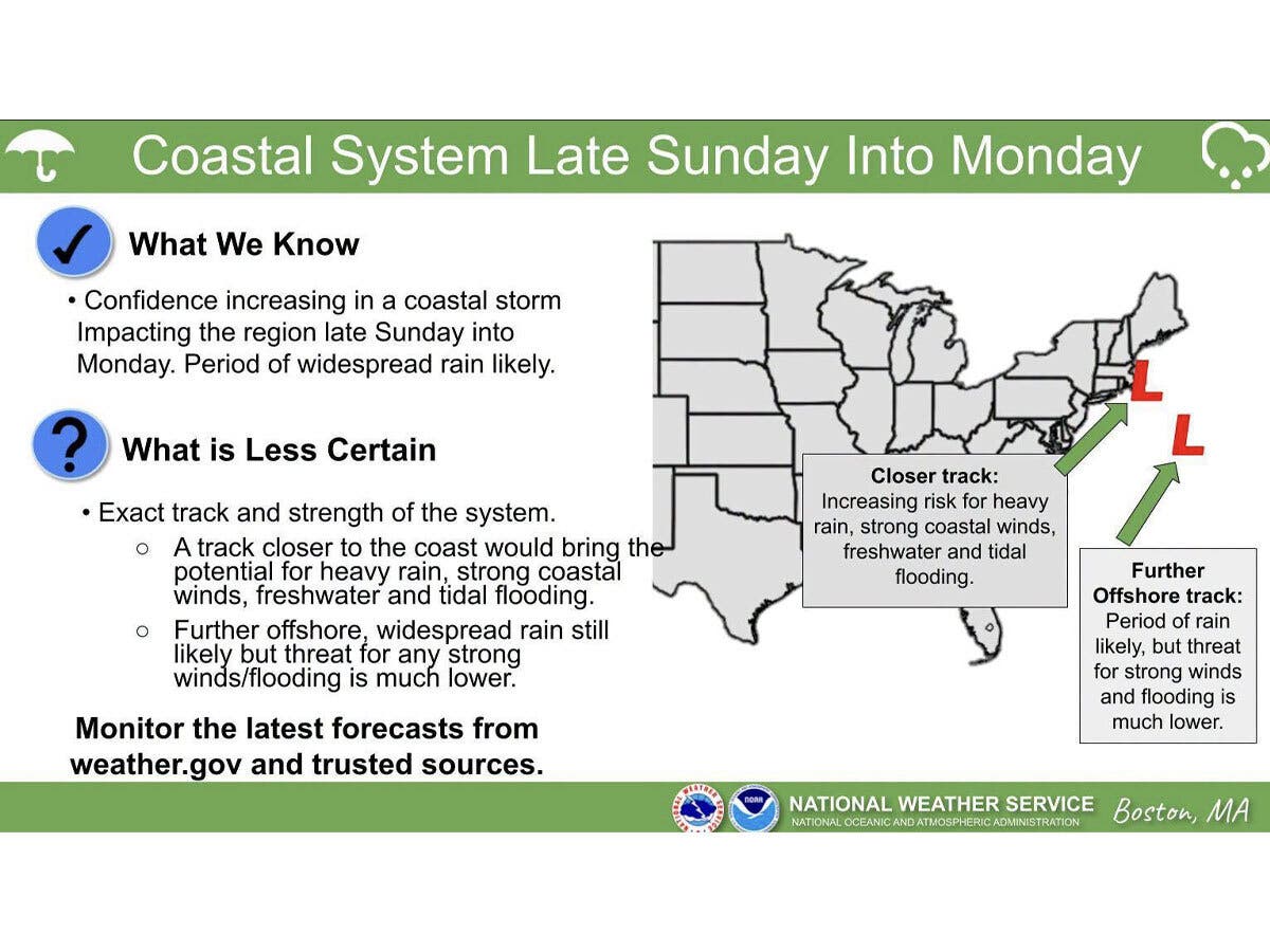
The National Weather Service in Boston reports confidence is increasing that a coastal storm will impact the region late Sunday and into Monday.
“The potential exists for heavy rain, strong coastal winds and freshwater/tidal flooding depending on the exact track/intensity, which is uncertain at this time,” the National Weather Service said.
Find out what's happening in Across Connecticutfor free with the latest updates from Patch.
It is currently predicting widespread rain starting late Sunday and lasting into Monday.
As of Thursday morning, meteorologists are still monitoring the exact track of the storm system. The closer it gets to the coast, the higher the potential for heavy rain, coastal winds and freshwater and tidal flooding, the National Weather Service said. If the system tracks further offshore, its meteorologists report widespread rain will still be in the forecast, but the likelihood of strong winds and flooding will decrease.
Find out what's happening in Across Connecticutfor free with the latest updates from Patch.
WTNH’s meteorologists currently are predicting Sunday will be dry during the day, with rain arriving at night, followed by “heavy rain and gusty winds” on Monday, especially in the morning.
WFSB says Sunday will see increasing cloudiness with the approach of the storm system.
“We think the daylight hours will be dry with rain becoming likely after sunset,” WFSB reports. “Rain could be steady, even heavy at night, thanks to a tropical connection to a developing area of low pressure north of the Bahamas.”
WFSB predicts Monday will have potentially heavy rain early, followed by clearing in the afternoon.
In the short term, the National Weather Service’s forecast is for dry and unseasonably mild weather today through Saturday. Daytime highs will reach into the 60s through Saturday. The temperatures will dip to the upper 50s on Sunday and Monday.
Looking ahead to next week, cooler air moves into Connecticut following the Sunday to Monday storm system, with daytime highs in the 40s starting on Tuesday.
Read More:
- Flying Brake Parts Caused Fatal Crash, ID Released: State Police
- Student Critically Injured After Being Struck By Vehicle In Front Of School: Police
- Worker Seriously Injured After Being Struck By Large Tree: Officials
Here are the forecast details for northern Connecticut via the National Weather Service:
Today: Sunny, with a high near 65. Light southwest wind.
Tonight: Mostly clear, with a low around 30. Light and variable wind.
Friday: Sunny, with a high near 65. Calm wind becoming west around 6 mph in the afternoon.
Friday Night: Mostly clear, with a low around 38. Calm wind.
Saturday: Sunny, with a high near 60. Calm wind.
Saturday Night: Partly cloudy, with a low around 39. Light and variable wind.
Sunday: Mostly cloudy, with a high near 58. Light and variable wind.
Sunday Night: Rain, mainly after 7 p.m. The rain could be heavy at times. Low around 48. Calm wind becoming north 5 to 7 mph after midnight. Chance of precipitation is 80%.
Monday: Rain likely, mainly before noon. The rain could be heavy at times. Mostly cloudy, with a high near 59. Northwest wind 8 to 15 mph, with gusts as high as 26 mph. Chance of precipitation is 70%.
Here are the forecast details for southern Connecticut via the National Weather Service:
Today: Sunny, with a high near 60. Southwest wind 3 to 5 mph.
Tonight: Mostly clear, with a low around 40. Light west wind.
Friday: Sunny, with a high near 63. West wind 3 to 7 mph.
Friday Night: Clear, with a low around 38. Calm wind.
Saturday: Sunny, with a high near 58. Light and variable wind becoming east around 5 mph.
Saturday Night: Mostly cloudy, with a low around 43.
Sunday: A 30 percent chance of rain after 1 p.m. Mostly cloudy, with a high near 60.
Sunday Night: Rain likely. Cloudy, with a low around 49. Chance of precipitation is 70%.
Monday: A 40 percent chance of rain before 1 p.m. Mostly cloudy, with a high near 60.