Weather
Hazardous Weather Outlook Issued For Southern Connecticut: Here's Why, What To Know
Find out the latest on potentially stormy weather, and the weekend forecast.


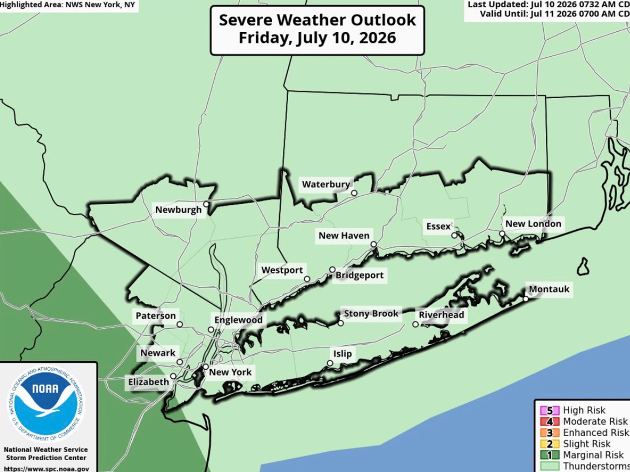
A hazardous weather outlook has been issued for southern Connecticut due to the potential for isolated strong to severe thunderstorms today.
Fairfield, New Haven, Middlesex, and New London counties are included in the alert.
The anticipated timing for any showers and potential storms is late this afternoon and evening, according to the National Weather Service.
Find out what's happening in Across Connecticutfor free with the latest updates from Patch.
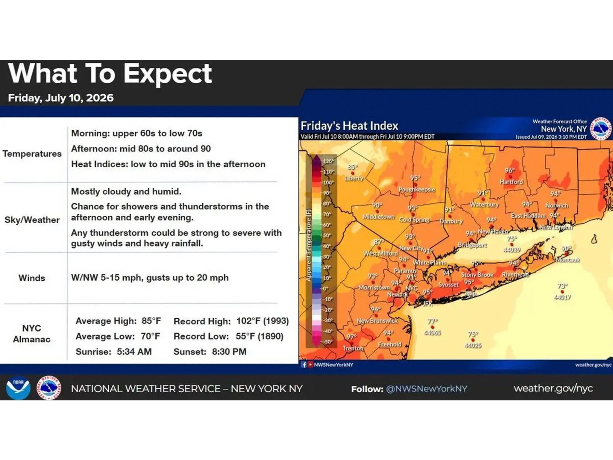
Today will become increasingly warm and muggy, with high temperatures in the upper 80s. The humidity will make it feel like it is in the low to mid 90s this afternoon.
“Any thunderstorm could be strong to severe with gusty winds and heavy rainfall,” the National Weather Service said. “Remember, if you can hear thunder, you are close enough to be struck by lightning.”
Find out what's happening in Across Connecticutfor free with the latest updates from Patch.
WFSB reports a cold front will move through Connecticut later today, bringing a “chance of a few storms late this afternoon through the evening hours.”
“They’ll be isolated but could be a bit strong, possibly even severe with downpours and lightning,” WFSB predicts.
Weekend outlook
The National Weather Service predicts both Saturday and Sunday will be dry and sunny days, with highs reaching the mid-80s.
“By July-standards, it will be pleasant... mugginess will not be much of a factor at all,” WFSB reports. “Overall, a great weekend for any outdoor plans!”
According to WFSB, early next week will start out similar to the weekend, then temperatures and humidity will rise again by midweek, bringing the potential for another heat wave.
Read More:
- A-List Celebrity Makes Surprise Stop At Local Business In CT
- Famous TV Star Spotted Dining At Popular Restaurant
- Famous Singer Issues Apology To Connecticut
Here are the forecast details for southern Connecticut via the National Weather Service:
Today: A 20 percent chance of showers and thunderstorms after 2 p.m. Partly sunny, with a high near 89. Northwest wind 3 to 7 mph.
Tonight: A slight chance of showers and thunderstorms. Patchy fog after 2 a.m. Otherwise, mostly cloudy, with a low around 68. Light and variable wind. Chance of precipitation is 20%.
Saturday: Partly sunny, with a high near 84. Northeast wind around 7 mph becoming east in the afternoon.
Saturday Night: Mostly clear, with a low around 64. Calm wind.
Sunday: Sunny, with a high near 84. North wind around 6 mph becoming light and variable in the afternoon.
Sunday Night: Mostly clear, with a low around 65.
Monday: Sunny, with a high near 86.
Get more local news delivered straight to your inbox. Sign up for free Patch newsletters and alerts.