Weather
Severe Weather Threat Increasing For CT: Here's Timeline Of Concern
Find out when thunderstorms are expected to impact the state, according to meteorologists.


A hazardous weather outlook has been issued for southern Connecticut for today and tonight due to a thunderstorm risk.
“Scattered strong to severe thunderstorms are possible with a squall line that is forecast to move through,” the National Weather Service said. “Isolated severe thunderstorms are possible across much of southern New England this afternoon and evening.”
Timeline for storms
Find out what's happening in Across Connecticutfor free with the latest updates from Patch.
The start time of the squall line will be between 5 p.m. and 7 p.m., and it will continue to impact the state into later this evening.
The National Weather Service’s Storm Prediction Center has placed most of the area in a slight risk (2 out of 5) for severe storms, with a marginal risk (1 out of 5) for eastern areas.
Find out what's happening in Across Connecticutfor free with the latest updates from Patch.
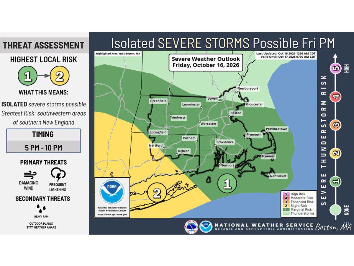
Much of this morning will be rainy, with the thunderstorm risk beginning after 5 p.m. and lasting until around 10 p.m., according to the National Weather Service.
It predicts showers this morning will be followed by a lull in the precipitation mid-day and early afternoon.
“A strong cold front moving across the region could bring a line of strong to severe thunderstorms later in the day, with the greatest concern between 5 p.m. and 10 p.m.,” the National Weather Service said.
Heavy rainfall, damaging wind gusts, and lightning will be the primary concerns, according to the National Weather Service.
WTNH predicts the likeliest timing for severe weather will be in the 5 p.m. to 8 p.m. timeframe.
“Widespread severe weather is not expected, but any storm that develops could produce a briefly strong wind gust of up to 60 mph, along with locally heavy downpours, and frequent cloud to ground lightning,” WTNH reports.
WFSB is calling today a “First Alert Weather Day,” due to the storm threat.
It predicts the timeline for possible strong to severe storms will be around the evening commute.
“In addition to lightning, damaging wind gusts are a concern. Overall, the threat diminishes as storms move east across CT, from 5 to 9 p.m.,” WFSB reports.
Weekend looks cool but dry
The National Weather Service is forecasting dry weather from Saturday through Tuesday, with daily high temperatures in the 50s through Monday, and in the 60s on Tuesday. Patchy frost is expected in northern areas this weekend due to nighttime temperatures dipping into the 30s, according to the National Weather Service.
Read More:
- Teen Found On Side Of Road Seriously Injured, Police Investigate
- Armed Road Rage Incident Spills From Highway Into Dunkin' Lot: Police
- Top Official Recovering From ATV Accident
Here are the forecast details for southern Connecticut via the National Weather Service:
Today: Showers, with thunderstorms also possible after 5 p.m. High near 71. Southwest wind around 11 mph, with gusts as high as 23 mph. Chance of precipitation is 100%. New rainfall amounts between a tenth and quarter of an inch, except higher amounts possible in thunderstorms.
Tonight: Showers likely and possibly a thunderstorm before 11 p.m., then a chance of showers. Mostly cloudy, with a low around 43. West wind 7 to 10 mph becoming northwest after midnight. Winds could gust as high as 20 mph. Chance of precipitation is 70%. New precipitation amounts between a tenth and quarter of an inch, except higher amounts possible in thunderstorms.
Saturday: Cloudy through mid morning, then gradual clearing, with a high near 53. Northwest wind 13 to 16 mph.
Saturday Night: Clear, with a low around 35. North wind 7 to 9 mph.
Sunday: Sunny, with a high near 56. North wind 5 to 8 mph.
Sunday Night: Mostly clear, with a low around 40.
Monday: Mostly sunny, with a high near 59.
Monday Night: Partly cloudy, with a low around 43.
Tuesday: Mostly sunny, with a high near 63.
Here are the forecast details for northern Connecticut via the National Weather Service:
Today: Showers before 4 p.m., then a chance of showers after 5 p.m. High near 68. South wind around 8 mph, with gusts as high as 24 mph. Chance of precipitation is 100%. New precipitation amounts between a tenth and quarter of an inch possible.
Tonight: Showers and thunderstorms before 9 p.m., then a chance of showers between 9 p.m. and 11 p.m. Some of the storms could produce heavy rainfall. Patchy fog between 7 p.m. and 8 p.m. Low around 47. Northwest wind 8 to 14 mph. Chance of precipitation is 80%. New precipitation amounts between a quarter and half of an inch possible.
Saturday: Mostly cloudy, then gradually becoming sunny, with a high near 53. North wind around 15 mph, with gusts as high as 28 mph.
Saturday Night: Patchy frost after 11 p.m. Otherwise, clear, with a low around 30. North wind 5 to 9 mph becoming light after midnight.
Sunday: Areas of frost before 10 a.m. Otherwise, sunny, with a high near 56. Calm wind becoming west around 5 mph in the afternoon.
Sunday Night: Patchy frost after 4 a.m. Otherwise, mostly clear, with a low around 34. Light south wind.
Monday: Patchy frost before 8 a.m. Otherwise, mostly sunny, with a high near 59. North wind 5 to 7 mph.
Monday Night: Partly cloudy, with a low around 37. North wind around 7 mph.
Tuesday: Partly sunny, with a high near 64. North wind around 7 mph.
Get more local news delivered straight to your inbox. Sign up for free Patch newsletters and alerts.