Weather
Timeline, New Details Released For Strong, Fast-Moving Storm For CT
Chillier temperatures and a chance for snow are in the long-range forecast, according to meteorologists.


Heavy rain is expected in Connecticut between late Sunday and early Monday, with between one and three inches of precipitation possible, according to meteorologists.
The National Weather Service reports it will be a fast moving storm with the heaviest precipitation on Sunday night.
It anticipates rain will start in the early afternoon on Sunday, continue through Sunday night, and end by mid-day Monday. It will also be windy during the storm, with gusts of up to 45 miles per hour possible on the shoreline.
Find out what's happening in Across Connecticutfor free with the latest updates from Patch.
The risk of flooding will be low with this system, because it is expected to pass through the state quickly, according to the National Weather Service.
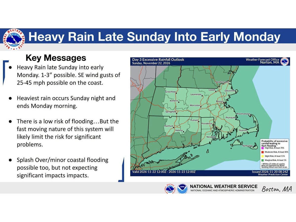
WTNH’s meteorologists said the storm will move up the eastern seaboard and through Connecticut Sunday afternoon and into early Monday morning, bringing both rain and gusty winds.
Find out what's happening in Across Connecticutfor free with the latest updates from Patch.
“It could be steady (even heavy) at night, thanks to a tropical connection to a developing area of low pressure north of the Bahamas,” WFSB reports. “Monday starts wet, with potentially heavy rain (track dependent on the incoming storm); by the afternoon, we expect partial clearing.”
In the short term, the National Weather Service says today and Saturday will both be dry and sunny, with highs in the 60s. Looking ahead, after the Sunday to Monday storm system, Connecticut will see much cooler temperatures, with daytime highs starting on Tuesday in the 40s, according to the National Weather Service.
It is currently predicting Thanksgiving Day will have a chance for rain and snow.
Read More:
- Doctor Arrested After Investigation, Police Announce
- ‘Our Community Was Threatened’: New Details Emerge After Reports Of Possible Gunman On Campus
- Wanted Fugitive Arrested After Lockdown Order: Police
Here are the forecast details for northern Connecticut via the National Weather Service:
Today: Sunny, with a high near 65. Calm wind becoming west 5 to 9 mph in the afternoon.
Tonight: Patchy fog after 2 a.m. Otherwise, mostly clear, with a low around 38. Northwest wind around 5 mph becoming calm in the evening.
Saturday: Patchy fog before 8 a.m. Otherwise, sunny, with a high near 61. Calm wind becoming south 5 to 7 mph in the afternoon.
Saturday Night: Mostly cloudy, with a low around 39. South wind around 5 mph becoming calm in the evening.
Sunday: Rain, mainly after 2 p.m. High near 60. Calm wind becoming southeast around 5 mph. Chance of precipitation is 80%.
Sunday Night: Rain. The rain could be heavy at times. Low around 51. Calm wind becoming north around 6 mph after midnight. Chance of precipitation is 100%.
Monday: Rain likely, mainly before 10 a.m. Mostly cloudy, with a high near 61. Northwest wind 8 to 13 mph, with gusts as high as 28 mph. Chance of precipitation is 60%.
Monday Night: Partly cloudy, with a low around 34. Northwest wind 9 to 13 mph.
Tuesday: Sunny, with a high near 47. Northwest wind 9 to 13 mph, with gusts as high as 24 mph.
Tuesday Night: Mostly clear, with a low around 25. North wind 3 to 6 mph.
Wednesday: Sunny, with a high near 41. North wind around 5 mph becoming east in the afternoon.
Wednesday Night: A chance of snow. Mostly cloudy, with a low around 28. Northeast wind 5 to 14 mph. Chance of precipitation is 30%.
Thanksgiving Day: A chance of rain and snow. Mostly cloudy, with a high near 47. Northeast wind 14 to 16 mph, with gusts as high as 29 mph. Chance of precipitation is 50%.
Here are the forecast details for southern Connecticut via the National Weather Service:
Today: Sunny, with a high near 63. West wind 3 to 6 mph.
Tonight: Clear, with a low around 39. Calm wind.
Saturday: Increasing clouds, with a high near 59. Calm wind becoming east around 5 mph.
Saturday Night: Mostly cloudy, with a low around 43. Calm wind.
Sunday: Rain likely, mainly after 1 p.m. Mostly cloudy, with a high near 62. East wind 3 to 7 mph. Chance of precipitation is 70%. New precipitation amounts between a tenth and quarter of an inch possible.
Sunday Night: Rain. Steady temperature around 55. Chance of precipitation is 90%. New precipitation amounts between three quarters and one inch possible.
Monday: Rain likely before 1 p.m. Cloudy, then gradually becoming mostly sunny, with a high near 63. Chance of precipitation is 60%.
Monday Night: Partly cloudy, with a low around 34.
Tuesday: Sunny, with a high near 46.
Tuesday Night: Mostly clear, with a low around 27.
Wednesday: Mostly sunny, with a high near 45.
Wednesday Night: A 40 percent chance of rain. Mostly cloudy, with a low around 33. Breezy.
Thanksgiving Day: Rain likely. Mostly cloudy, with a high near 49. Breezy. Chance of precipitation is 60%.