Weather
NWS Warns Of Renewed Tornado, Flash Flood Threat In GA Saturday
The NWS in Atlanta on Saturday warned that portions of Georgia could see another round of potentially dangerous weather.


The National Weather Service in Atlanta around noon Saturday warned that portions of Georgia could see another round of potentially dangerous weather associated with Hurricane Isaias.
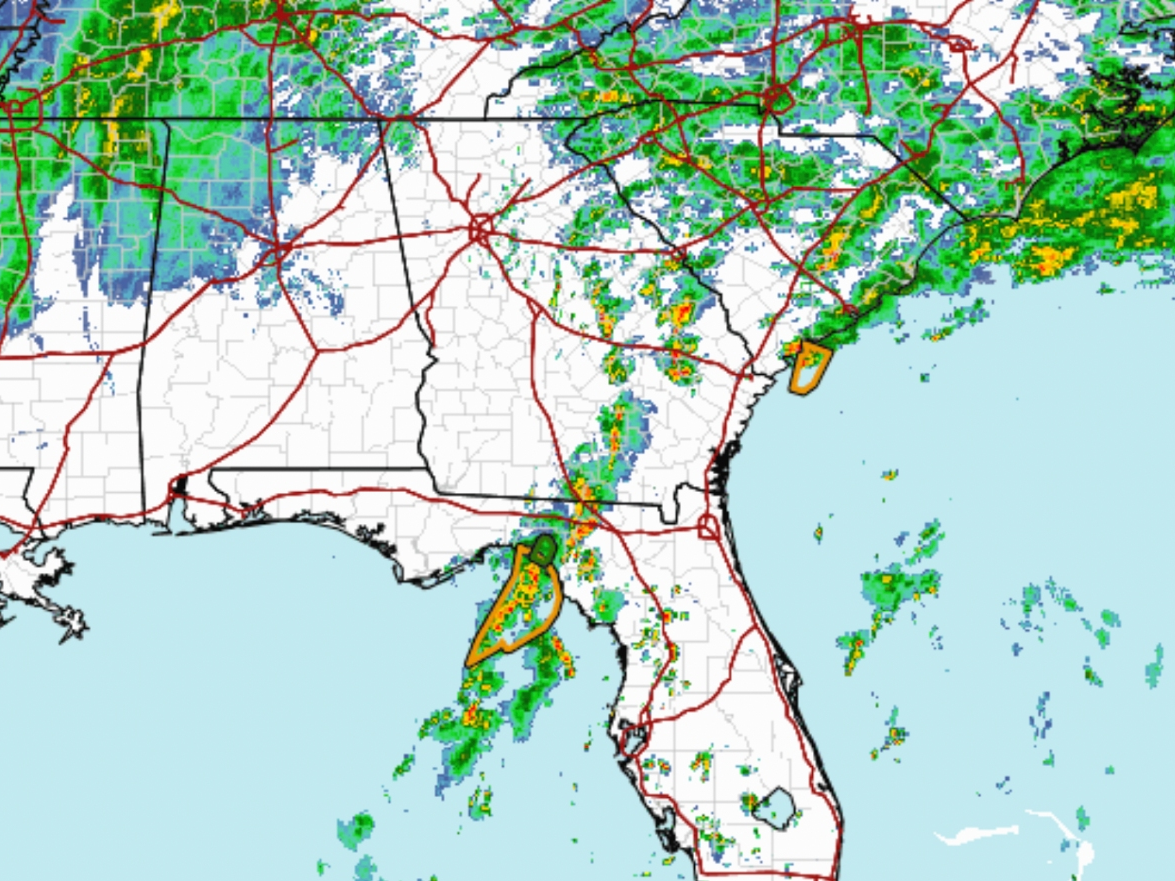
Forecasters said this could include brief tornadoes and flash flooding, as officials monitor the possible redevelopment of heavy rain bands during the afternoon and evening.
In its most recent update issued Saturday, the NWS said atmospheric conditions could support the formation of new bands of heavier showers generally along and east of Interstate 75, potentially bringing renewed threats to areas already dealing with the effects of the storm.
Find out what's happening in Across Georgiafor free with the latest updates from Patch.
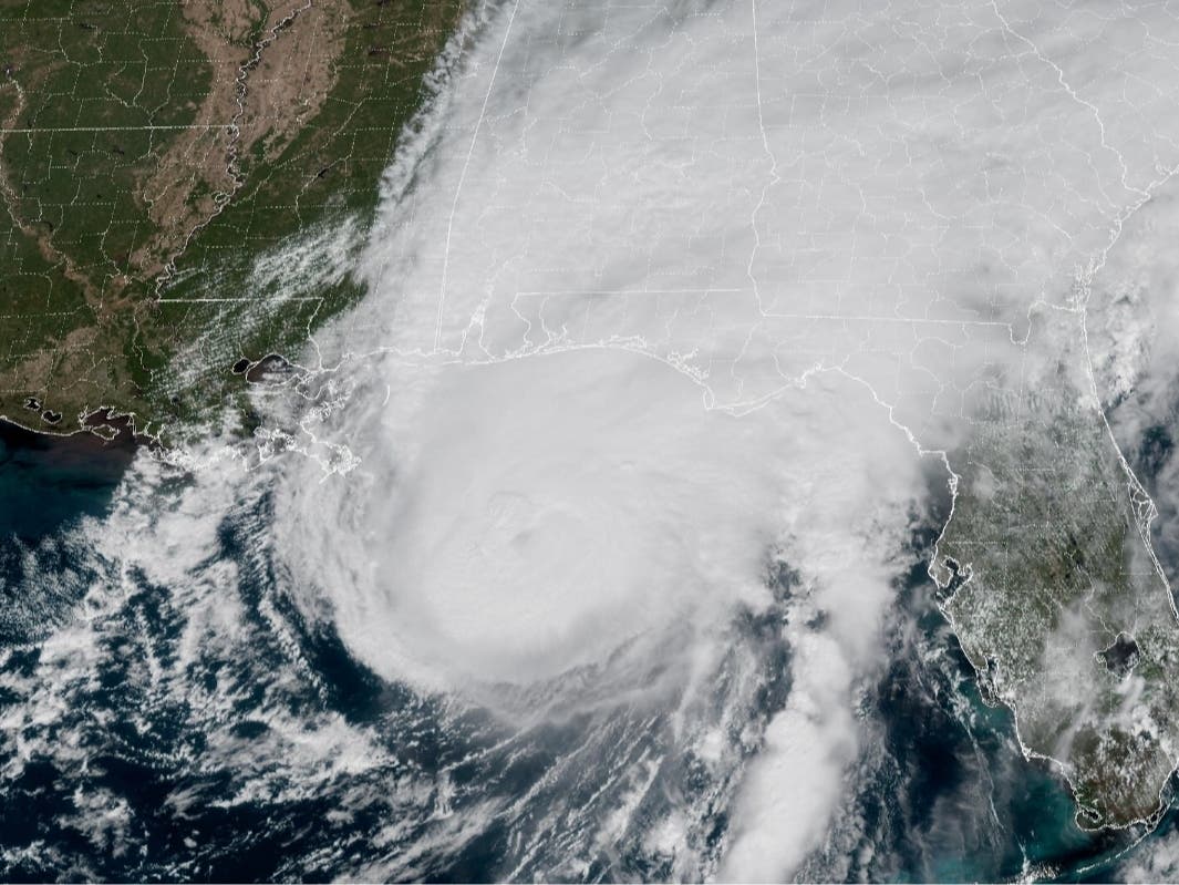
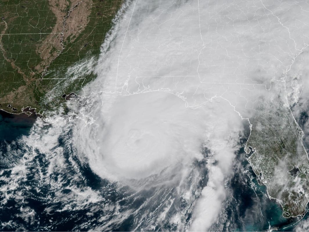
The warning comes after Isaias made landfall Friday night near Destin, Florida, as a Category 2 hurricane before moving inland and bringing damaging winds, heavy rainfall and widespread power outages to portions of the Southeast.
According to the NWS, bands of showers were continuing to weaken along and west of the I-75 corridor Saturday morning, but increasing moisture, atmospheric instability and lingering wind shear could allow stronger showers to redevelop later in the day.
Find out what's happening in Across Georgiafor free with the latest updates from Patch.
Forecasters cautioned that some of the stronger showers could produce brief, spin-up tornadoes, even in areas where thunderstorms and lightning are not present.
"Instability is expected to expand to the north and west over the coming hours with shear held across the warm front," the NWS said, referring to an area generally along the Interstate 20 corridor.
NWS meteorologists said the combination of instability and wind shear could allow showers to develop rotation, creating a tornado threat that may be difficult for residents to recognize based on traditional signs of severe thunderstorms.
Some high-resolution weather models suggest redevelopment could begin as early as 2 p.m. ET Saturday, while others indicate the stronger showers might not form until 7 or 8 p.m.
The NWS described its confidence in the potential redevelopment as medium to low because of significant differences among the forecast models.
The weather service also said it remains unclear which communities could receive the heaviest rainfall, raising concerns about localized flash flooding in areas already saturated by the hurricane.
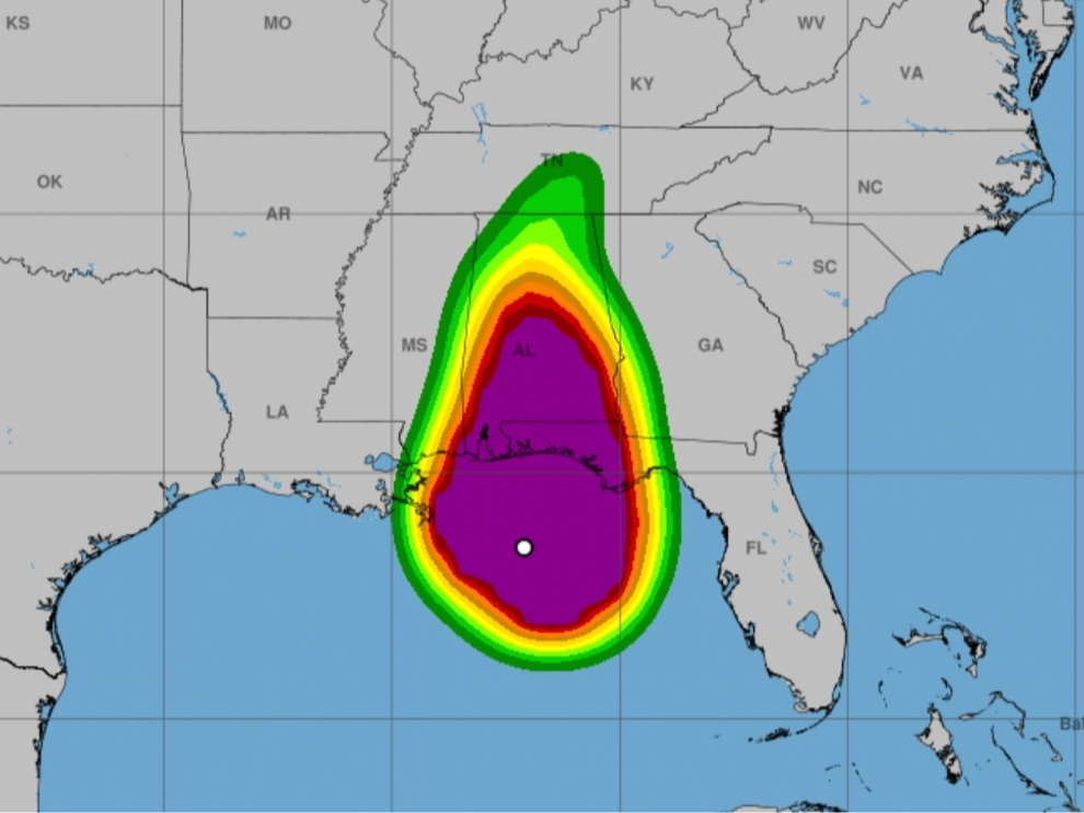
Officials said winds could still occasionally gust between 20 and 30 mph, with stronger gusts possible along mountain ridgelines in northern Georgia.
Residents are urged to remain alert for changing weather conditions, particularly during the afternoon and evening, and avoid driving across flooded roads.
The latest advisory follows a morning of significant storm impacts across Georgia.
As Patch reported earlier Saturday, flash flood warnings were issued for portions of metro Atlanta, including Fulton, DeKalb, Gwinnett, Clayton, Henry and Rockdale counties.
According to the latest numbers, 64,812 homes and businesses are currently without power as of noon Saturday.
The NWS reported that between 1 and 3 inches of rain had already fallen in parts of the Atlanta area Saturday morning, with additional rainfall threatening roads, creeks and low-lying neighborhoods.
The agency also previously warned that portions of north and central Georgia could receive several inches of additional rainfall through the weekend, with isolated totals approaching 8 inches where persistent bands develop.
Gov. Brian Kemp declared a state of emergency Thursday for all 159 Georgia counties, allowing state agencies to mobilize additional resources as the storm moved inland.
Forecasters urged residents to monitor weather alerts throughout the afternoon and evening, particularly in areas along and east of I-75, where the potential for renewed heavy rainfall and brief tornadoes remains.
While Patch has reported on two deaths from falling trees near Birmingham, Alabama and in Escambia County, Florida in the wake of the storm, no fatalities or injuries have been reported in Georgia as of the publication of this update.
This is a developing story. Patch will provide additional updates as information becomes available.
Get more local news delivered straight to your inbox. Sign up for free Patch newsletters and alerts.