Weather
Tornado Warnings As Damaging Storms, 'Stifling Humidity' Hit Chicago Area
Here's when the worst of the storms could hit. An extreme heat warning was also in effect for most of the area.


Severe weather is expected Monday, and a tornado warning was in effect for northwestern Will and Cook counties.
Affected areas include Orland Park, Tinley Park, Oak Forest, Matteson, Mokena, Frankfort, and Frankfort Square; as well as Joliet, Lockport, New Lenox, Homer Glen, Crest Hill, and Ingalls Park.
Severe storm warnings were also in effect until 1 p.m. for northwestern Will, DuPage and northern Cook Counties, as well as eastern Lake County until 1:30 p.m.
Find out what's happening in Across Illinoisfor free with the latest updates from Patch.
The storms can bring up to 2-inch hail and winds of 70 mph.
An extreme heat warning was in effect for most of the Chicago area until 9 p.m. Monday, as peak heat index values up to 100 to 110 were expected, according to the National Weather Service.
Find out what's happening in Across Illinoisfor free with the latest updates from Patch.
In addition to the heat, severe weather is possible for the Chicago area. The weather service said that if storms do develop, "conditions will be very favorable" for damaging severe storms.
Severe storms are possible between 10 a.m. and 9 p.m., with the most likely time between 1 and 7 p.m.
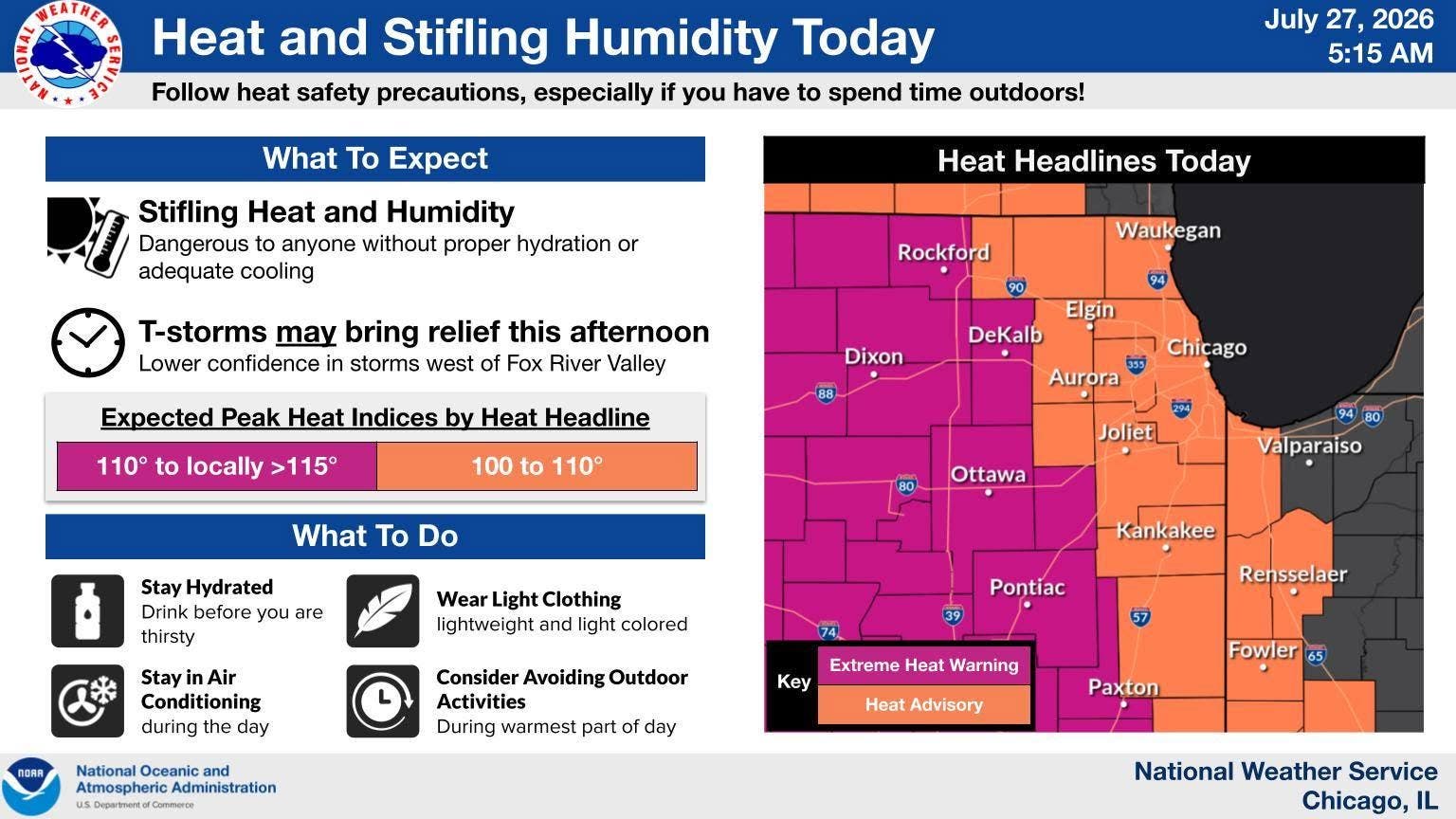
"Storm coverage remains uncertain, and some areas may not see storms at all," the weather service said.
Dangerous swimming conditions are also expected at southern Lake Michigan beaches through Wednesday morning. Dangerous waves and hazardous boating conditions with life-threatening currents are expected, the weather service said.
After Monday, "a cold front will bring cooler and drier conditions mid-week," according to the weather service. Temps look to be in the 80s for the rest of the week
Here's a more detailed look at the forecast for the Joliet area, per the weather service:
MONDAY: A 20 percent chance of showers and thunderstorms after noon. Patchy fog before 10 a.m. Otherwise, mostly cloudy, with a high near 90. Heat index values as high as 106. Southwest wind 10 to 15 mph, with gusts as high as 25 mph.
MONDAY NIGHT: A 30 percent chance of showers and thunderstorms, mainly before 10 p.m. Mostly cloudy, with a low around 70. West southwest wind 10 to 15 mph becoming north after midnight. Winds could gust as high as 25 mph.
TUESDAY: Mostly sunny, with a high near 80. North wind around 15 mph, with gusts as high as 20 mph.
TUESDAY NIGHT: Mostly clear, with a low around 64. North wind 5 to 10 mph, with gusts as high as 20 mph.
WEDNESDAY: Sunny, with a high near 82. North northeast wind 5 to 10 mph.
WEDNESDAY NIGHT: Mostly clear, with a low around 64.
THURSDAY: Sunny, with a high near 84.
THURSDAY NIGHT: Partly cloudy, with a low around 67.
FRIDAY: chance of showers, with thunderstorms also possible after 1pm. Mostly cloudy, with a high near 82.
FRIDAY NIGHT: A chance of showers. Mostly cloudy, with a low around 66.
Get more local news delivered straight to your inbox. Sign up for free Patch newsletters and alerts.