Weather
MD Temperatures To Dip As Storms Return This Weekend: What To Expect
A cold front moving into the region translates into a cool, wet weekend for Marylanders. Here's what you can expect.


If you've got outdoor plans this weekend, expect to keep a raincoat or light sweater nearby (or at least inside the car).
A cold front moving into the region will bring cooler temperatures and the chance for showers and thunderstorms across Maryland, according to forecasts released by the National Weather Service.
While conditions remain partly sunny for the majority of the day Friday, with temperatures peaking in the high 80s, things take a bit of a turn by nightfall.
Find out what's happening in Across Marylandfor free with the latest updates from Patch.
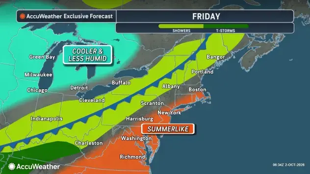
Officials say the cold front will prompt temperatures to drop as low as 60 degrees and potentially cause stormy conditions to develop.
The storm showers will stick around into Saturday morning, mainly before 7 a.m. But don't expect too much of a warm October day: while conditions will stay partly sunny for most of Saturday, temperatures are due to max out in the high 60s.
Find out what's happening in Across Marylandfor free with the latest updates from Patch.
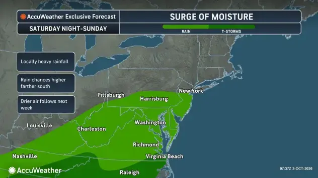
The biggest chance for rain is Sunday, thanks to a stalled front.
Forecasts indicate storms are expected to start around 2 a.m. — when temperatures could be around 58 degrees — and cover the region through 8 a.m.
The rain will be on and off for much of the day but officials say the system should move away by Sunday evening.
Marylanders can also anticipate a light breeze throughout the weekend.
Detailed Forecast For Baltimore Region
Friday Afternoon: Partly sunny, with a high near 87. West wind around 8 mph.
Friday Night: A chance of showers and thunderstorms. Mostly cloudy, with a low around 60. North wind 6 to 9 mph. Chance of precipitation is 40%.
Saturday: A chance of showers, mainly before 7 a.m. Partly sunny, with a high near 69. North wind 6 to 8 mph. Chance of precipitation is 30%.
Saturday Night: A slight chance of showers after 2 a.m. Increasing clouds, with a low around 58. Light east wind. Chance of precipitation is 20%.
Sunday: Showers likely, mainly after 8 a.m. Cloudy, with a high near 65. East wind around 7 mph. Chance of precipitation is 70%.
Sunday Night: Cloudy, with a low around 57.
Monday: Mostly sunny, with a high near 70.
Monday Night: Mostly clear, with a low around 48.
Tuesday: Sunny, with a high near 61.
Tuesday Night: Mostly clear, with a low around 46.
Wednesday: Sunny, with a high near 63.
Wednesday Night: Mostly clear, with a low around 49.
Thursday: Sunny, with a high near 69.
Get more local news delivered straight to your inbox. Sign up for free Patch newsletters and alerts.