Weather
Severe Storms To Bring MD Heavy Rain, Damaging Winds: See The Timeline
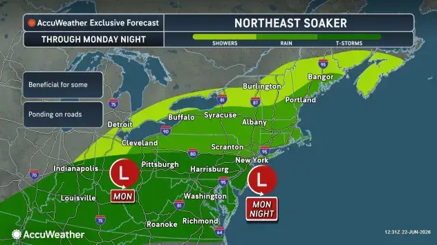
Storms moving into Maryland are forecast to bring heavy rain, thunderstorms, and the chance for localized flooding during the evening.

MARYLAND — The looming evening commute is expected to be seriously impacted by rounds of severe weather moving into parts of Maryland.
Weather outlooks issued by the National Weather Service indicate the region will see severe scattered thunderstorms capable of creating damaging winds, frequent lightning and heavy rain.
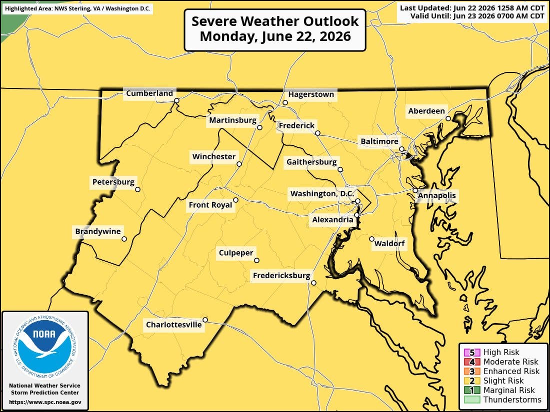
The storms are rolling in on a cold front that has put the majority of the D.C. area under a slight risk for severe storms.
Find out what's happening in Across Marylandfor free with the latest updates from Patch.
What Time Does The Storm Hit?
"Isolated tornadoes are possible this afternoon and evening," reads the latest notice issued by the NWS.
"Multiple rounds of thunderstorms are possible, which could lead to scattered instances of urban and poor drainage flooding in the Baltimore-Washington metro area."
Find out what's happening in Across Marylandfor free with the latest updates from Patch.
Residents may begin to experience some inclement weather starting as early as 4 p.m., but the heaviest portion of the storm is forecast to arrive around 6 p.m.
A severe thunderstorm watch is in effect for much of the region until 9 p.m.
What About The Rest Of The Week?
Temperatures for Monday may get into the low-90s, but humid conditions are likely to place feels-like temperatures closer to the mid-90s.
However, once the storm moves through the area, temperatures will plummet as low as the high 6os.
With overnight rainfall possible, residents can anticipate cooler and slightly muggy conditions by Tuesday.
Here's the detailed forecast for the Baltimore region:
Monday Afternoon: A chance of showers and thunderstorms, then showers and possibly a thunderstorm after 4pm. Some of the storms could be severe and produce heavy rainfall. High near 91. South wind around 15 mph, with gusts as high as 22 mph. Chance of precipitation is 80%. New rainfall amounts between a half and three quarters of an inch possible.
Monday Night: Showers and thunderstorms, mainly before 3am. Some of the storms could be severe and produce heavy rainfall. Low around 68. South wind around 6 mph becoming calm in the evening. Chance of precipitation is 80%. New rainfall amounts between a quarter and half of an inch possible.
Tuesday: A chance of showers before 3pm. Mostly cloudy, with a high near 82. West wind 7 to 11 mph becoming north in the afternoon. Winds could gust as high as 20 mph. Chance of precipitation is 50%.
Tuesday Night: Mostly cloudy, then gradually becoming clear, with a low around 62. North wind 3 to 6 mph.
Wednesday: Sunny, with a high near 86. North wind 3 to 5 mph.
Wednesday Night: Mostly clear, with a low around 65.
Thursday: A chance of showers and thunderstorms after 2pm. Mostly sunny, with a high near 89. Chance of precipitation is 30%.
Thursday Night: A chance of showers and thunderstorms before 2am. Mostly cloudy, with a low around 68. Chance of precipitation is 30%.
Friday: A chance of showers and thunderstorms after 2pm. Partly sunny, with a high near 91. Chance of precipitation is 50%.
Friday Night: A chance of showers and thunderstorms. Mostly cloudy, with a low around 70. Chance of precipitation is 40%.
Saturday: A chance of showers and thunderstorms. Partly sunny, with a high near 87. Chance of precipitation is 50%.
Saturday Night: A chance of showers and thunderstorms. Mostly cloudy, with a low around 69. Chance of precipitation is 30%.
Sunday: A slight chance of showers and thunderstorms. Mostly sunny, with a high near 89. Chance of precipitation is 20%.
Get more local news delivered straight to your inbox. Sign up for free Patch newsletters and alerts.