Weather
Storms, Then Big Weather Shift Ahead For MD
Maryland faces thunderstorms and gusty winds Friday before temperatures plunge into the 50s, with frost and freezing conditions possible.


Maryland's weather is about to take a dramatic turn, with thunderstorms and gusty winds giving way to some of the season's coldest temperatures this weekend.
After a stretch of unusually warm October weather, a powerful cold front will sweep through the region Friday, bringing the possibility of severe storms before sending temperatures tumbling Saturday and Sunday.
The National Weather Service expects weekend temperatures to run 10 to 15 degrees below normal, with daytime highs struggling to climb out of the 50s in much of Maryland. Some communities could wake up Sunday morning to temperatures near or below freezing.
Find out what's happening in Across Marylandfor free with the latest updates from Patch.
AccuWeather says the blast of Canadian air will bring some of the coldest weather since spring to parts of the Northeast, a sharp reversal from the summerlike warmth earlier in the week.
Storms Arrive Before The Cold
Thursday will bring a brief cooldown, with highs in the 60s around Baltimore and Washington, D.C., and possible rain throughout the day.
Find out what's happening in Across Marylandfor free with the latest updates from Patch.
But don't pack away the short sleeves just yet.
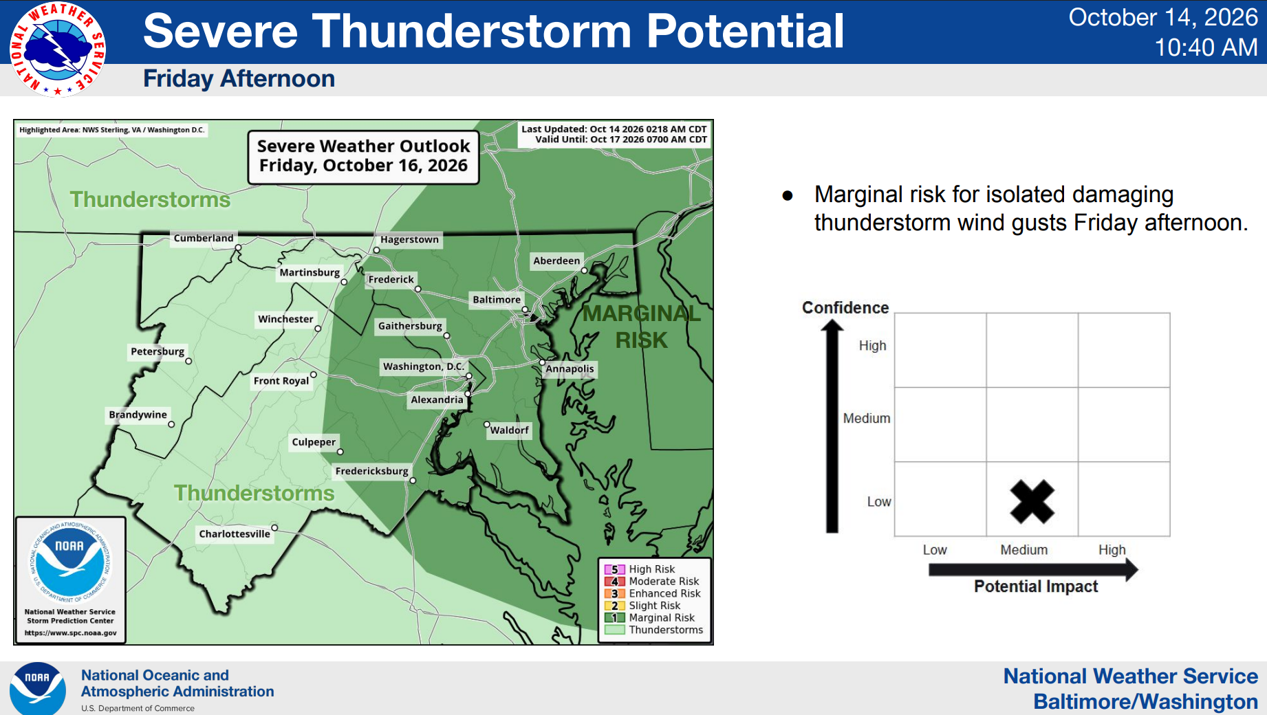
Temperatures could rebound into the lower 80s on Friday before a stronger cold front arrives, bringing scattered thunderstorms during the afternoon and evening.
Some storms could produce damaging wind gusts, according to the National Weather Service. AccuWeather says the strongest storms across the broader Mid-Atlantic region could produce gusts of 55 to 65 mph, though those speeds aren't expected everywhere.
Even after the thunderstorms move out, the wind could stick around.
Forecasters say gusts of 35 to 45 mph are possible Friday into Saturday as colder air rushes into the region. Those winds could knock down tree limbs, scatter Halloween decorations and cause isolated power outages.
Weekend Temperatures Take A Dive
By Saturday morning, it will feel like a different season in Maryland.
Baltimore, which could reach 82 degrees on Friday, is forecast to top out near 55 on Saturday and 57 on Sunday, according to the National Weather Service.
The chill will be especially noticeable in the mornings, when gusty winds could make temperatures feel even colder.
AccuWeather predicts that wind and other conditions could make Saturday morning feel like the 30s or lower 40s along much of the Interstate 95 corridor.
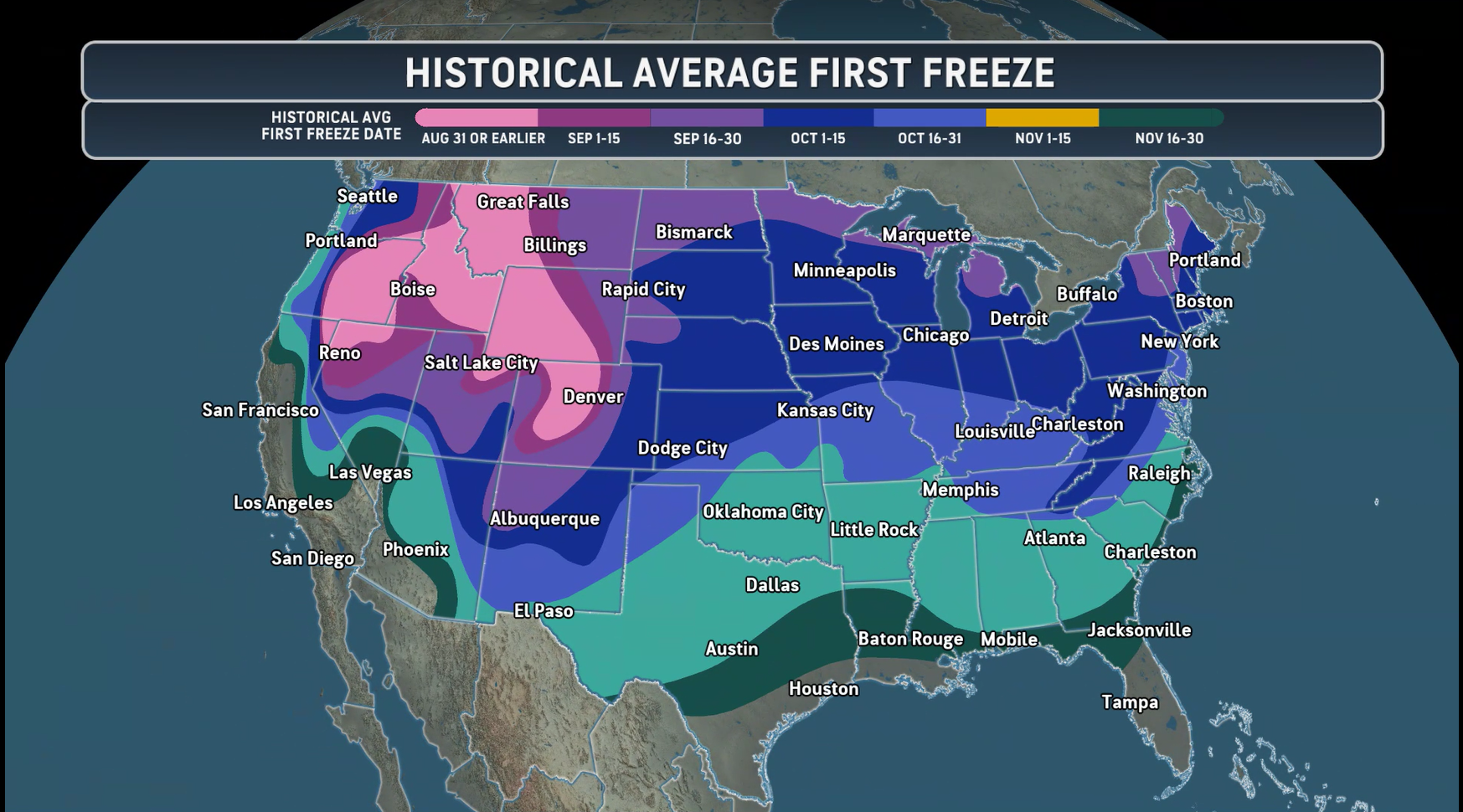
The coldest temperatures are expected Saturday night into Sunday morning, when frost and freezing conditions could develop, especially in communities west of Interstate 95.
That means gardeners may want to bring sensitive plants indoors or cover them before heading to bed Saturday.
And while AccuWeather says some higher elevations in the Northeast could see their first snowflakes of the season, snow isn't expected to be a widespread concern in Maryland.
How Long Will The Cold Last?
The good news for anyone not quite ready for winter: The cold snap should be relatively short-lived.
Sunday will remain chilly, but temperatures are expected to gradually recover early next week.
The National Weather Service forecasts highs around Baltimore climbing into the lower 60s on Monday and the mid-60s on Tuesday.
AccuWeather expects temperatures across much of the region to return closer to mid-October norms by early next week.
For now, Marylanders should prepare for a little bit of everything: rain Thursday, a warmup and potentially strong storms Friday, and jacket weather — possibly with the first frost of the season — over the weekend.
Detailed Baltimore-Area Forecast
Thursday: A chance of showers, mainly after 2pm. Mostly cloudy, with a high near 64. East wind 5 to 7 mph. Chance of precipitation is 50%.
Thursday Night: A chance of showers, mainly between 9pm and 3am. Patchy fog after 2am. Otherwise, cloudy, with a low around 58. East wind 3 to 5 mph. Chance of precipitation is 40%.
Friday: Cloudy through mid morning, then gradual clearing, with a high near 82. Southwest wind 7 to 11 mph, with gusts as high as 20 mph.
Friday Night: Showers and thunderstorms likely. Mostly cloudy, with a low around 49. Northwest wind 9 to 13 mph, with gusts as high as 25 mph. Chance of precipitation is 70%. New precipitation amounts between a tenth and quarter of an inch, except higher amounts possible in thunderstorms.
Saturday: A chance of showers before 8am. Mostly sunny, with a high near 55. North wind around 15 mph, with gusts as high as 26 mph. Chance of precipitation is 30%.
Saturday Night: Mostly clear, with a low around 40.
Sunday: Sunny, with a high near 57.
Sunday Night: A slight chance of showers before 2am. Mostly clear, with a low around 43. Chance of precipitation is 20%.
Monday: Mostly sunny, with a high near 61.
Get more local news delivered straight to your inbox. Sign up for free Patch newsletters and alerts.