Weather
Heat Wave Set To Build Across Twin Cities This Weekend
Twin Cities highs push into the 90s by the weekend, with hot, dry conditions expected to linger into the following week, forecasters say.


MINNEAPOLIS, MN — A warm-up is on the way for the Twin Cities, with temperatures forecast to climb steadily through the week and reach the low 90s by the weekend, according to the National Weather Service.
Wednesday will bring a chance of showers and thunderstorms in the morning, with a high near 83. Skies clear out Thursday and Friday, with highs in the low-to-mid 80s and comfortable humidity.
The bigger heat arrives this weekend. Saturday's high is forecast near 88, followed by a sunny Sunday near 92. The hottest day of the stretch looks to be Monday, when the forecast calls for a high near 94 under sunny skies.
Find out what's happening in Minneapolisfor free with the latest updates from Patch.
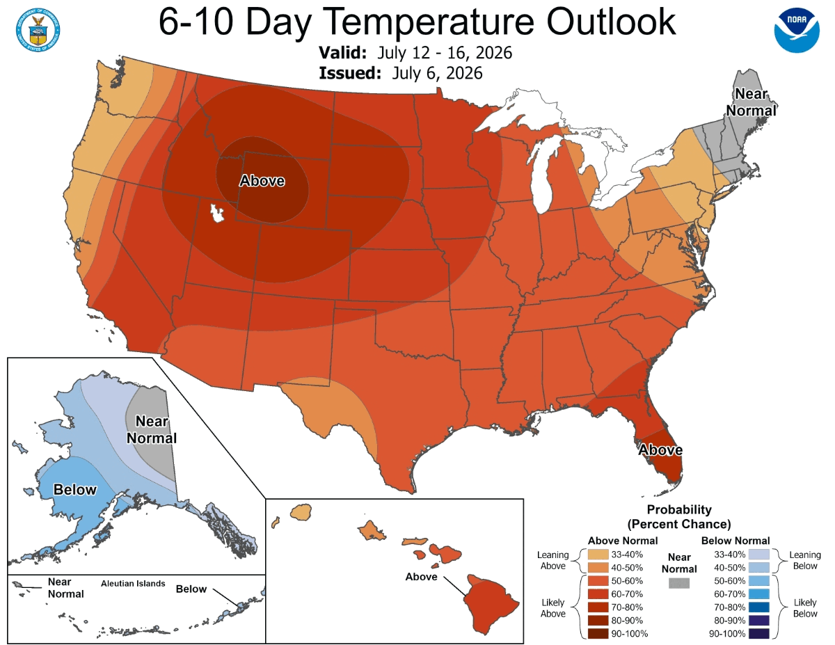
The National Oceanic and Atmospheric Administration's Climate Prediction Center has placed Minnesota in its 6 to 10 day outlook zone favoring above-normal temperatures, giving the Twin Cities a 60 to 70 percent chance of above-normal heat from July 12 through 16. That outlook is part of a broader hot pattern centered over the northern Plains and Rockies, where some areas carry a 90 to 100 percent probability of above-normal temperatures over the same period.
Residents planning outdoor activities this weekend should prepare for high heat, stay hydrated, and check on elderly neighbors or those without reliable air conditioning as temperatures rise.
Find out what's happening in Minneapolisfor free with the latest updates from Patch.
Check out the full NWS forecast from the MSP Airport below:
Wednesday: Showers likely and possibly a thunderstorm before 9am, then a chance of showers and thunderstorms, mainly between 9am and 3pm. Mostly cloudy, with a high near 83. South wind 5 to 10 mph becoming north northwest in the afternoon. Chance of precipitation is 60%. New rainfall amounts between a tenth and quarter of an inch, except higher amounts possible in thunderstorms.
Wednesday Night: A chance of showers and thunderstorms. Mostly cloudy, with a low around 64. North wind 5 to 10 mph. Chance of precipitation is 40%.
Thursday: Mostly sunny, with a high near 82. North northeast wind around 5 mph.
Thursday Night: Partly cloudy, with a low around 63. North northeast wind 5 to 10 mph becoming light east after midnight.
Friday: Mostly sunny, with a high near 85. East southeast wind around 5 mph.
Friday Night: Mostly clear, with a low around 66. South southeast wind around 5 mph.
Saturday: Sunny, with a high near 88. South southwest wind 5 to 10 mph.
Saturday Night: Mostly clear, with a low around 68. South southwest wind 5 to 10 mph.
Sunday: Sunny, with a high near 92. South southwest wind 5 to 10 mph.
Sunday Night: Mostly clear, with a low around 71. South wind 5 to 10 mph.
Monday: Sunny and hot, with a high near 94. Southwest wind 5 to 10 mph.
Get more local news delivered straight to your inbox. Sign up for free Patch newsletters and alerts.