Weather
Hurricane Forecast Updated: Details, Timing For NJ
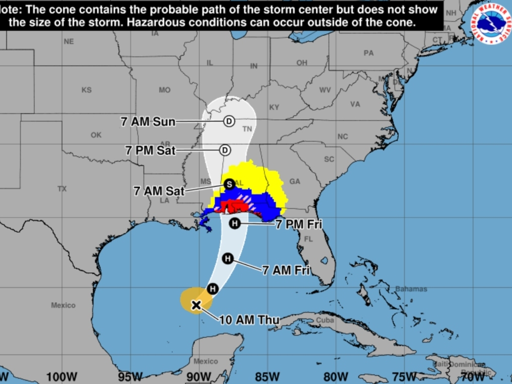
Some severe thunderstorms, flash flooding and tidal flooding are possible Sunday as Hurricane Isaias remnants hit New Jersey.


Tidal flooding, flash flooding and severe storms are possible Sunday as the remnants of Hurricane Isaias soak New Jersey with heavy rain, according to the latest forecast.
The storm, the latest first hurricane of the season in more than 100 years, is set to make landfall on the Gulf Coast Friday night. Its remnants will reach New Jersey by Sunday, according to the National Weather Service.
"The storm is forecast to turn eastward and cut across the Appalachians and then off the mid-Atlantic coast by early next week," Accuweather said. "By then, as a tropical rainstorm, drenching downpours can lead to localized flash flooding, especially in steep terrain and in areas where the ground is saturated."
Find out what's happening in Across New Jerseyfor free with the latest updates from Patch.
The primary threat with this is widespread, heavy rain, forecasters said. The current forecast is 1 to 2 inches of rain, with more than 2 inches possible in some areas, particularly South Jersey.
Rain is likely to begin Sunday and possibly linger into early Monday.
Find out what's happening in Across New Jerseyfor free with the latest updates from Patch.
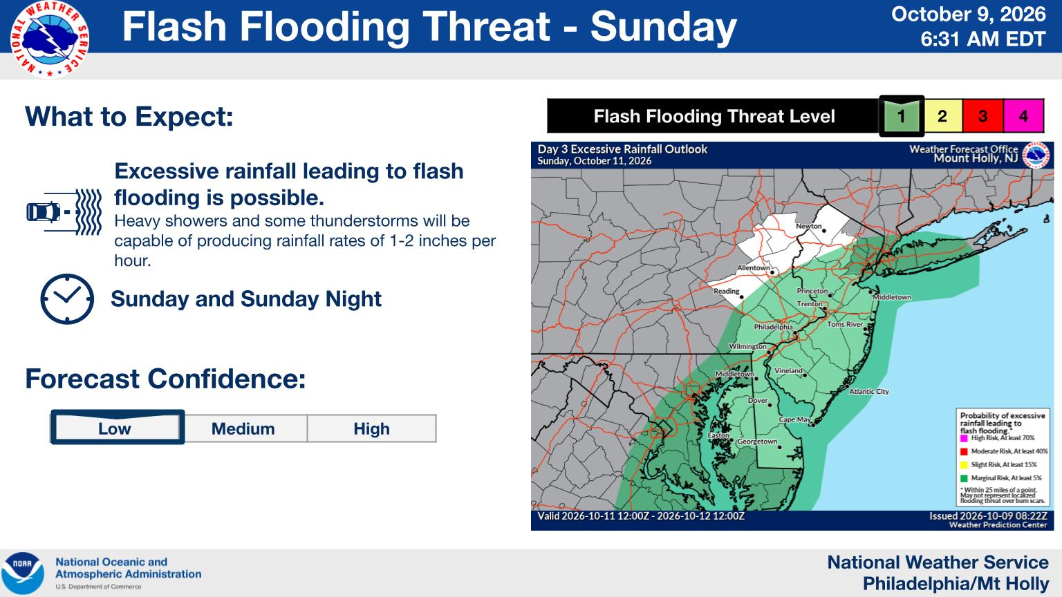
Most of New Jersey is under a marginal risk for excessive rainfall.
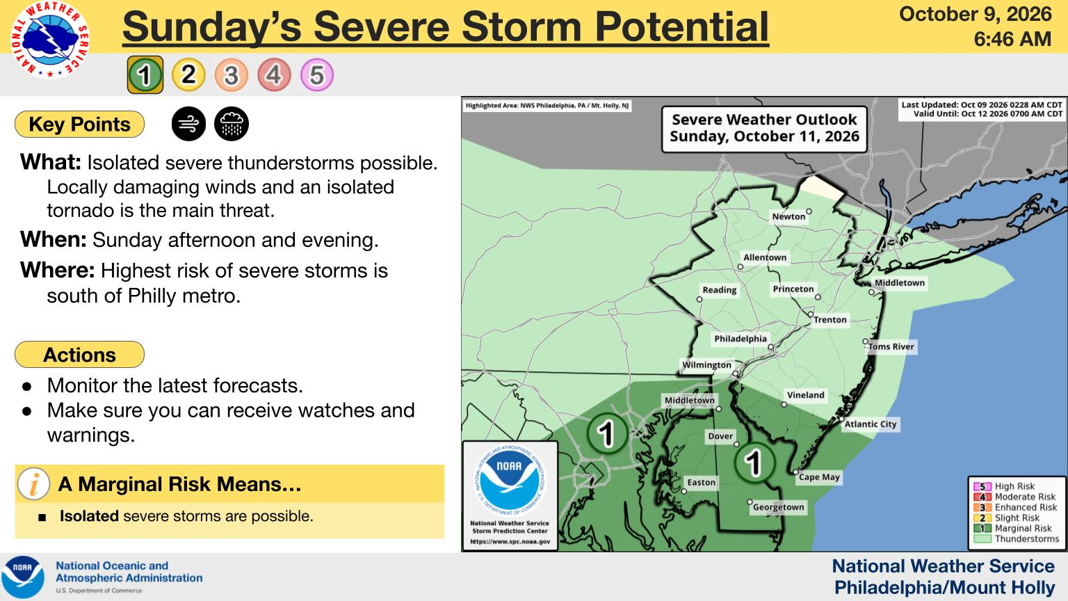
With this rain, far South Jersey may see some isolated severe thunderstorms, according to the National Weather Service.
Localized flash flooding and minor tidal flooding is also possible. This is likely to occur in areas that are already flood prone.
Some gusty winds are expected, particularly along the coast.
Get more local news delivered straight to your inbox. Sign up for free Patch newsletters and alerts.