Weather
Severe Storms, Flash Flooding, Tornado Threat Loom Over NJ: See Timing
Multiple rounds of thunderstorms could bring damaging winds, flash flooding, hail and tornadoes to New Jersey this week.


The Garden State is heading into a week of severe thunderstorms, flash flooding, damaging winds, and possible hail and tornadoes ramping up by Tuesday, according to the latest forecast models.
Monday will see some isolated scattered thunderstorms in the evening, particularly in the northern portion of the state, according to the National Weather Service.
The real threats for widespread severe storms will begin Tuesday, when most of the state, except for the coastline, is under a "slight risk" for severe weather, which is a 2 out of 5 on the scale.
Find out what's happening in Across New Jerseyfor free with the latest updates from Patch.
If the storm takes the more severe track, hail and tornadoes are possible Tuesday through Wednesday, the forecasters said. Rain falling at a rate of 1-2 inches per hour is possible during the height of the storm in the evening.
Chances for flash flooding increase on Wednesday, particularly in the northern portion of the state.
Find out what's happening in Across New Jerseyfor free with the latest updates from Patch.
"Repeating rounds of convective clusters, especially on Wednesday, could produce locally higher amounts of rainfall totals exceeding 3 inches. Isolated to scattered flash floods possible," National Weather Service forecasters said.
Humidity and heat will build toward the middle of the week, beginning Tuesday, forecasters said.
Highs for Tuesday will be in the mid-80s before the storms sweep through the afternoon and evening, bringing the lows down to the high-60s.
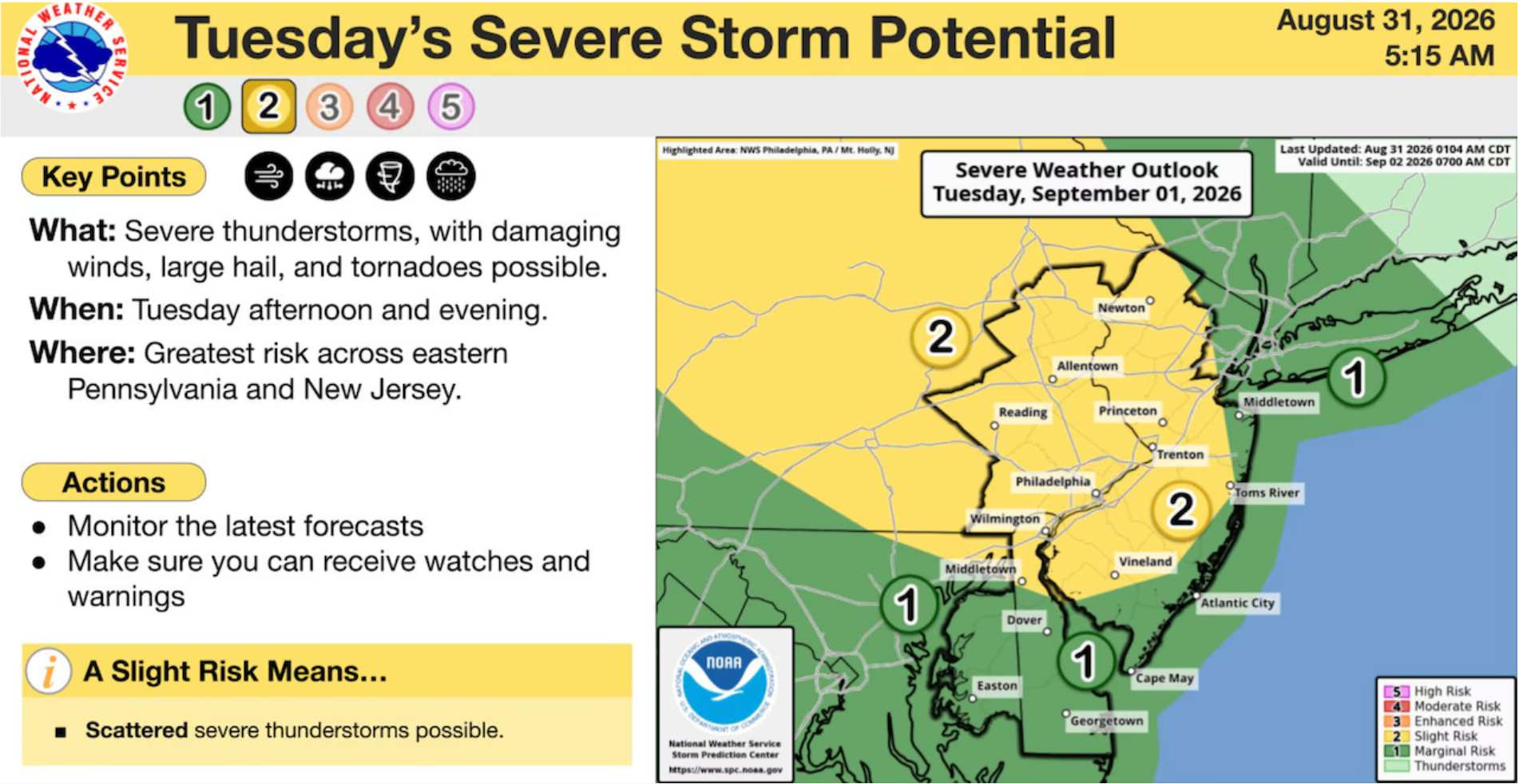
The threat of severe storms will intensify through Wednesday, according to the National Weather Service.
On Wednesday, nearly all of the state is under a "slight risk" of severe weather, including the shore.
Thunderstorms are expected to hit the state throughout the day, but chances increase in the afternoon and evening on Wednesday, forecasters said. Highs on Wednesday will be in the 80s, and lows will be in the 60s.
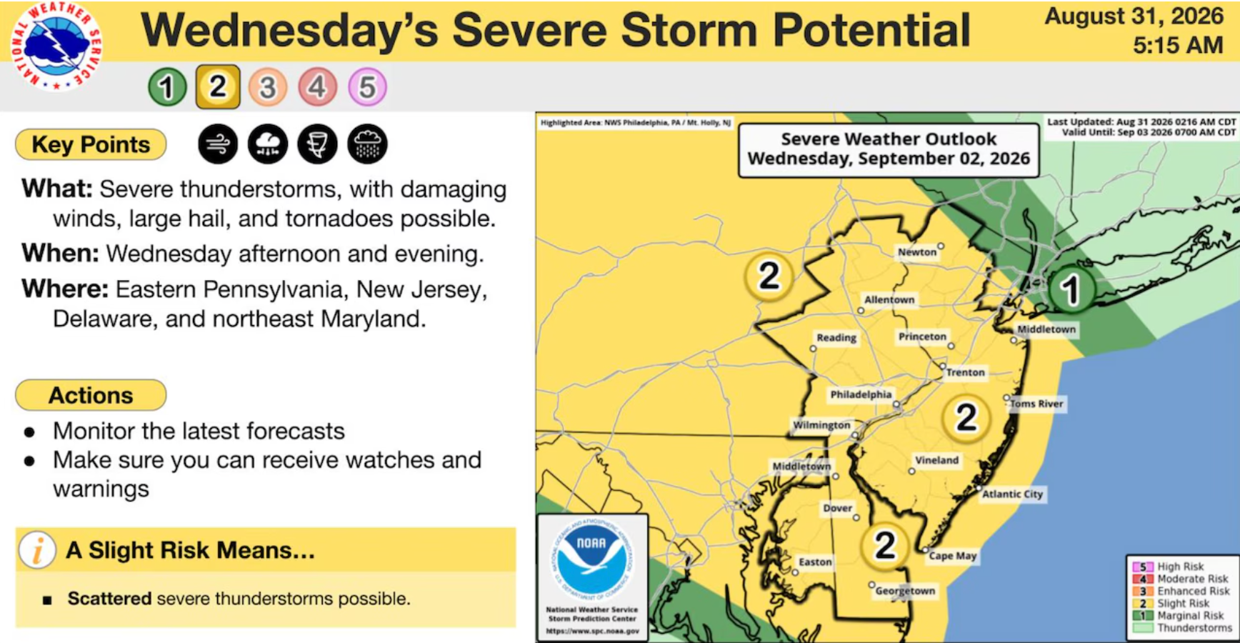
By Thursday, the storms are expected to peter out, with isolated scattered Thunderstorms after 2 p.m., before clearing out by Friday.
However, the storm's progress is still coming into focus, and the forecast could change as the storm moves closer to the region.
"Long story short, the Tuesday through Thursday period looks very active with multiple rounds of thunderstorms across the region, but details still remain unclear," the National Weather Service forecasters said.
Check back for updates.
Get more local news delivered straight to your inbox. Sign up for free Patch newsletters and alerts.