Weather
New Snow Map Released As Overnight Storm Arrives In NJ
The National Weather Service forecasts a rain and snow mix for parts of the region, with potential for up to 2 inches of snow.


The National Weather Service in Mt. Holly has dropped a new snow map as an overnight storm rolls into the Garden State Sunday night.
Light rain moved into the region Sunday evening and is anticipated to transition to snow later this evening, according to the National Weather Service. This change will occur primarily along and north of I-195, the forecast says.
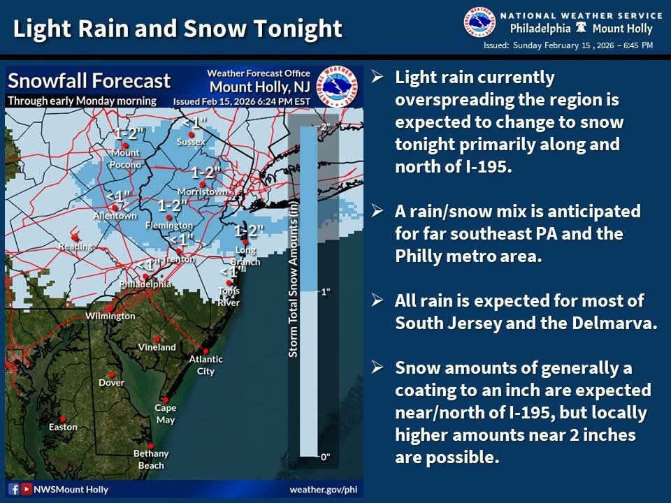
Snowfall amounts are generally expected to range from a coating to an inch. However, isolated areas could see close to 2 inches of accumulation. For far southeastern Pennsylvania, including the Philadelphia metropolitan area, a rain and snow mix is forecast with little accumulation expected.
Find out what's happening in Mendham-Chesterfor free with the latest updates from Patch.
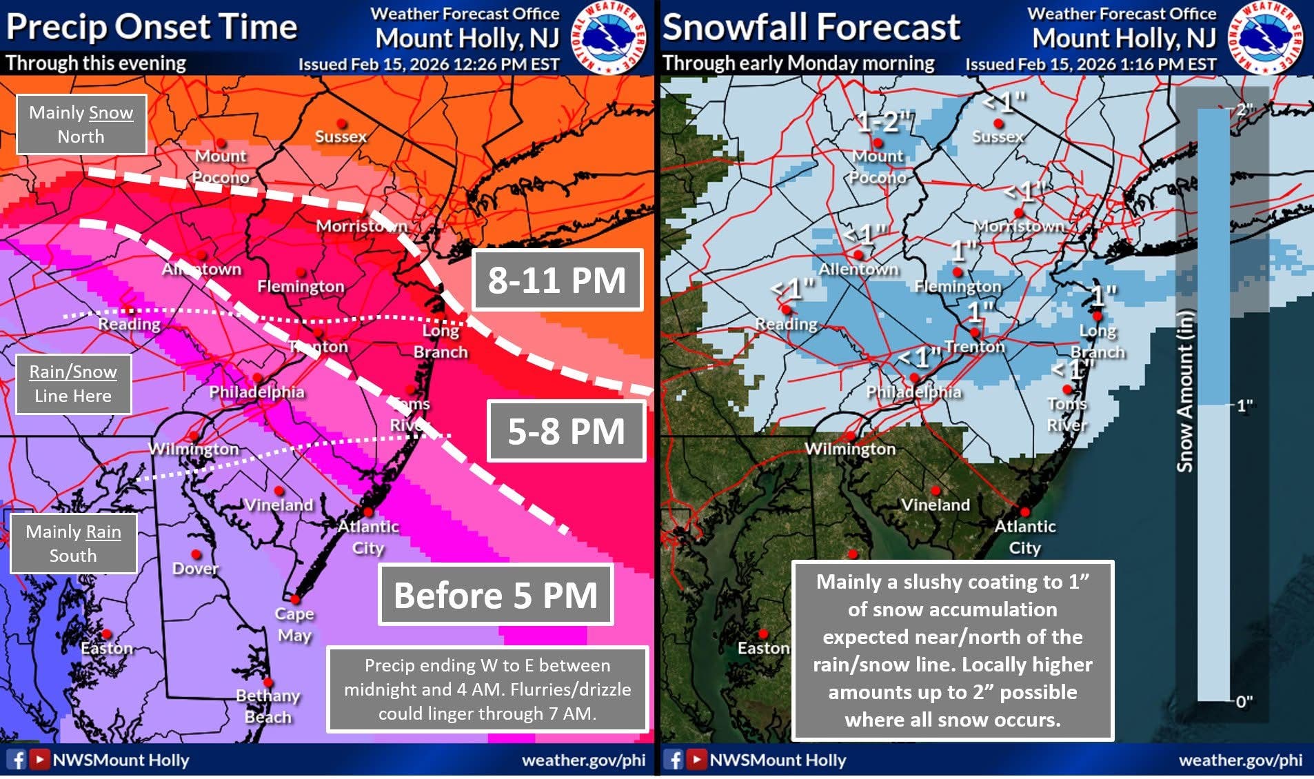
Most of southern New Jersey and the Delmarva Peninsula are predicted to experience all rain. Precipitation will gradually spread into the region from southwest to northeast through this evening. The rain and snow line is expected to establish itself within the Philadelphia metro and extend eastward toward the coast.
The National Weather Service reported that precipitation will conclude from west to east between midnight and 4 a.m.
Find out what's happening in Mendham-Chesterfor free with the latest updates from Patch.
Flurries or drizzle might persist through 7 a.m. Road conditions could become slippery overnight and continue into Monday morning. Commuters are advised to allow for additional travel time to account for potentially hazardous road conditions, officials said.
Get more local news delivered straight to your inbox. Sign up for free Patch newsletters and alerts.