Weather
Frigid Temperatures, Snow Chance In Hudson Valley Forecast: NWS
Find out when the region will finally see warmer weather, according to meteorologists.

HUDSON VALLEY, NY — The National Weather Service has issued advisories for the region due to the bitterly cold temperatures.
Wind chills as low as 10 to 14 degrees below zero are expected tonight and early Friday in Westchester, Orange, Putnam, and Rockland counties, one of the advisories says.
In the mid Hudson Valley, wind chills could get as low as 15 to 25 below zero, according to the National Weather Service.
Find out what's happening in Mid Hudson Valleyfor free with the latest updates from Patch.
Hypothermia and frostbite are possible, and residents are urged to bundle up and be cautious while outdoors.
The region won’t see temperatures rise into the 30s again until Monday, the National Weather Service’s long-range forecast shows.
Find out what's happening in Mid Hudson Valleyfor free with the latest updates from Patch.
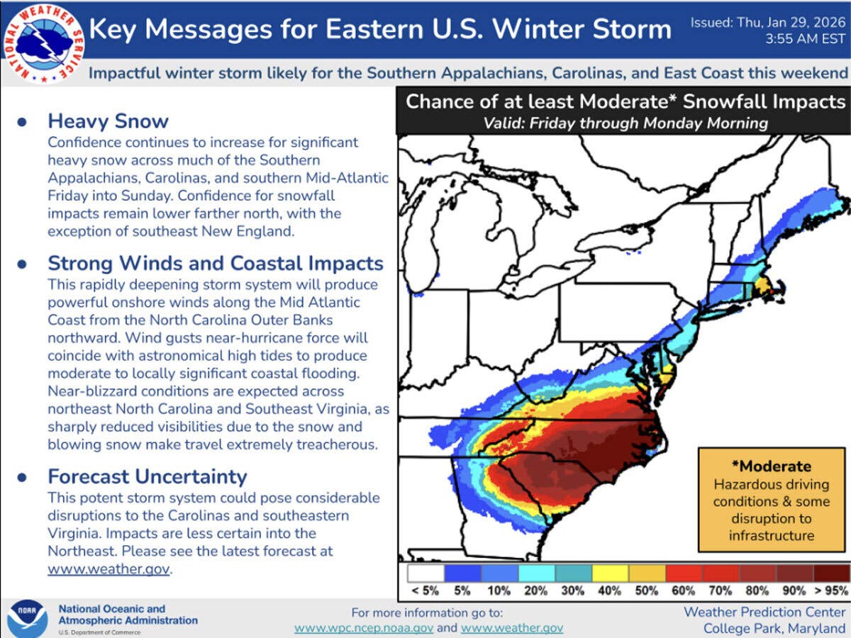
Monitoring a weekend coastal storm
A coastal storm is expected to bring significant snow to parts of the East Coast on Sunday.
As of Thursday, the National Weather Service was predicting that only the southernmost portion of the Hudson Valley region was in the area of potential impact.
The National Weather Service is reporting a 30 percent chance of snow in the lower Hudson Valley for Sunday.
Meteorologists are monitoring whether the storm will move to the west, which could increase the local impact, or go eastward, potentially missing the Hudson Valley completely.
Here are the forecast details for the lower Hudson Valley area via the National Weather Service, as of Thursday:
Today: Sunny, with a high near 21. Wind chill values between 5 and 10. West wind around 10 mph.
Tonight: Mostly clear, with a low around 6. Wind chill values between -5 and 5. Northwest wind around 10 mph, with gusts as high as 20 mph.
Friday: Sunny and cold, with a high near 16. Wind chill values between -10 and zero. West wind 9 to 11 mph.
Friday Night: Mostly clear, with a low around 3. Wind chill values between -5 and zero. Northwest wind 5 to 9 mph.
Saturday: Mostly sunny and cold, with a high near 19. North wind 5 to 7 mph.
Saturday Night: A 30 percent chance of snow after 1 a.m. Mostly cloudy, with a low around 9.
Sunday: A 30 percent chance of snow. Mostly cloudy, with a high near 22.
Here are the forecast details for the Mid-Hudson Valley area via the National Weather Service, as of Thursday:
Today: Mostly sunny, with a high near 22. Calm wind becoming west around 6 mph in the afternoon.
Tonight: Mostly clear, with a low around -4. Light west wind.
Friday: Sunny, with a high near 17. Wind chill values as low as -5. Calm wind becoming northwest around 6 mph in the afternoon.
Friday Night: Mostly clear, with a low around -9. Calm wind.
Saturday: Sunny, with a high near 19. Calm wind becoming north around 6 mph in the afternoon.
Saturday Night: Mostly cloudy, with a low around 3.
Sunday: Partly sunny, with a high near 21.
Get more local news delivered straight to your inbox. Sign up for free Patch newsletters and alerts.