Politics & Government
These Are The Most Controversial NYC Street Redesign Projects
Dozens of projects across Manhattan, Brooklyn and Queens target bus delays, crashes and pedestrian safety.

NEW YORK, NY — The City’s Department of Transportation has advanced a set of street redesign projects across the five boroughs, aiming to speed up buses and expand space for pedestrians and cyclists— even as some of the most ambitious proposals face political pushback and federal scrutiny.
The projects target some of the city’s most congested corridors, where buses often move at walking speed and pedestrian injuries remain a concern, according to officials.
Busways And Public Space Collide With Federal Pressure
In Manhattan, a proposed redesign of 116th Street seeks to address bus speeds that drop below 4 mph for more than 65,000 daily riders.
Find out what's happening in New York Cityfor free with the latest updates from Patch.
Plans include transit priority and pedestrian safety upgrades.
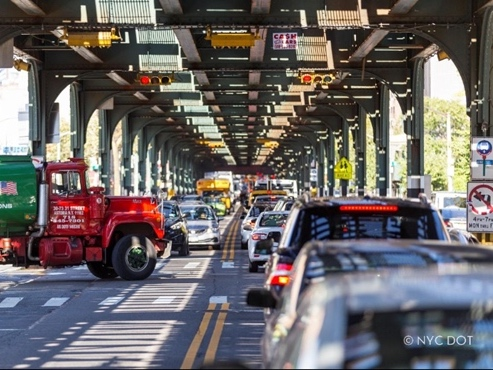
Across Midtown, a broader effort to expand bus priority on 34th Street has become one of the city’s most politically sensitive transportation fights.
Find out what's happening in New York Cityfor free with the latest updates from Patch.
Federal officials have previously intervened over concerns tied to the street’s designation as part of the National Highway System: a rarely enforced classification now shaping local street design.
“The same federal constraints that affected 34th Street are now influencing decisions across the city,” one administration source said, adding officials are wary of actions that could “draw the ire” of regulators.
The issue has already had ripple effects beyond Manhattan.
A similar proposed busway on Tremont Avenue in the Bronx was shelved after pressure from the Federal Highway Administration, which warned it could block funding for projects statewide.
Meanwhile, the long-running “Broadway Vision” initiative continues to expand plazas and shared streets.
“These designs focus on safer crossings, clearer traffic patterns and dedicated space for buses and bikes,” transportation officials noted in public presentations.
Major Corridor Overhaul Underway On Flatbush Avenue
In Brooklyn, the most significant project is already entering construction.
On Flatbush Avenue, one of the borough’s busiest transit corridors, the city is rebuilding the street between Grand Army Plaza and Livingston Street. The redesign will introduce center-running bus lanes, new boarding islands and expanded pedestrian space.
About 130,000 riders use buses along the corridor daily, where speeds average roughly 4 mph.
“Time is money, and too often our city has taken both from working people who rely on our buses,” said Zohran Mamdani. “These center-running bus lanes will give New Yorkers back something precious: time.”
Officials warned drivers to avoid the corridor during the six-month construction period.
Elsewhere in Brooklyn, projects on Bay Parkway and in central neighborhoods would expand bike infrastructure and redesign intersections near schools and public housing, while a Red Hook study is examining truck congestion tied to growing freight demand.
Big Visions Meet Funding And Implementation Challenges
In Queens, planners are advancing both sweeping long-term plans and smaller neighborhood upgrades.
The proposed Queens Waterfront Greenway would create a 16-mile continuous biking and walking route connecting neighborhoods from Gantry Plaza State Park to Fort Totten.
But like many greenway projects, it faces questions about timelines, funding and coordination across agencies.
“An administration that’s not afraid to take on these issues can say, ‘This is the plan and we’re doing it,’” Jon Orcutt, a former DOT official, said.
Citywide, greenway expansion is complicated by fragmented oversight, with multiple agencies responsible for different segments and many existing routes in poor condition.
Another major Queens project, the redesign of Woodhaven Boulevard, aims to improve bus service and safety on a major arterial roadway, though similar corridor projects have historically sparked concerns about traffic and parking impacts.
Debate Intensifies As Projects Move Forward
Community board meetings have become key battlegrounds, with debates often centering on the reallocation of street space away from cars.
Supporters argue the changes are essential to reducing traffic deaths and improving transit reliability. Opponents cite concerns about parking loss, reduced vehicle capacity and spillover traffic on residential streets.
Most projects remain in planning or early construction, with several expected to advance further in 2026.
Selected NYC DOT Projects For 2026
Manhattan
- 116th Street (Morningside Ave to Pleasant Ave) — Bus priority and safety upgrades
- 34th Street (12th Ave to FDR Drive) — Busway and pedestrian improvements
- Broadway Vision (Union Square to Columbus Circle) — Plazas and shared streets
- Canal Street Redesign — Major corridor overhaul
- Third Avenue (E. 24th St to E. 59th St) — Bus lanes and protected bike lanes
- Sixth Avenue (Lispenard St to W. 35th St) — Expanded bike infrastructure
- 79th Street SBS Corridor — Bus and pedestrian upgrades
- Amsterdam Avenue (W. 188th St corridor) — School safety and bike lanes
- Hudson Square Plaza — New pedestrian public space
- Central Park Drives — Safer layouts for cyclists and pedestrians
Brooklyn
- 86th Street (19th Ave to 25th Ave) — Bus stops, curb extensions, accessibility upgrades
- Albany Ave / Troy Ave / Bergen St / Park Place) — School safety, bike lanes, new signals
- Atlantic Avenue (Logan St to Rockaway Blvd) — Median redesign, bike lanes, traffic calming
- Avenue X & Avenue W — Pedestrian islands, truck loading zones, safety upgrades
- Bay Parkway & Cropsey Ave — Bus priority for 35,000 riders
- Bedford-Stuyvesant Bike Expansion — Protected lanes and network connections
- Broadway (Marcus Garvey Blvd to Howard Ave) — Signals, curb extensions, slip lane closure
- Brooklyn Ave & Kingston Ave — Protected bike lanes, school zone safety
- Flatbush Ave (Tillary St to Ave V) — Bus priority and pedestrian upgrades
- McDonald Ave — Two-way protected bike lane, bus boarding improvements
- Meeker Ave (under BQE) — Pedestrian and bike space redesign
- Red Hook Traffic Study — Freight and congestion analysis
- Union St (Van Brunt to 3rd Ave) — Protected bike lane over Gowanus Canal
Queens
- Queens Waterfront Greenway — 16-mile walking and cycling corridor
- Woodhaven Boulevard (Queens Blvd to 107th Ave) — Bus and safety improvements
- Conduit Corridor Plan — Long-term transportation planning
- Jamaica & South Jamaica Plan — Neighborhood-wide connectivity strategy
- Grand Street / Grand Avenue — Bus priority corridor
- Northern Boulevard — School safety redesign
- Liberty Avenue — Vision Zero safety improvements
- Astoria Boulevard — Truck route redesign and safety upgrades
- 31st Avenue — Protected bike lane and open street upgrades
- 31st Street — Vision Zero safety improvements
- 19th Avenue / Astoria Heights — Bike network expansion
- Borden / Review / Starr Ave — Bike connectivity project
- Cypress Ave & Vermont Place — Protected bike lanes
- 34th Avenue Open Street — Capital public space project
- Court Square Improvements — Public space and street redesign
- 110th Avenue Open Street — Permanent pedestrian upgrades
- Bayswater Reconstruction — Pedestrian and drainage improvements
- Beach Channel Drive — School safety project
- Jamaica Avenue — Intersection safety redesign
- Little Neck Parkway — Traffic calming improvements
Get more local news delivered straight to your inbox. Sign up for free Patch newsletters and alerts.