Weather
New Timeline For Arrival Of Hurricane Remnants In PA
Tropical Storm Isaias has officially become Hurricane Isaias.


Tropical Storm Isaias has become Hurricane Isaias as it approaches the Gulf Coast Friday night, and long term forecasts indicate that its remnants will hit the Philadelphia area Sunday into Sunday night.
The heaviest rainfall is likely to arrive in eastern Pennsylvania by around 8 p.m. Sunday, according to Accuweather.
"The most substantial impact from the brewing storm will be from heavy rainfall that can lead to flooding, especially in areas where the ground remains saturated from drenching rain in the past week," Accuweather added.
Find out what's happening in Across Pennsylvaniafor free with the latest updates from Patch.
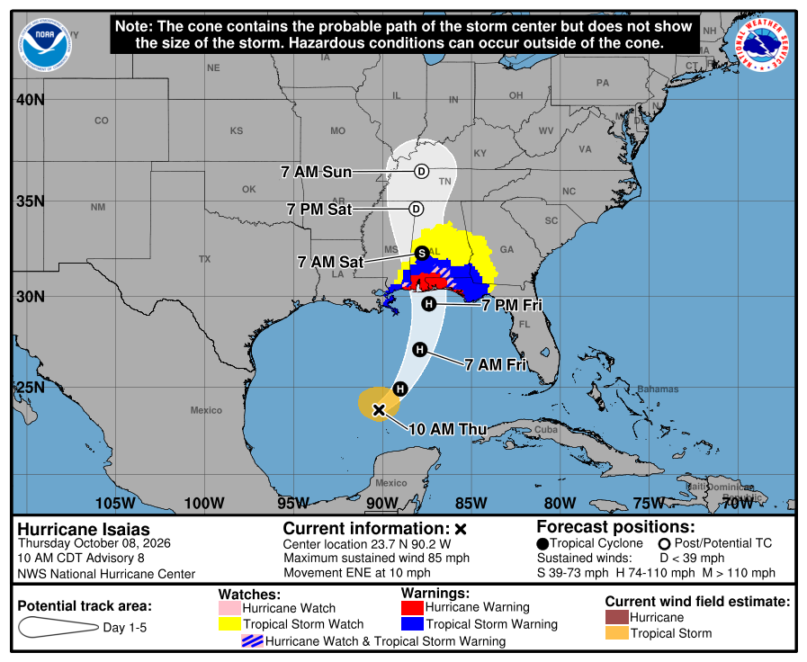
A broad swath of the south and the mid-Atlantic is forecast to receive anywhere from 1 to 4 inches of rain. Specific totals remain unclear, and will depend on how the remnants of the hurricane move across the southern states on Saturday.
Rain could continue into the early hours Monday.
Find out what's happening in Across Pennsylvaniafor free with the latest updates from Patch.
Strong wind gusts are also possible. The Gulf Coast could receive gusts up to 120 miles per hour, and winds up to 60 miles per hour are expected inland in the south, though nothing approaching that severity is expected as far north as the mid-Atlantic, forecasters said.
Isaias is the first hurricane in the Atlantic in 2026, marking the latest date in a century for the first hurricane of the season, according to Accuweather.
In the meantime, temperatures remain mild and conditions clear to end this week, with highs in the low 70s and lows in the low 50s.
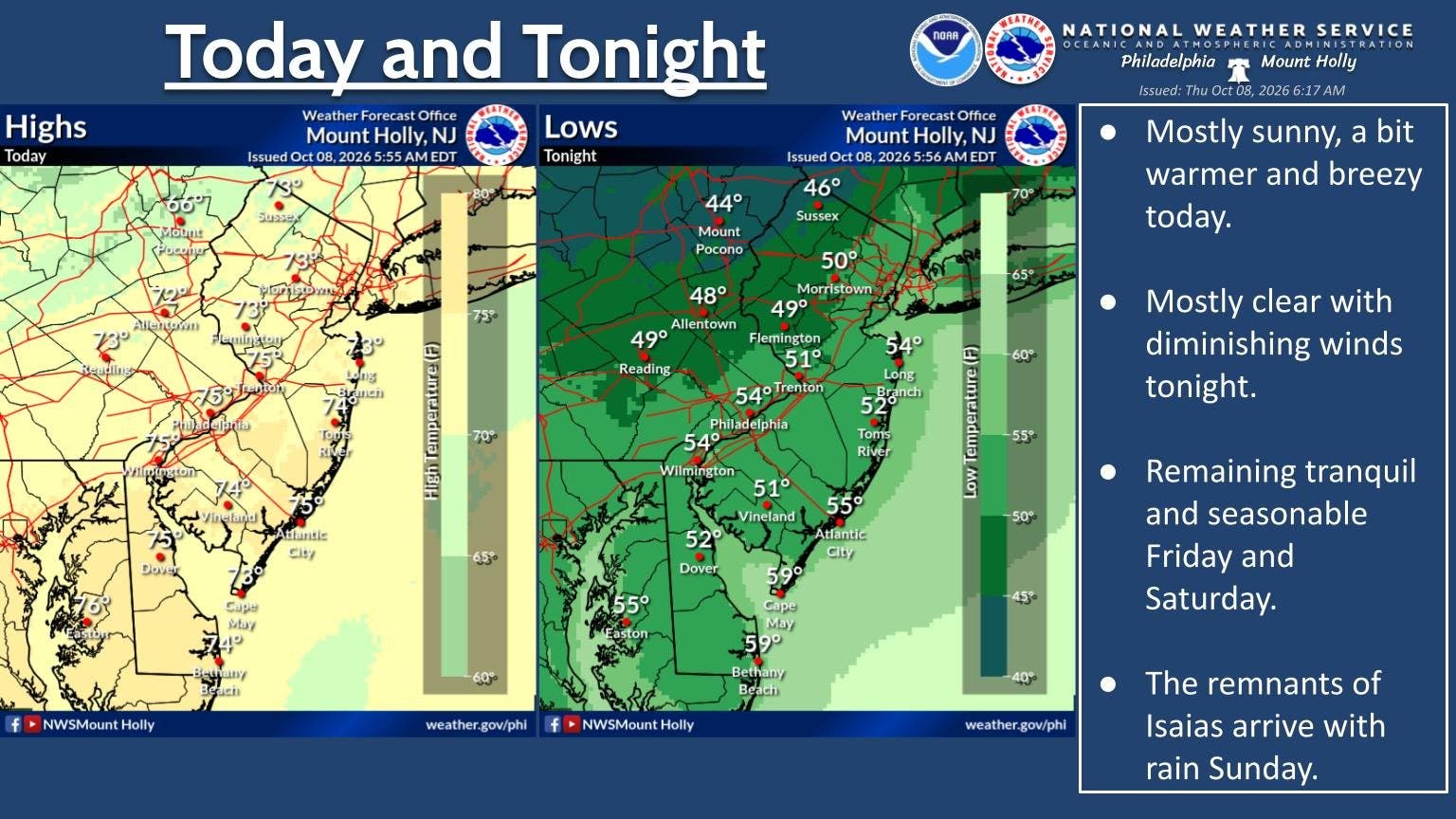
Here's the full forecast for the coming week:
Thursday
Sunny, with a high near 75. West wind 10 to 15 mph, with gusts as high as 25 mph.
Thursday Night
Mostly clear, with a low around 54. Northwest wind around 5 mph.
Friday
Sunny, with a high near 72. West wind 5 to 15 mph.
Friday Night
Partly cloudy, with a low around 53. West wind around 5 mph becoming north after midnight.
Saturday
Partly sunny, with a high near 71. Northeast wind around 5 mph becoming south in the afternoon.
Saturday Night
Mostly cloudy, with a low around 57.
Sunday
Showers likely, mainly after 2 p.m. Cloudy, with a high near 68. Chance of precipitation is 60 percent.
Sunday Night
Showers, mainly before 2 a.m. Low around 63. Chance of precipitation is 80 percent.
Monday
A chance of showers before 8 a.m. Mostly cloudy, with a high near 71. Chance of precipitation is 30 percent.
Monday Night
Partly cloudy, with a low around 61.
Tuesday
Mostly sunny, with a high near 72.
Tuesday Night
Partly cloudy, with a low around 54.
Wednesday
Mostly sunny, with a high near 62.
Get more local news delivered straight to your inbox. Sign up for free Patch newsletters and alerts.