Weather
Possible Hurricane Developing: See Potential Eastern PA Impacts
Another major weather system is brewing in the Gulf. See how it could impact your weekend plans:


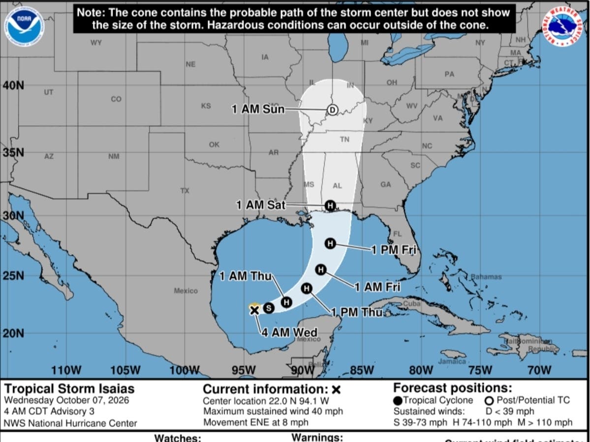
Another major weather system is brewing in the Atlantic, developing into a tropical storm and possibly a hurricane that could impact the greater Philadelphia area.
The storm is still developing in the Gulf of Mexico, and it's exact track and the extent of how far inland it his are still unclear.
However, forecasters believe it has a good chance of becoming the first hurricane in the Atlantic in 2026, marking the latest date in a century for the first hurricane of the season, according to Accuweather.
Find out what's happening in Across Pennsylvaniafor free with the latest updates from Patch.
Depending on the storm's track, its impacts could make it to Pennsylvania as early as Sunday night, with 1-2 inches of rain possible in the region, Accuweather says. However, the strength of the storm when it potentially reaches the area is uncertain. It's also unknown when exactly it could arrive, with new maps from the National Hurricane Center showing a slower approach.
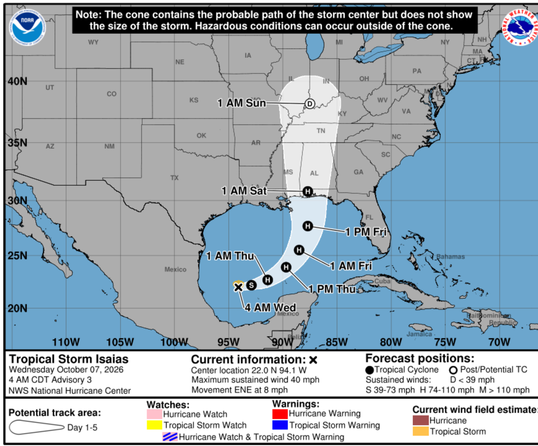
While the potential Category 2 or 3 storm could bring massive storm surges and flooding to the Gulf coast and the southern states, the mid-Atlantic is likely about its farthest reach.
Find out what's happening in Across Pennsylvaniafor free with the latest updates from Patch.
The most substantial impact from the brewing storm will be from heavy rainfall that can lead to flooding, especially in areas where the ground remains saturated from drenching rain in the past week," Accuweather added.
Temperatures will remain mild through the remainder of the week and the weekend, with the highs reaching the mid-70s and lows sticking in the low 40s to low 50s.
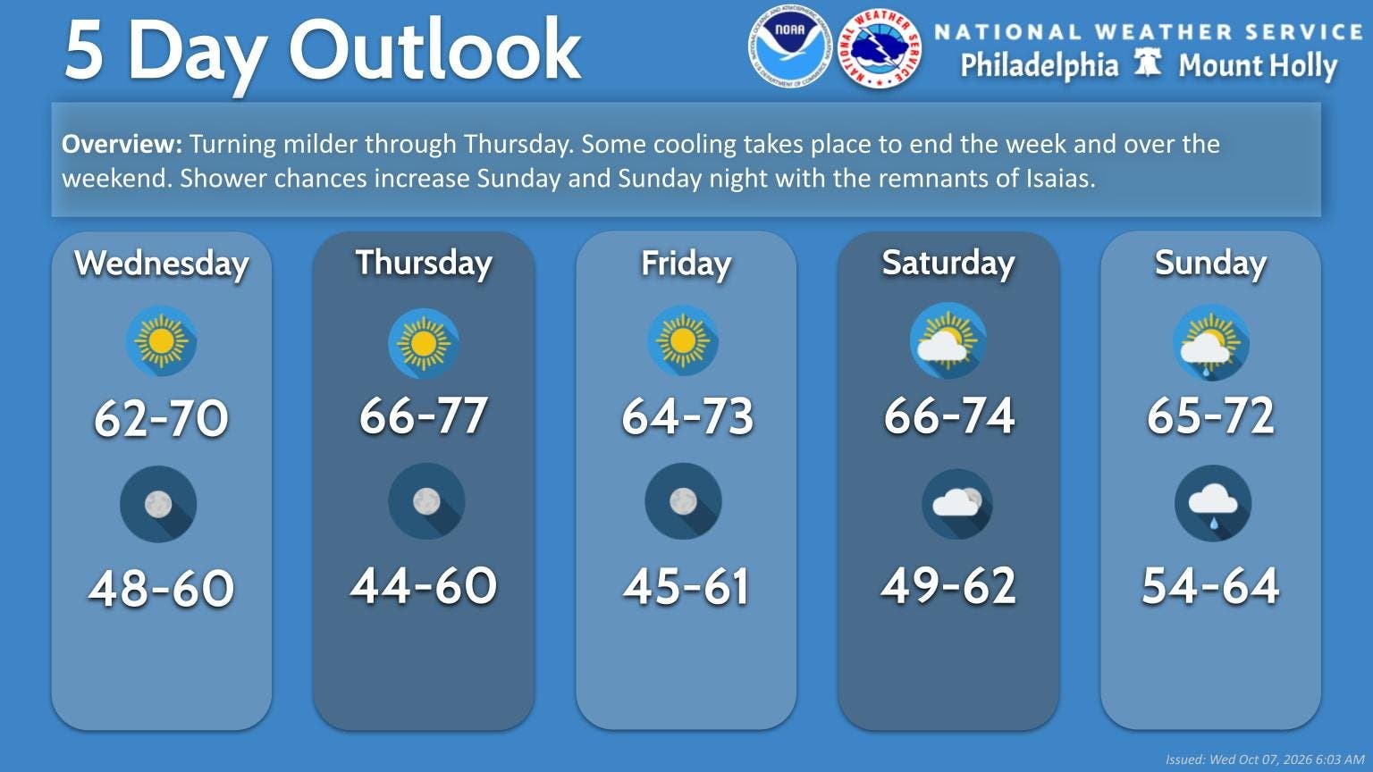
More certainty on timing of the arrival of rain this weekend, and the strength of the remnants that hit the Philadelphia area, will become more clear in the coming days, forecaster said.
For now, here is the storm's current predicted track, according to the National Hurricane Center.
Here's the full forecast for the coming week:
Wednesday
Sunny, with a high near 70. Southwest wind 5 to 10 mph.
Wednesday Night
Mostly clear, with a low around 55. South wind 5 to 10 mph.
Thursday
Sunny, with a high near 76. Southwest wind 5 to 10 mph, with gusts as high as 20 mph.
Thursday Night
Mostly clear, with a low around 53. Northwest wind around 5 mph.
Friday
Sunny, with a high near 73. West wind around 5 mph.
Friday Night
Partly cloudy, with a low around 54.
Saturday
Mostly sunny, with a high near 74.
Saturday Night
Mostly cloudy, with a low around 57.
Sunday
A chance of showers. Partly sunny, with a high near 72. Chance of precipitation is 50 percent.
Sunday Night
Showers. Low around 62. Chance of precipitation is 80 percent.
Monday
A chance of showers. Mostly cloudy, with a high near 73. Chance of precipitation is 50 percent.
Monday Night
Mostly cloudy, with a low around 60.
Tuesday
Partly sunny, with a high near 71.
Get more local news delivered straight to your inbox. Sign up for free Patch newsletters and alerts.