Weather
Winter Storm Warning In Washington: Lowland Snow This Weekend
A winter storm warning issued Friday night in Puget Sound will continue until Saturday afternoon. Here's what to expect for a snowy weekend


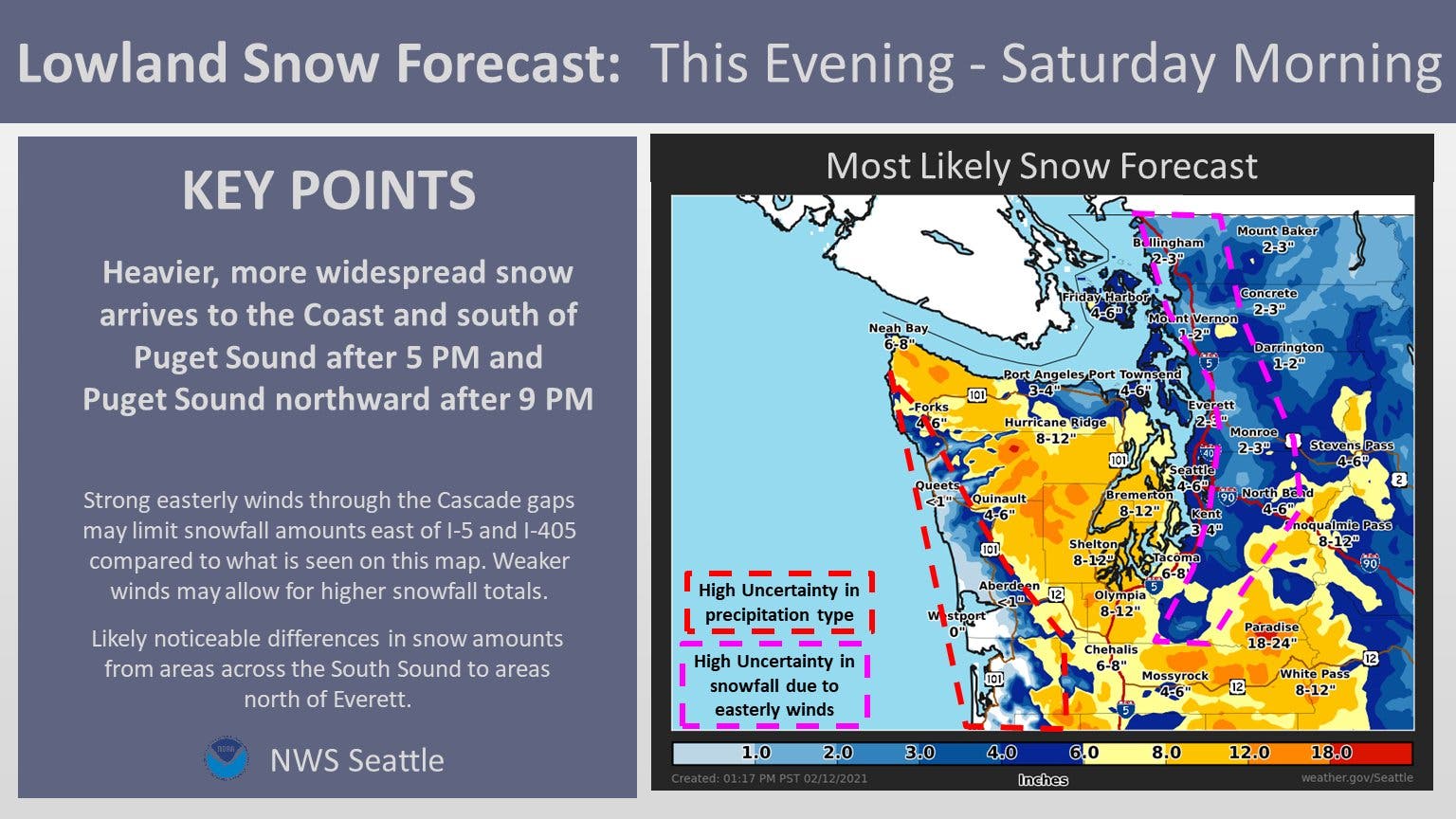
SEATTLE — The most significant lowland snow event of the season is upon us, and many Puget Sound communities are forecast to see several inches of accumulation through at least Saturday morning. After the first round brought just a preview of snow for most areas north of Olympia, a second system night promises widespread impact.
A winter storm warning will remain in effect from 10 p.m. Friday until at least 4 p.m. Saturday.
The National Weather Service shared an updated outlook for round two Friday afternoon, including favorable odds for at least 4 inches falling in Seattle by Saturday afternoon and a 50/50 shot at more than 6 inches.
Find out what's happening in Across Washingtonfor free with the latest updates from Patch.
Snow Probabilities FRI PM-SAT (2/3): These probability graphics depict the potential that snowfall amounts will exceed 1", 2", 4", 6", 8", 12" for select locations. Bottom Line: While actual snow amounts may vary, be prepared for widespread travel difficulties. pic.twitter.com/bhonts8Gik
— NWS Seattle (@NWSSeattle) February 12, 2021
A key factor leading to some uncertainty in snow projections is strong easterly winds, which have a drying effect on air and may limit snowfall east of Interstate 5 and Interstate 405. Forecasters said a noticeable difference in accumulation is likely between South Sound and North Sound towns, with a potential dividing line drawn somewhere in King County.
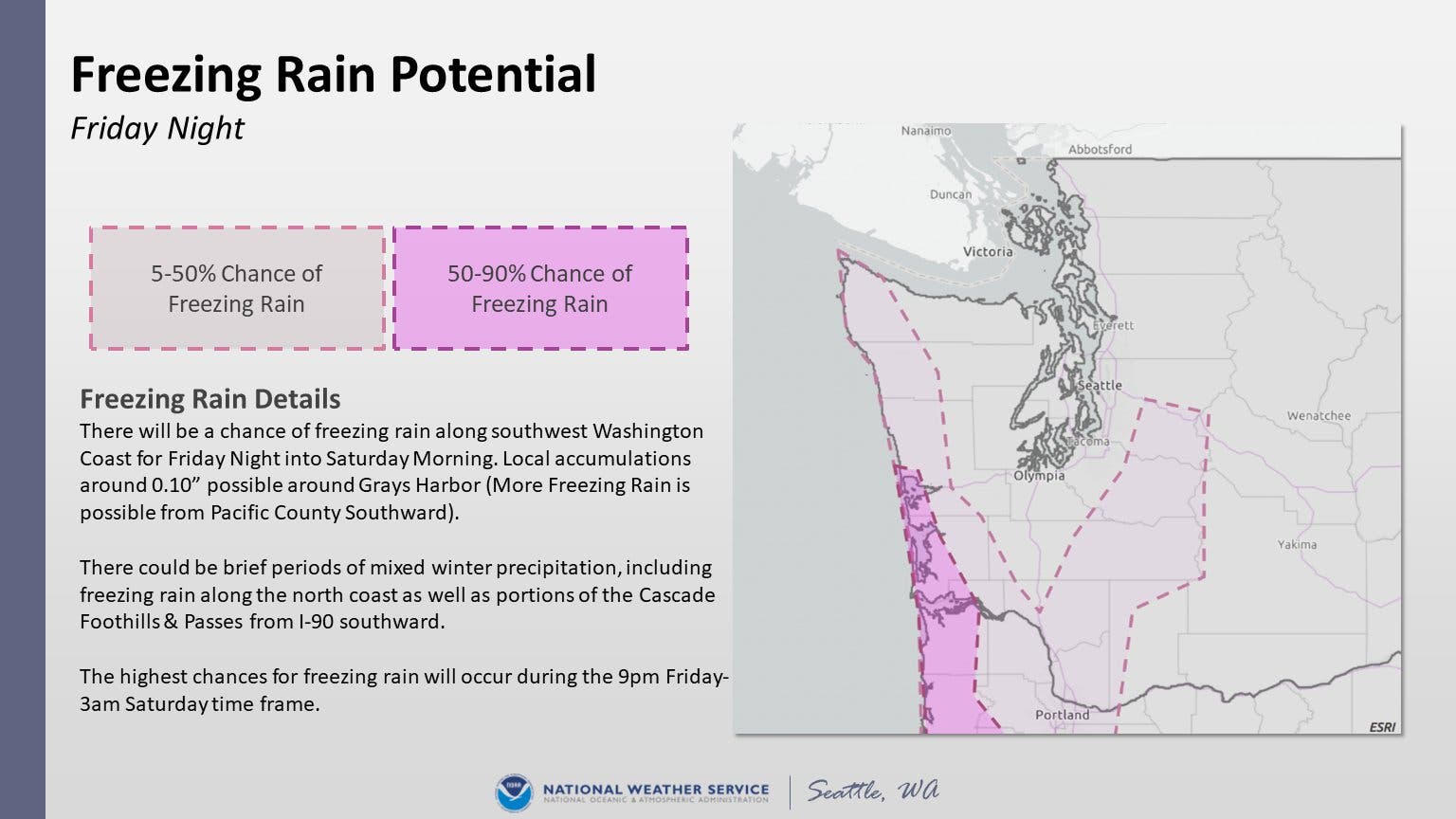
One change reflected in Friday's forecast was the potential for freezing rain along the coast and portions of the Cascade foothills and mountain passes.
Find out what's happening in Across Washingtonfor free with the latest updates from Patch.
Regardless of what happens, Saturday will present travel hazards across the region, with morning temperatures well below freezing and widespread ice and snow. Anyone planning to travel this weekend should expect wintry conditions and plan accordingly.
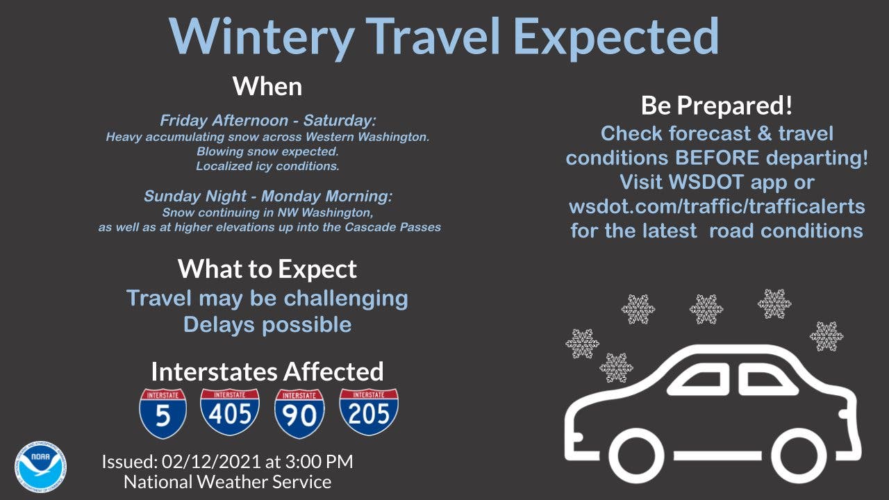
Saturday morning's wind chill will lend to temperatures in the teens across Puget Sound, and afternoon highs are unlikely to break out of the 30s, according to the National Weather Service. Frigid air will continue Sunday, but afternoon highs should creep a few degrees higher.

Forecasters are also monitoring a third storm, slated to arrive Sunday night, which may bring even more snow before transitioning to a rain-snow mix. Temperatures should climb a bit on Monday and warm further from Tuesday through next week. More wet weather next week, so far, is expected to bring rain to the lowlands rather than snow.
Get more local news delivered straight to your inbox. Sign up for free Patch newsletters and alerts.