Weather
Tornado Warning Issued For Janesville, Beloit, Clinton: WI Weather
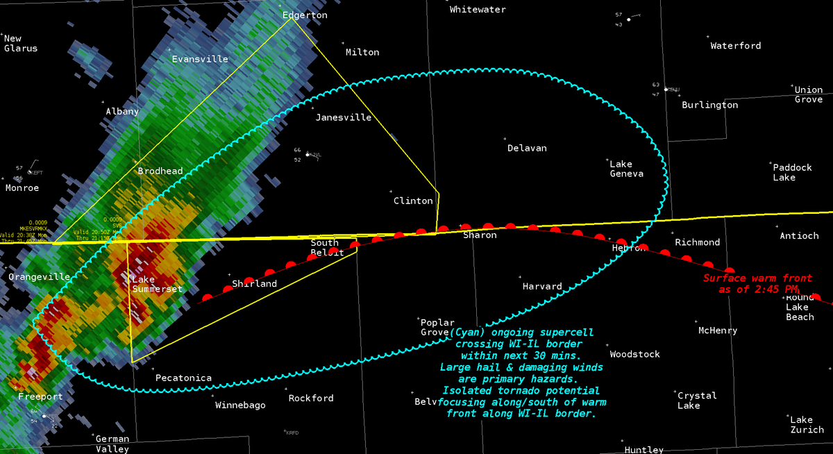
Moments after a "supercell" thunderstorm developed, the National Weather Service issued a tornado warning for the Janesville area.


ROCK COUNTY, WI — Moments after a "supercell" thunderstorm developed along the Wisconsin-Illinois border Monday afternoon, the National Weather Service issued a tornado warning for Janesville, Beloit, and Clinton until 3:45 p.m.
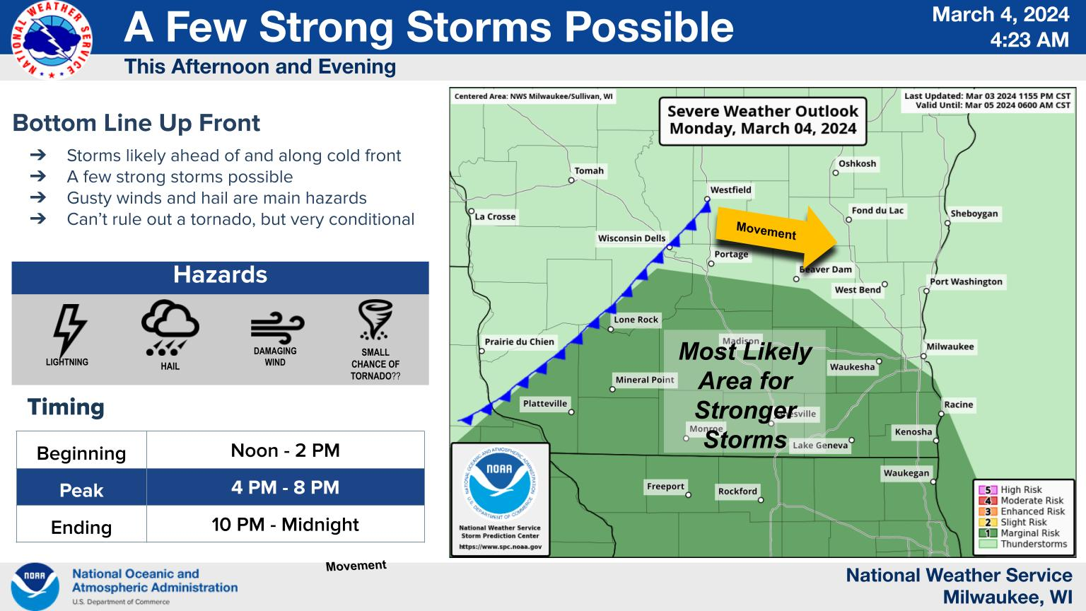
Meanwhile, a hazardous weather outlook was issued for the rest of southern and central Wisconsin, including the counties of Marquette, Green Lake, Fond du Lac, Sheboygan, Sauk, Columbia, Dodge, Washington, Ozaukee, Iowa, Dane, Jefferson, Waukesha, Milwaukee- Lafayette, Walworth, Racine, and Kenosha.
Those counties should expect good chances for showers and thunderstorms after 5 p.m.
Find out what's happening in Across Wisconsinfor free with the latest updates from Patch.
Here's the week-ahead NWS forecast from the Milwaukee Airport:
Monday: A chance of showers and thunderstorms, then showers likely and possibly a thunderstorm after 5pm. Mostly cloudy, with a high near 56. Northeast wind 5 to 10 mph. Chance of precipitation is 60%. New rainfall amounts of less than a tenth of an inch, except higher amounts possible in thunderstorms.
Find out what's happening in Across Wisconsinfor free with the latest updates from Patch.
Monday Night: Showers and possibly a thunderstorm before 3am, then a chance of showers and thunderstorms, mainly between 3am and 5am. Low around 38. North wind 10 to 15 mph, with gusts as high as 30 mph. Chance of precipitation is 100%. New rainfall amounts between a half and three quarters of an inch possible.
Tuesday: Cloudy through mid morning, then gradual clearing, with a high near 45. North wind around 15 mph, with gusts as high as 30 mph.
Tuesday Night: Increasing clouds, with a low around 33. Northeast wind 10 to 15 mph.
Wednesday: Mostly sunny, with a high near 45. Northeast wind around 10 mph.
Wednesday Night: Mostly cloudy, with a low around 35. Northeast wind 5 to 10 mph becoming east after midnight.
Thursday: Partly sunny, with a high near 47. East wind 5 to 10 mph.
Thursday Night: A 30 percent chance of rain after midnight. Mostly cloudy, with a low around 38. East wind around 10 mph.
Friday: Rain likely, mainly after noon. Cloudy, with a high near 46. Chance of precipitation is 60%.
Friday Night: Rain likely, mainly before midnight. Cloudy, with a low around 33. Breezy. Chance of precipitation is 60%.
Saturday: A 30 percent chance of rain. Mostly cloudy, with a high near 43. Breezy.
Saturday Night: A slight chance of rain and snow. Partly cloudy, with a low around 28. Chance of precipitation is 20%.
Sunday: Mostly sunny, with a high near 43.
Get more local news delivered straight to your inbox. Sign up for free Patch newsletters and alerts.