Weather
Tropical Storm Isaias Forms In Gulf, Could Become Hurricane Before Landfall
Tropical Storm Isaias has formed in the Gulf and is forecast to strengthen into the first hurricane of the 2026 Atlantic season.


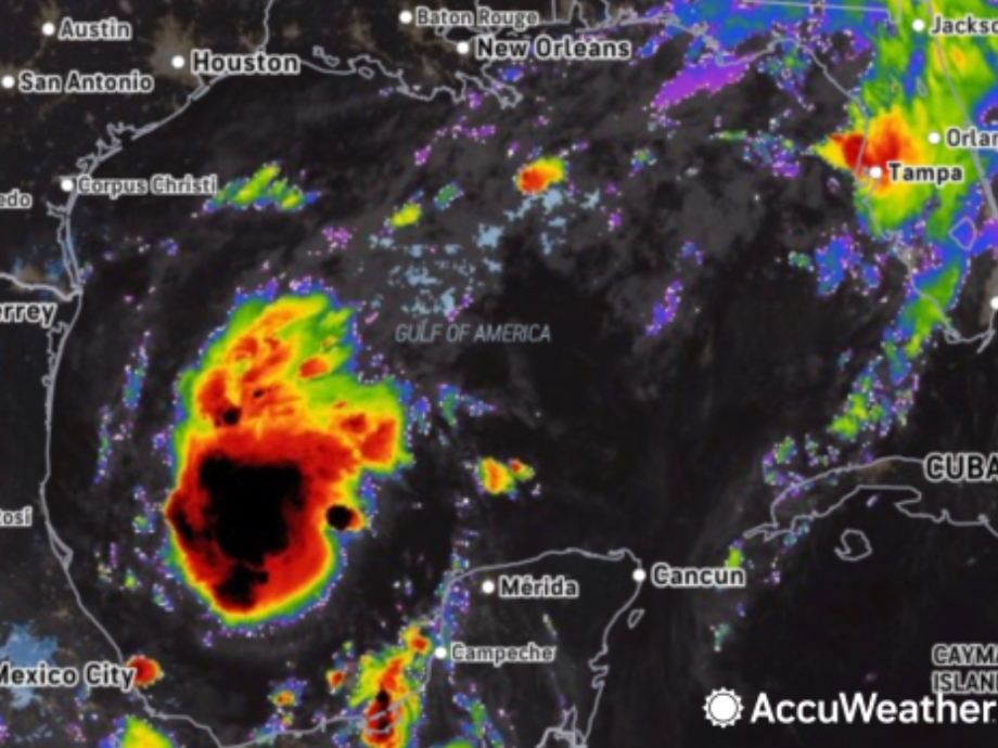
Tropical Storm Isaias has formed in the Gulf and is forecast to strengthen into the first hurricane of the 2026 Atlantic season before threatening the central Gulf Coast this weekend.
Click here to subscribe to our free daily newsletter and breaking news alerts.
AccuWeather meteorologists said Wednesday morning that Isaias is expected to track northeastward across the Gulf and strengthen, potentially reaching Category 2 hurricane intensity before making landfall late Friday night or early Saturday morning.
Find out what's happening in Across Alabamafor free with the latest updates from Patch.
This comes ahead of a busy weekend in Alabama, with the Crimson Tide football team set to take on Georgia in a highly anticipated matchup Saturday that is expected to be attended by President Donald Trump.
Alabama Athletics said it is closely monitoring the weather forecast ahead of Saturday’s game.
Find out what's happening in Across Alabamafor free with the latest updates from Patch.
"At this time, there are no plans to alter the contest," UA said in a statement. "We will continue to observe conditions throughout the week and remain in communication with the Southeastern Conference office, as needed. Fans are encouraged to rely on official Alabama Athletics and SEC channels for the latest information regarding Saturday’s game."
The Tuscaloosa Patch area is expected to begin seeing impacts Saturday and into Sunday morning as of the publication of this story, although the path and speed of the storm remains uncertain and subject to change.
While the storm's eventual landfall remains unclear, AccuWeather said the most likely area stretches from southeastern Louisiana to the western Florida Panhandle.
AccuWeather Lead Hurricane Expert Alex DaSilva said waters across the Gulf are well into the 80s, providing ample fuel for strengthening.
Wind shear remains one factor that could limit the storm's development, but AccuWeather's forecast track currently takes Isaias away from the strongest shear.
“Our forecast track has the storm avoiding the strongest wind shear, which should foster strengthening,” DaSilva said.
If Isaias reaches hurricane strength, it would become the first hurricane of an unusually quiet 2026 Atlantic hurricane season. AccuWeather said it would also mark the latest first hurricane of an Atlantic season in more than a century.
AccuWeather said flooding could become the storm's most widespread threat, particularly because portions of the Gulf Coast and Southeast have already received heavy rain.
Forecasters are calling for a broad area of 1 to 4 inches of rain across the Southeast, with bands of 4 to 8 inches and potentially 8 to 12 inches near and east of Isaias' track.
AccuWeather's Local StormMax rainfall estimate is 25 inches.
The strongest winds and greatest threat of coastal storm surge flooding are expected near and just east of wherever the storm makes landfall.
AccuWeather projects wind gusts of 100 to 120 mph near and east of the center if Isaias strengthens into a hurricane as forecast. A broader area could experience tropical storm-force gusts of 40 to 60 mph.
Conditions along the Gulf Coast are expected to deteriorate as the system approaches, with building seas and dangerous rip currents expected along portions of the north-central and northeastern Gulf Coast.
Severe thunderstorms will also be possible.
“Another hazard from the storm will be the risk of severe thunderstorms, including tornadoes and waterspouts,” AccuWeather Chief On-Air Meteorologist Bernie Rayno said.
After landfall, AccuWeather expects the system to move north-northeast across the interior Southeast before potentially reaching the Ohio Valley.
This is a developing story. Tuscaloosa Patch will have more information as it becomes available.
Get more local news delivered straight to your inbox. Sign up for free Patch newsletters and alerts.