Weather
Power Shutoffs Possible As Santa Ana Winds Bring Heat And Threat Of SoCal Wildfires
After days of storms and a dramatic cooldown, SoCal faces 90-degree heat, dangerous winds, wildfire risk and possible power shutoffs.


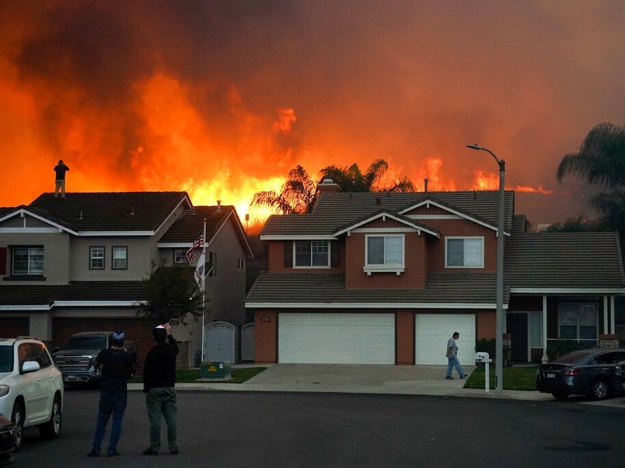
Southern California is in for another dramatic weather shift this week as the stormy conditions and chilly temperatures of recent days give way to scorching heat and elevated wildfire danger thanks to the first powerful Santa Ana winds of the fall wildfire season.
After temperatures dropped sharply Monday and massive waves battered beaches across the region, forecasters are warning of a rapid warm-up beginning Wednesday. By Friday, temperatures could soar into the mid-90s in some areas, while wind gusts could reach 70 mph in the mountains, according to the National Weather Service.
From Beach Hazards To Wildfire Danger
The abrupt reversal comes after a turbulent stretch of weather fueled in part by the remnants of former Tropical Storm Rachel, which sent destructive waves crashing into coastal communities in Long Beach and Orange County.
Find out what's happening in Los Angelesfor free with the latest updates from Patch.
Although the surf began subsiding Tuesday, dangerous rip currents, elevated waves and possible coastal flooding remained concerns. A beach hazards statement was in effect for Southern California beaches through Thursday afternoon.

But the bigger weather threat is shifting inland, where strengthening Santa Ana winds are expected to send temperatures soaring and dramatically increase wildfire danger across Los Angeles, Orange, Riverside, San Bernardino and San Diego counties.
Find out what's happening in Los Angelesfor free with the latest updates from Patch.
Forecasters said temperatures will begin climbing Wednesday as the low-pressure system responsible for the recent cooldown moves east, and high pressure builds off the coast.
In Los Angeles County, coastal and valley temperatures are expected to rise roughly 10 degrees each day, reaching the upper 80s to mid-90s by Friday.
Orange and San Diego counties will experience a similar warmup, with highs in the 80s and 90s Thursday through Saturday. Inland Orange County could see some of the hottest conditions, with a 30% to 50% chance of temperatures exceeding 95 degrees in some locations, according to the National Weather Service.
Even typically cooler coastal communities won't escape the heat. Some areas could experience overnight lows above 70 degrees.
Heat advisories will be in effect from 10 a.m. Thursday through Saturday for much of Los Angeles and Orange counties.Coastal San Diego County will also be under a heat advisory through 8 p.m. Saturday.
High Temperatures Through Saturday
| City | Weds. | Thurs. | Fri. | Sat. |
|---|---|---|---|---|
| Santa Ana | 80 | 90 | 95 | 90 |
| Laguna Hills | 80 | 90 | 94 | 90 |
| Van Nuys | 84 | 90 | 93 | 91 |
| San Diego | 76 | 87 | 93 | 88 |
| Long Beach | 77 | 87 | 93 | 87 |
| Los Angeles | 81 | 89 | 92 | 89 |
| Burbank | 83 | 89 | 92 | 90 |
| Irwindale | 80 | 87 | 90 | 89 |
| LAX | 76 | 84 | 90 | 85 |
| Newport Beach | 75 | 86 | 90 | 83 |
| Santa Monica | 75 | 85 | 89 | 84 |
| Murrieta | 83 | 87 | 88 | 86 |
| Palm Desert | 82 | 87 | 88 | 85 |
| Banning | 78 | 82 | 82 | 78 |
The strongest wind gusts are expected Thursday and Friday across much of the region.
In Los Angeles County, winds could reach 20 to 40 mph in the mountains, with gusts as high as 70 mph in particularly vulnerable areas of the San Gabriel Mountains. Other communities could experience gusts approaching 50 mph.
High wind watches have also been issued for the mountains of Riverside and San Bernardino counties, the Inland Empire, the Santa Ana Mountains and the San Gorgonio Pass, where gusts could reach 50 to 65 mph or higher, forecasters said.
In San Diego County, high wind watches will remain in effect through Saturday evening for mountain and valley communities.
Red Flag Warnings Issued
The combination of strong winds, soaring temperatures and plummeting humidity is expected to create particularly dangerous wildfire conditions.
The weather service issued red flag warnings from 6 a.m. Thursday through 10 p.m. Friday for large portions of Los Angeles County, including the Santa Monica and San Gabriel mountains, Malibu, Calabasas and the Santa Clarita, San Fernando and San Gabriel valleys.
The warnings also cover the 5 and Antelope Valley freeway corridors.
Humidity could plunge to between 8% and 20% in mountain areas and as low as 5% elsewhere, quickly drying out vegetation despite the recent wet weather.
"Moderate to locally strong Santa Ana winds will quickly develop on Thursday, peak Thursday afternoon through Friday afternoon, then weaken through the weekend," the National Weather Service warned. "Meanwhile, dry air will settle over the region and dry out any helpful effects of the recent rains."
Some of the windiest areas could remain under critical fire weather conditions into Saturday.
The dangerous wind forecast is also raising concerns about possible electricity shutoffs.
Southern California Edison was considering so-called Public Safety Power Shutoffs affecting more than 37,700 customers in Los Angeles County as of Tuesday afternoon, although no customers had been affected at that point.
The utility uses public safety power shutoffs during periods of extreme fire danger to reduce the risk of damaged electrical equipment igniting wildfires, officials said.
Malibu officials said SCE had notified the city of possible shutoffs beginning as early as Thursday morning because of the forecast conditions.
Cooler Temperatures Ahead
The weather whiplash may be relatively short-lived.
Forecasters expect the Santa Ana winds to gradually weaken over the weekend as another low-pressure system approaches the West Coast.
That system could bring cooler temperatures early next week, with the possibility of below-normal temperatures, breezy conditions and even precipitation by the middle of next week.
City News Service contributed to this report.
Get more local news delivered straight to your inbox. Sign up for free Patch newsletters and alerts.