Crime & Safety
Sepulveda Pass Fire Map: See Getty Fire Perimeter, Evacuation Areas
The Getty Fire broke out Wednesday afternoon near the 405 Freeway, prompting evacuation warnings.


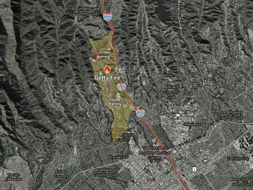
LOS ANGELES, CA — A brush fire broke out Wednesday afternoon near the 405 Freeway in the Sepulveda Pass, prompting evacuation warnings and forcing the Getty Center to close.
The Getty Fire was reported at 4:17 p.m. near Getty Center Drive, according to the Los Angeles Fire Department.
About five acres of brush has burned as firefighters battled the flames, and the department requested additional resources, including hand crews and aircraft, according to an LAFD update before 5 p.m.
Find out what's happening in Los Angelesfor free with the latest updates from Patch.
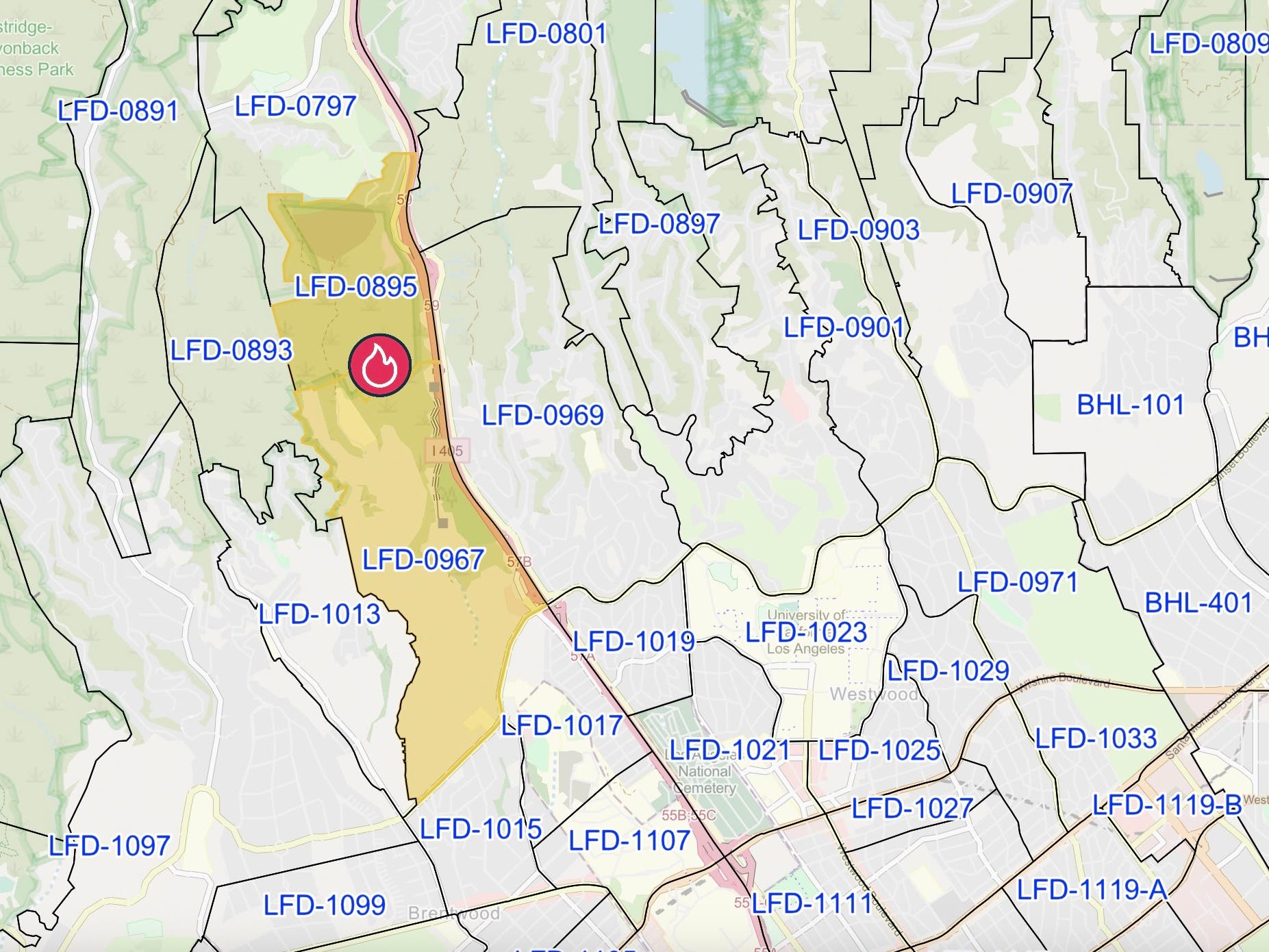
As of 5:45 p.m., evacuation warnings were in effect for areas west of the 405 and north of Sunset Boulevard in the pass.
The zones under evacuation warnings at that time were:
Find out what's happening in Los Angelesfor free with the latest updates from Patch.
- LFD-0967
- LFD-0967
People in those areas were urged to prepare to evacuate if conditions worsen and to monitor instructions from first responders.
Get more local news delivered straight to your inbox. Sign up for free Patch newsletters and alerts.