Crime & Safety
Bryson Fire: See Malibu Fire Perimeter Map, Evacuation Orders
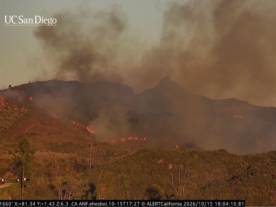
The Bryson Fire broke out in the mountains north of Malibu shortly before 5 p.m. Thursday.


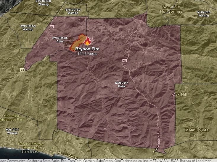
MALIBU, CA — A wildfire that broke out in the mountains north of Malibu Thursday afternoon quickly grew to about 80 acres in an hour, prompting evacuation orders and warnings as powerful Santa Ana winds fueled the flames.
The Bryson Fire, burning near the 400 block of Encinal Canyon Road, west of Mulholland Highway, broke out shortly before 5 p.m. Thursday, according to fire officials.
Firefighters responded to the fast-moving blaze, with a second alarm issued as winds pushed the flames forward and sparked spot fires.
Find out what's happening in Malibufor free with the latest updates from Patch.
Water- and retardant-dropping helicopters and fixed-wing aircraft were dispatched to the scene to help subdue the flames, which were burning in largely inaccessible terrain.
There was no immediate word on what caused the blaze.
Find out what's happening in Malibufor free with the latest updates from Patch.
By shortly after 6 p.m., the fire had grown to about 100 acres.
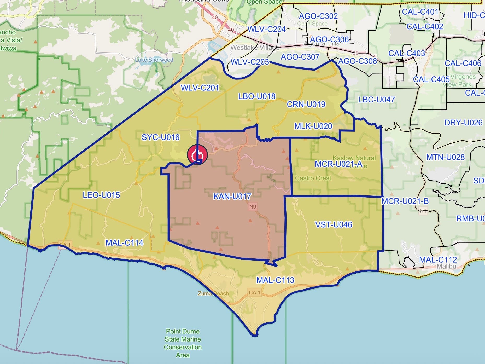
At that time, Evacuation orders were in place for zone KAN-U017, centered around Kanan Dume Road, while evacuation warnings were issued for areas near Mulholland Highway, extending toward Leo Carrillo State Park and parts of Malibu around Point Dume.
The Los Angeles County Probation Department announced it has safely evacuated 38 female and gender expansive youth from Campus Vernon Kilpatrick in the Malibu area due to the Bryson Fire. The youths have arrived at Barry J. Nidorf Juvenile Hall, according to the department.
City News Service contributed to this report.
Get more local news delivered straight to your inbox. Sign up for free Patch newsletters and alerts.