Weather
Special Weather Statement Issued For Inland Southern Connecticut
Find out the latest forecast for wintry weather and the weekend outlook, according to meteorologists.

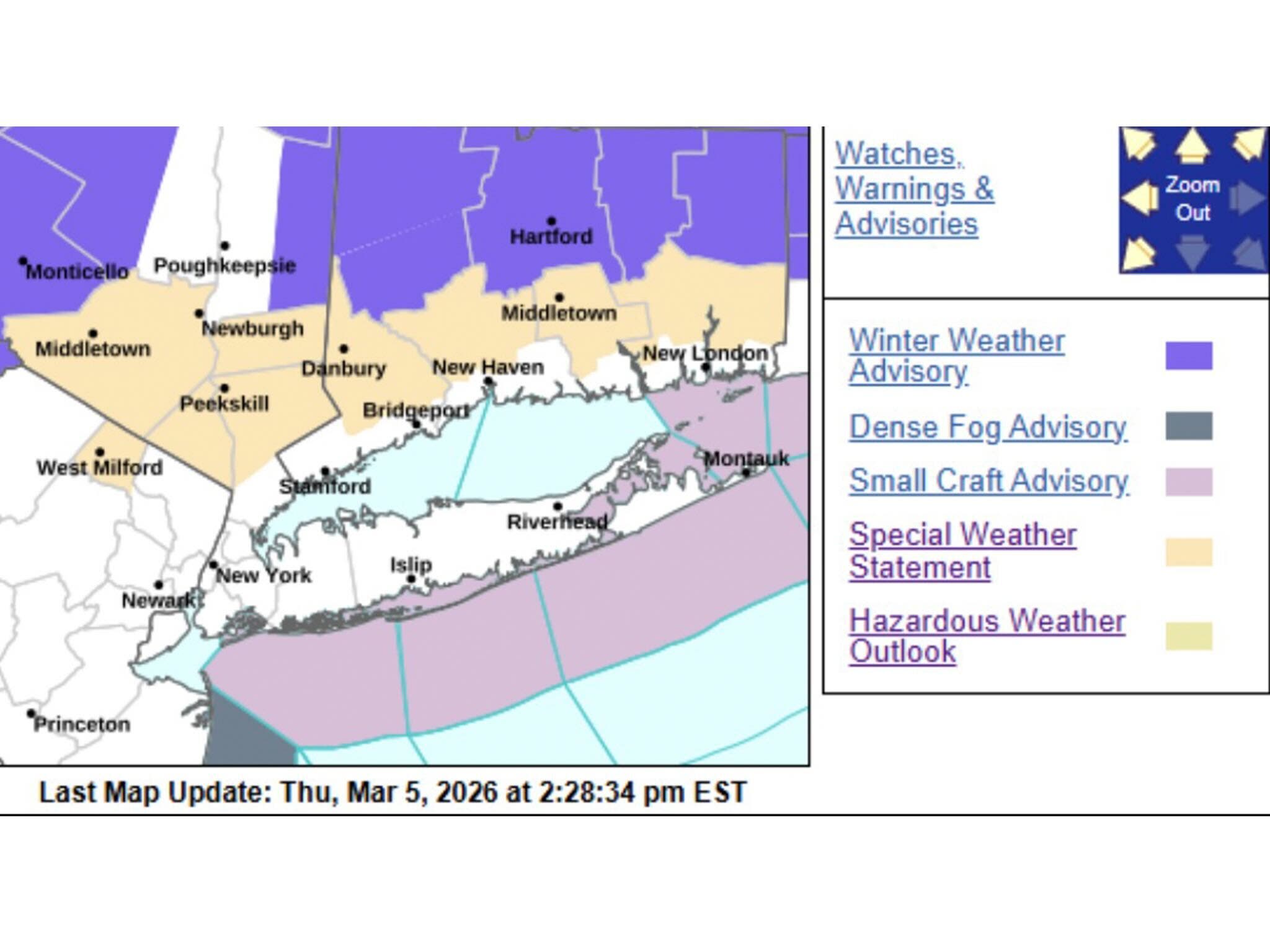
UPDATE: The National Weather Service’s New York office issued a special weather statement Thursday afternoon for northern Fairfield, New Haven, Middlesex and New London counties in Connecticut.
It advises there will be possible pockets of freezing rain overnight and into Friday morning.
“As rain continues to fall tonight into Friday morning, temperatures are expected to lower to near the freezing mark. Localized icy conditions could develop, and motorists and pedestrians are advised to use extra caution if traveling tonight or early Friday morning,” the statement said.
Find out what's happening in Across Connecticutfor free with the latest updates from Patch.
ORIGINAL STORY: Northern areas of Connecticut could get freezing rain tonight, which could lead to slippery conditions for the Friday morning commute, according to meteorologists.
Winter weather advisories are in effect from 5 p.m. Thursday to noon on Friday for the Connecticut River Valley, and Hartford, Litchfield, Tolland and Windham counties, according to the National Weather Service.
Find out what's happening in Across Connecticutfor free with the latest updates from Patch.
It predicts rain and then mixed precipitation in these areas, with snow and sleet leading to slippery road conditions.
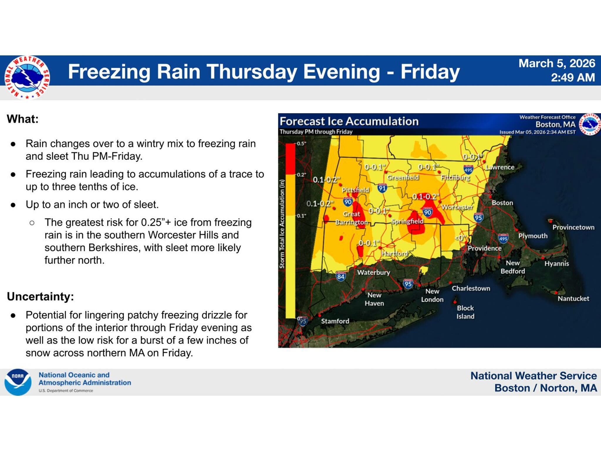
Freezing rain could lead to an accumulation of ice, ranging between a trace and three-tenths of an inch in northern Connecticut, according to the National Weather Service’s Boston office.
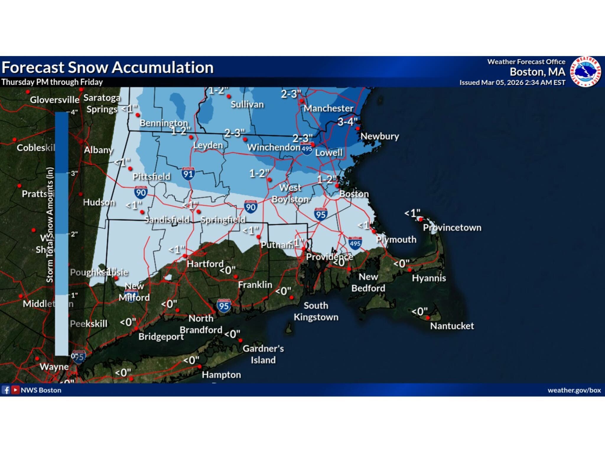
Snow accumulation will be less than an inch in northern Connecticut, it reported Thursday morning.
WFSB reports today will be a rainy one, with high temperatures hovering around 40 degrees.
“Tonight, as some colder air drains southward into CT, freezing rain becomes a concern,” WFSB reports. “Inland parts of the state, especially across the NW and NE hills, have the greatest risk for a glaze (or more) of ice to form on untreated surfaces.”
WFSB is calling Friday a “First Alert Weather Day,” due to this freezing rain concern and the anticipated impact on Friday morning’s commute.
WTNH also predicts rain today, with the precipitation remaining as rain in southern Connecticut, but a changeover tonight in northern sections.
“Inland areas (especially the northern four counties) are expected to change over to sleet and freezing rain tonight,” WTNH reports. “Depending on how much icing develops overnight, inland areas could be dealing with another messy commute Friday morning, with the possibility of school delays as well.”
Gov. Ned Lamont is activating Connecticut’s Severe Cold Weather Protocol starting at 5 p.m. today and lasting until noon Friday, due to the forecast for sleet and freezing rain. Anyone who needs shelter or a warming center should visit 211ct.org or call 2-1-1.
Looking ahead, the weekend is expected to bring warmer temperatures, with highs on Saturday around 50 degrees, and Sunday temperatures reaching around 55, according to the National Weather Service.
Read More:
- Suspect Accused Of Poisoning People: Police
- Man Found Dead In Water, Police Investigating
- Major Company To Layoff 300 Employees, Timeline Issued
Here are the forecast details for northern Connecticut via the National Weather Service:
Today: Rain, mainly after 11 a.m. Areas of fog before 10 a.m., then areas of fog after 11 a.m. High near 39. Calm wind becoming northeast 5 to 7 mph in the afternoon. Chance of precipitation is 90%. New precipitation amounts between a tenth and quarter of an inch possible.
Tonight: Rain. Areas of fog. Low around 32. Northeast wind 7 to 10 mph. Chance of precipitation is 100%. New precipitation amounts between a half and three quarters of an inch possible.
Friday: Rain likely, mainly before 10 a.m. Areas of fog before 1 p.m., then areas of fog after 3 p.m. Otherwise, cloudy, with a high near 37. North wind around 8 mph, with gusts as high as 20 mph. Chance of precipitation is 70%. New precipitation amounts of less than a tenth of an inch possible.
Friday Night: A slight chance of rain after 3 a.m. Cloudy, with a low around 33. North wind around 6 mph becoming calm in the evening. Chance of precipitation is 20%.
Saturday: A slight chance of rain before 10 a.m., then a slight chance of rain after 5 p.m. Cloudy, with a high near 49. Light south wind increasing to 5 to 10 mph in the morning. Winds could gust as high as 20 mph. Chance of precipitation is 20%.
Saturday Night: Rain likely, mainly between 10 p.m. and 1 a.m. Cloudy, with a low around 42. South wind 7 to 10 mph, with gusts as high as 21 mph. Chance of precipitation is 60%.
Sunday: A chance of rain before 8 a.m. Partly sunny, with a high near 55. West wind around 6 mph. Chance of precipitation is 30%.
Here are the forecast details for southern Connecticut via the National Weather Service:
Today: Rain. Patchy fog. High near 39. Calm wind becoming northeast around 6 mph in the afternoon. Chance of precipitation is 90%. New precipitation amounts between a quarter and half of an inch possible.
Tonight: Rain. Patchy fog. Low around 33. Northeast wind 6 to 10 mph, with gusts as high as 20 mph. Chance of precipitation is 100%. New precipitation amounts between a half and three quarters of an inch possible.
Friday: Rain likely, mainly before 7 a.m. Patchy fog before 10 a.m. Otherwise, mostly cloudy, with a high near 41. Northeast wind 7 to 10 mph, with gusts as high as 20 mph. Chance of precipitation is 60%. New precipitation amounts of less than a tenth of an inch possible.
Friday Night: A 20 percent chance of rain after 1 a.m. Cloudy, with a low around 33. Northeast wind around 5 mph becoming calm in the evening.
Saturday: Cloudy, with a high near 48. Calm wind becoming south 5 to 7 mph in the afternoon.
Saturday Night: Showers likely. Cloudy, with a low around 41. Chance of precipitation is 70%. New precipitation amounts of less than a tenth of an inch possible.
Sunday: Partly sunny, with a high near 55.
Get more local news delivered straight to your inbox. Sign up for free Patch newsletters and alerts.