Weather
Thunderstorms Emerge In Forecast, Unsettled Weather Returns For CT
Find out the latest timeline for possible wet weather, according to meteorologists.


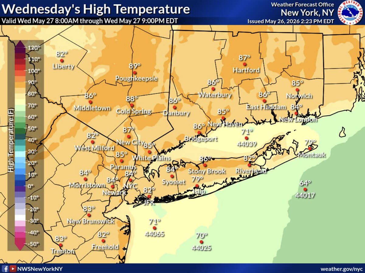
It will be hot and muggy today, with isolated showers and storms possible this afternoon and evening, according to meteorologists.
The National Weather Service is forecasting highs today reaching between 85 in southern Connecticut and 87 inland, under mostly cloudy skies.
The isolated showers and storms are most likely after 3 p.m., and winds could gust up to 20 miles per hour, according to the National Weather Service.
Find out what's happening in Across Connecticutfor free with the latest updates from Patch.
According to WTNH, today will be “warmer and slightly more humid with a few afternoon/evening thundershowers” after 3 p.m.
WFSB also anticipates a muggy day today with temperatures statewide in the 80s.
Find out what's happening in Across Connecticutfor free with the latest updates from Patch.
“A cold front could trigger isolated showers or storms late, but impacts look minimal given the timing (around/after sunset),” WFSB reports. “The front looks overall moisture-starved, so many towns stay entirely dry.”
WTNH anticipates cooler and mostly dry weather will be on tap for Connecticut for Thursday and Friday, though it says pop-up showers are possible both afternoons.
The National Weather Service predicts both Thursday and Friday will be mostly sunny, with highs in the mid-70s.
Read More:
- Car Crashes Into Pizza Sign, Video Shows: Police
- Woman Charged After Attempting to Hit Another Woman Twice With Car After Reversing Onto Sidewalk: PD
- Fatal Motorcycle Crash Investigated: Police
Friday night is expected to bring another chance of showers, according to the National Weather Service.
“A higher shower threat with upper level energy dropping down across Connecticut Friday night and early Saturday,” WTNH predicts.
WFSB reports the highest risk for rain on Friday will be overnight.
“The fifth weekend of May begins unsettled, with the potential for some showers to linger into Saturday morning,” WFSB said. “The day will be mostly cloudy and unseasonably cool with temps only in the mid-60s, though we will dry up in the afternoon. Sunday is the pick of the weekend: 70-75 under a partly to mostly sunny sky.”
Here are the forecast details for northern Connecticut via the National Weather Service:
Today: A slight chance of showers after 3 p.m. Partly sunny, with a high near 87. Light and variable wind becoming west 5 to 10 mph in the morning. Winds could gust as high as 20 mph. Chance of precipitation is 20%.
Tonight: Partly cloudy, with a low around 58. Northwest wind 6 to 8 mph.
Thursday: Mostly sunny, with a high near 74. North wind 8 to 14 mph.
Thursday Night: Mostly clear, with a low around 53. North wind 3 to 8 mph.
Friday: Mostly sunny, with a high near 74. West wind 5 to 9 mph.
Friday Night: A chance of showers, mainly after 10 p.m. Mostly cloudy, with a low around 52. Light west wind increasing to 5 to 9 mph in the evening. Chance of precipitation is 40%.
Saturday: Partly sunny, with a high near 68. North wind 14 to 17 mph.
Saturday Night: Mostly clear, with a low around 46. North wind 7 to 11 mph, with gusts as high as 22 mph.
Sunday: Mostly sunny, with a high near 72. Northwest wind 8 to 13 mph.
Here are the forecast details for southern Connecticut via the National Weather Service:
Today: Mostly cloudy, with a high near 85. Southwest wind 6 to 11 mph.
Tonight: Partly cloudy, with a low around 61. West wind around 6 mph becoming north after midnight.
Thursday: Sunny, with a high near 78. North wind 6 to 11 mph.
Thursday Night: Mostly clear, with a low around 55. North wind 3 to 6 mph.
Friday: Mostly sunny, with a high near 79. West wind 3 to 7 mph.
Friday Night: A 30 percent chance of showers after 2 a.m. Mostly cloudy, with a low around 56.
Saturday: A 30 percent chance of showers before 8 a.m. Mostly sunny, with a high near 72.
Saturday Night: Partly cloudy, with a low around 49.
Sunday: Sunny, with a high near 73.
Get more local news delivered straight to your inbox. Sign up for free Patch newsletters and alerts.