Weather
Tropical Storm Isaias Forms In Gulf: See GA Impacts
Forecasters told Patch that Tropical Storm Isaias "is not like a thunderstorm" and could be "long-lasting" after making landfall.

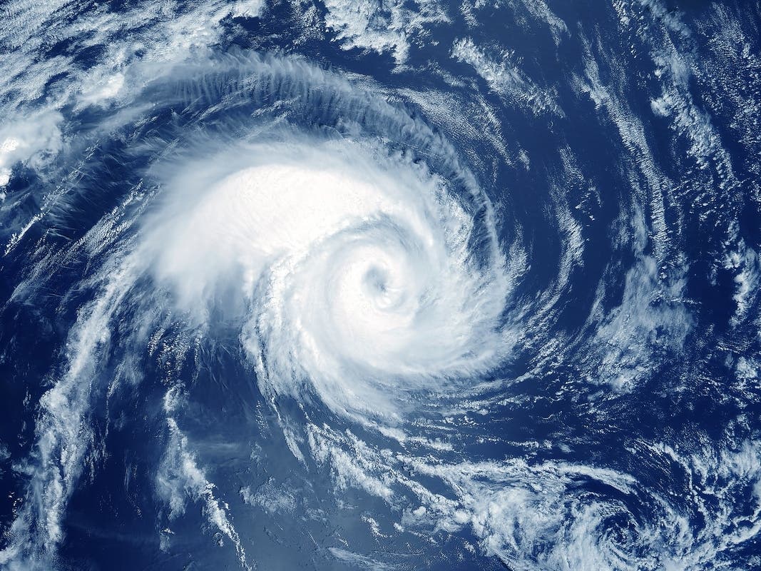
After Tropical Storm Isaias took shape early Wednesday morning, forecasters told Patch the next 48-72 hours could paint a damp picture for Georgia.
Patch spoke with Vaughn Smith, a meteorologist with the National Weather Service's Peachtree City office.
In its 4 a.m. update, the National Hurricane Center predicted Isaias to quickly gain strength in the next two days. It could be the first hurricane of the 2026 Atlantic season.
Find out what's happening in Atlantafor free with the latest updates from Patch.
Isaias brewed in the Gulf and is expected to head northward in the next day or two, potentially making landfall as a hurricane along the Alabama-Florida coast around 1 a.m. Saturday, Smith said.
While in the Gulf, the storm will reach Category 2 status but may weaken and hit landfall as a Category 1, he said.
Find out what's happening in Atlantafor free with the latest updates from Patch.
It will then trek northward through Alabama with Georgia on its "dirty side," or its east side, Smith said.
"This is not like a thunderstorm," he said. "This is a hurricane. This is a long-lasting thing."
RELATED: Weather 1st Hurricane Likely To Form, Slam South: What To Know In GA
Specific impacts to Georgia remained uncertain Wednesday. However, Smith said rain could start Friday night and last through Saturday, causing a dreary weekend.
As of Wednesday, the western side of Georgia was expected to receive more downpour than other areas in the state. Isaias could conjure about 1-3 inches of rain and 20-30 mph winds in Georgia.
Forecasters also predicted flash/river flooding and tornadoes. Lightning and thunder cannot be ruled out, Smith said.
A system, such as Isaias, could topple trees and lead to power outages, he said.
He added the storm's track could change as the weekend nears.
"Make sure you know where this thing is going because it's such a large storm," Smith said.
Updates will be posted on the weather service's Twitter page, the weather service's Facebook page and its website.
"Since there is still much uncertainty in the track of Tropical Storm Isaias, please keep an eye on forecast updates from your local National Weather Service office and take a minute to review your hurricane plans with your family," the Georgia Emergency Management and Homeland Security Agency stated.
Here is the National Weather Service's Wednesday morning forecast for metro Atlanta:
Today: Sunny, with a high near 81. East wind around 5 mph.
Tonight: Mostly clear, with a low around 57. Calm wind.
Thursday: Sunny, with a high near 85. Calm wind becoming north around 5 mph.
Thursday Night: Mostly cloudy, with a low around 62. Calm wind.
Friday: A 20 percent chance of showers after 2 p.m. Partly sunny, with a high near 81. East wind 5-10 mph, with gusts as high as 20 mph.
Friday Night: Showers likely, mainly after 2 a.m. Mostly cloudy, with a low around 61. Chance of precipitation is 70 percent.
Saturday: Showers, with thunderstorms also possible after 2 p.m. High near 72. Chance of precipitation is 80 percent.
Saturday Night: Showers and possibly a thunderstorm. Low around 63. Chance of precipitation is 90 percent.
Sunday: Showers likely and possibly a thunderstorm. Mostly cloudy, with a high near 77. Chance of precipitation is 70 percent.
Sunday Night: A 40 percent chance of showers and thunderstorms, mainly before 2 a.m. Mostly cloudy, with a low around 62.
Columbus Day: A 20 percent chance of showers. Mostly sunny, with a high near 81.
Monday Night: A 10 percent chance of showers. Partly cloudy, with a low around 61.
Tuesday: Mostly sunny, with a high near 82.
Get more local news delivered straight to your inbox. Sign up for free Patch newsletters and alerts.