Weather
2 Rounds Of Storms Possible Before 'Heat Dome' Returns To MD
Heavy showers and strong thunderstorms are possible, with a few producing damaging winds and torrential rain, forecasters say.


Two rounds of potentially severe weather are forecast for Maryland this weekend, occurring ahead of a new heat dome forecast to build over the region, according to the latest forecasts.
On Friday, heavy showers and strong thunderstorms are possible, a few of which may produce damaging winds and torrential rain, according to the National Weather Service.
The greatest chance for showers and thunderstorms will be after 4 p.m. and could affect the evening commute, forecasters said.
Find out what's happening in Baltimorefor free with the latest updates from Patch.
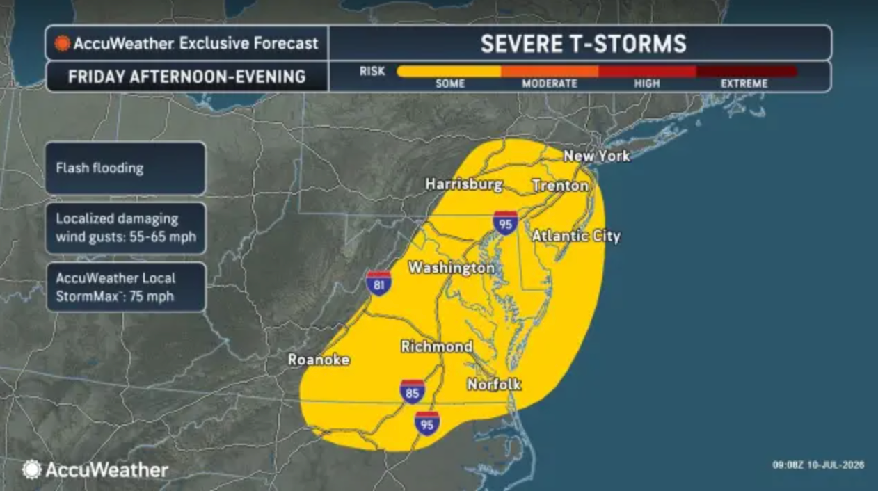
"Because of the high amount of moisture in the air, the thunderstorms in the East will tend to be spotty but mighty with localized flash flooding, as well as microburst wind gusts," AccuWeather Chief On-Air Meteorologist Bernie Rayno said.
On Saturday, a few storms could produce locally damaging wind gusts and isolated instances of flooding, mainly during the afternoon and evening hours. New rainfall amounts could be between a tenth and a quarter of an inch, though locally higher totals are possible.
Find out what's happening in Baltimorefor free with the latest updates from Patch.
While conditions will dry out on Sunday, temperatures will climb heading into the work week as a new heat dome builds across the region.
Last week, a heat dome developed over the Ohio Valley and expanded, AccuWeather forecasters wrote. This time, instead of developing over the Ohio and mid-Mississippi valleys, the heat dome will build northward over the West through the weekend, then surge into the north-central United States early next week. From there, it is expected to expand farther east.
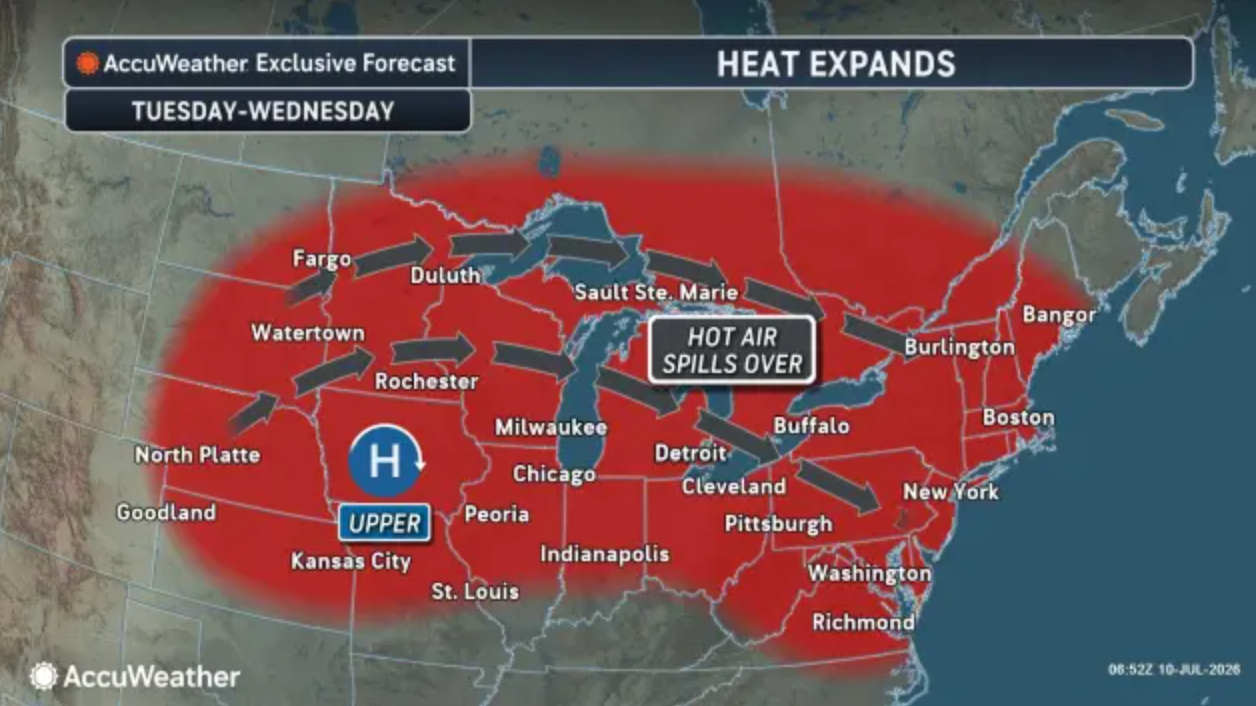
How much of the heat reaches the Appalachians and the Atlantic Seaboard next week remains uncertain. During last week's heat wave, highs reached 100-105 degrees in major Northeast cities, including Baltimore and Washington, D.C.
This time, it appears Maryland will experience just a day or two of extreme heat and high humidity before a cold front moves in. According to AccuWeather, highs are more likely to range from the 90s to near 100 degrees rather than the low 100s.
"Regardless, conditions will still be dangerously hot," AccuWeather forecasters wrote.
Detailed Baltimore-Area Forecast
Friday: A chance of showers and thunderstorms, mainly after 4pm. Partly sunny, with a high near 90. West wind around 7 mph. Chance of precipitation is 30%.
Friday Night: A slight chance of showers and thunderstorms. Mostly cloudy, with a low around 71. Light west wind. Chance of precipitation is 20%.
Saturday: A slight chance of showers and thunderstorms before 2pm, then showers likely and possibly a thunderstorm between 2pm and 4pm, then a chance of showers and thunderstorms after 4pm. Mostly cloudy, with a high near 87. North wind 3 to 7 mph. Chance of precipitation is 70%. New rainfall amounts between a tenth and quarter of an inch, except higher amounts possible in thunderstorms.
Saturday Night: A chance of showers and thunderstorms before 11pm, then a slight chance of showers between 11pm and 2am. Mostly cloudy, with a low around 68. Northeast wind 3 to 5 mph. Chance of precipitation is 30%.
Sunday: Mostly sunny, with a high near 86. Northeast wind 3 to 6 mph.
Sunday Night: Partly cloudy, with a low around 68.
Monday: Mostly sunny, with a high near 87.
Monday Night: Mostly clear, with a low around 67.
Tuesday: Sunny, with a high near 91.
Tuesday Night: Mostly clear, with a low around 72.
Wednesday: Sunny and hot, with a high near 97.
Get more local news delivered straight to your inbox. Sign up for free Patch newsletters and alerts.