Weather
Dramatic 60 Degree Weather Shift Coming To NJ
Thunderstorms and "sub-freezing temperatures" are in the New Jersey forecast for the weekend and workweek.

After days of record-setting heat, the Garden State will be impacted by thunderstorms and a dramatic temperature drop over the weekend and into the workweek, forecasters say.
Find out what's happening in Ridgewood-Glen Rockfor free with the latest updates from Patch.
The picture will change dramatically on Sunday, dropping into the 30s in some areas.
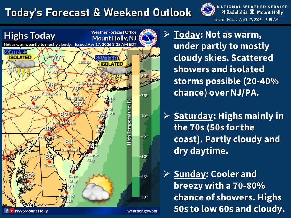
"A strong cold front will cross through the area Sunday morning, resulting in a period of showers and some thunderstorms," f0recasters said. "Much cooler, below normal temperatures are expected into early next week. Widespread frost and/or freeze appears likely Monday night into Tuesday morning."
Find out what's happening in Ridgewood-Glen Rockfor free with the latest updates from Patch.
Forecasters predict that the state will be "outright chilly on Monday with sub-freezing temps possible Monday night."
How Low?
How low will the temperatures go?
Some areas could see temperatures in the 30s on Sunday and into the 20s on Monday night.
The state may also soaked by thunderstorms Sunday, with a better than 70 percent chance of precipitation, according to the chart.

"The heaviest downpours are most likely along the Gulf Coast and from the mid-Atlantic to New England," said Accuweather.
Temperatures are likely to climb back into the spring-like 70s by Wednesday, the NWS says.
Get more local news delivered straight to your inbox. Sign up for free Patch newsletters and alerts.