Weather
Severe Weather Threat Increasing For Hudson Valley: Here's Timeline Of Concern
Find out when thunderstorms are expected to impact the region, according to meteorologists.


HUDSON VALLEY, NY — A hazardous weather outlook alert has been issued for southeast New York due to the potential for thunderstorms today.
The National Weather Service’s alert includes Orange, Putnam, Rockland and Westchester counties in the Hudson Valley.
“Scattered strong to severe thunderstorms are possible with a squall line that is forecast to move through,” the National Weather Service said.
Find out what's happening in Mid Hudson Valleyfor free with the latest updates from Patch.
It anticipates the squall line will begin to impact the region between 5 p.m. and 7 p.m.
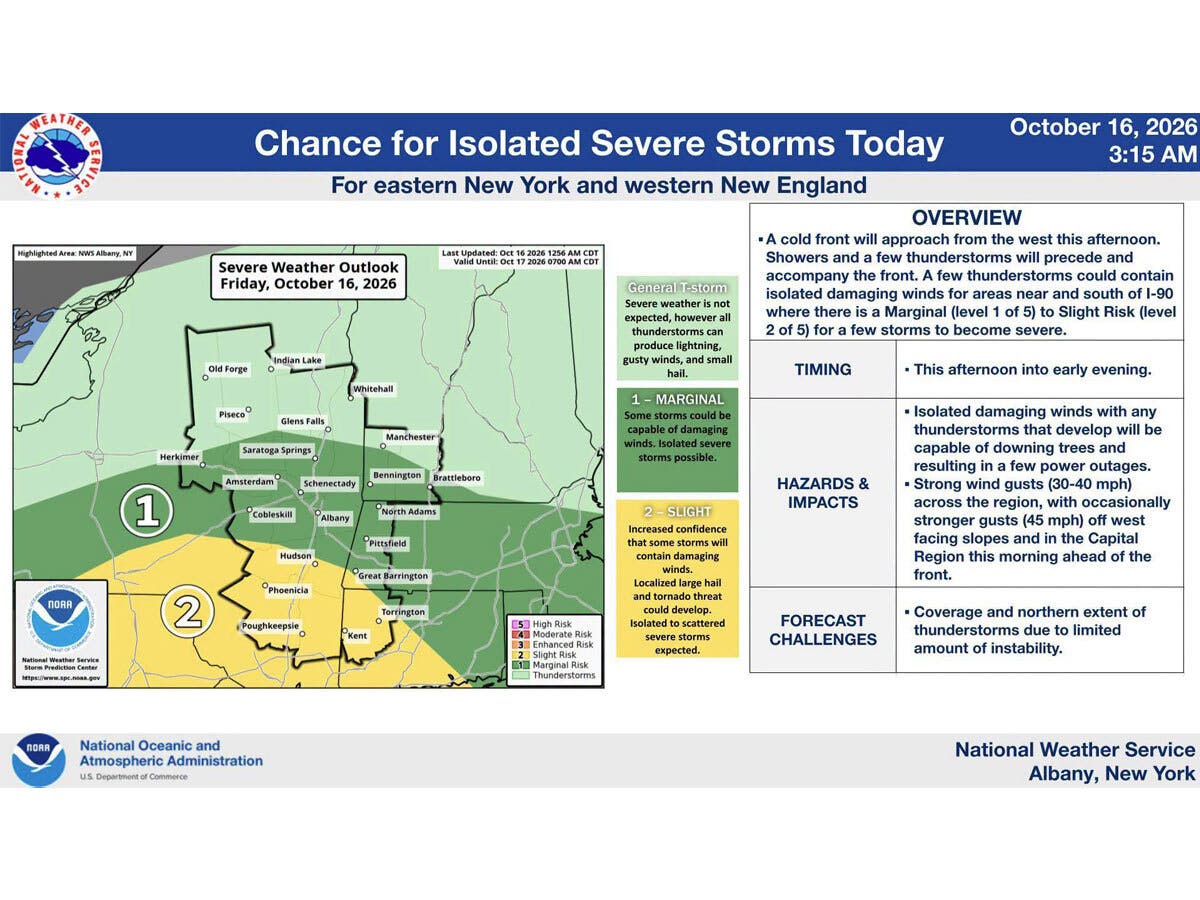
The National Weather Service’s Storm Prediction Center says most of the region is under a slight risk (2 out of 5) for severe storms.
Find out what's happening in Mid Hudson Valleyfor free with the latest updates from Patch.
This morning’s showers are expected to taper off this afternoon. After a lull, an approaching cold front this afternoon brings the thunderstorm risk.
“Another round of showers and scattered thunderstorms (some of which could be strong to severe) arrives late this afternoon into this evening,” the National Weather Service said.
It predicts any severe thunderstorms will be mainly near and south of Interstate 90.
Heavy rain, damaging wind gusts, downed trees and power outages are possible, according to the National Weather Service.
After today’s stormy weather, the weekend looks to be much quieter.
The National Weather Service predicts it will be dry in the Hudson Valley Saturday through Tuesday. Daytime highs will be in the 50s for Saturday through Monday, followed by a warm-up into the 60s for Tuesday. It will be chilly at night this weekend, with both Saturday and Sunday nights dipping into the 30s, according to its meteorologists.
Here are the forecast details for the lower Hudson Valley area via the National Weather Service:
Today: Showers before 2 p.m., then showers and possibly a thunderstorm after 5 p.m. High near 74. Southwest wind 8 to 10 mph, with gusts as high as 22 mph. Chance of precipitation is 90%. New rainfall amounts between a tenth and quarter of an inch, except higher amounts possible in thunderstorms.
Tonight: Showers and possibly a thunderstorm before 8 p.m., then showers likely. Low around 45. West wind 8 to 11 mph, with gusts as high as 23 mph. Chance of precipitation is 80%. New precipitation amounts between a tenth and quarter of an inch, except higher amounts possible in thunderstorms.
Saturday: Mostly cloudy, then gradually becoming sunny, with a high near 52. Northwest wind 11 to 15 mph, with gusts as high as 26 mph.
Saturday Night: Mostly clear, with a low around 35. North wind 7 to 9 mph.
Sunday: Sunny, with a high near 55. North wind around 6 mph becoming east in the afternoon.
Sunday Night: Mostly clear, with a low around 39.
Monday: Mostly sunny, with a high near 59.
Monday Night: Partly cloudy, with a low around 43.
Tuesday: Mostly sunny, with a high near 64.
Here are the forecast details for the Mid-Hudson Valley area via the National Weather Service:
Today: A chance of showers and thunderstorms, then showers likely and possibly a thunderstorm after 5 p.m. Mostly cloudy, with a high near 73. South wind 7 to 9 mph, with gusts as high as 22 mph. Chance of precipitation is 60%. New rainfall amounts between a quarter and half of an inch possible.
Tonight: Showers and possibly a thunderstorm before 9 p.m., then a slight chance of showers between 9 p.m. and 10 p.m. Low around 42. Southwest wind 5 to 9 mph becoming northwest after midnight. Winds could gust as high as 23 mph. Chance of precipitation is 80%. New precipitation amounts between a tenth and quarter of an inch, except higher amounts possible in thunderstorms.
Saturday: Mostly sunny, with a high near 52. North wind 9 to 14 mph, with gusts as high as 29 mph.
Saturday Night: Clear, with a low around 29. North wind around 6 mph becoming calm in the evening.
Sunday: Sunny, with a high near 58. Light northwest wind.
Sunday Night: Mostly clear, with a low around 35.
Monday: Sunny, with a high near 61.
Monday Night: Partly cloudy, with a low around 38.
Tuesday: Mostly sunny, with a high near 65.
Get more local news delivered straight to your inbox. Sign up for free Patch newsletters and alerts.