Weather
Another Round Of Hazardous Weather Targets PA
Following a day of strong thunderstorms that hit PA on Tuesday, more storms are expected to develop throughout the day Wednesday.


Following severe thunderstorms that hit Pennsylvania on Tuesday, forecasters expect more severe storms to develop across the region on Wednesday.
According to the latest forecast from the National Weather Service (NWS), scattered thunderstorms are forecast to develop throughout the day on Wednesday and Wednesday night.
While the exact timing and coverage of any severe storms is uncertain, the weather service said these storms could linger "well into the night."
Find out what's happening in Across Pennsylvaniafor free with the latest updates from Patch.
The primary hazard is damaging winds, as well as hail and possible tornadoes, mainly across Southeast PA, as well as parts of New Jersey and Delmarva.
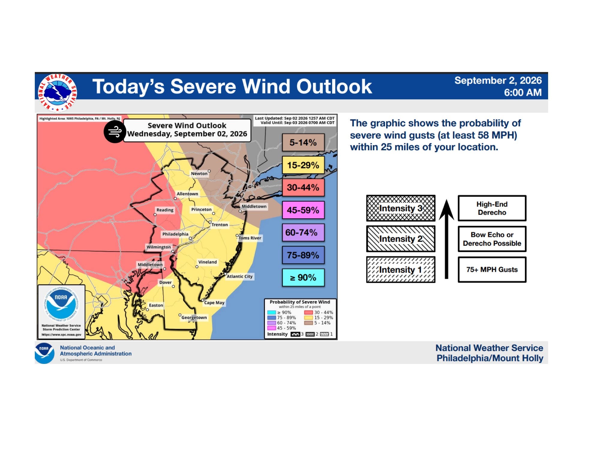
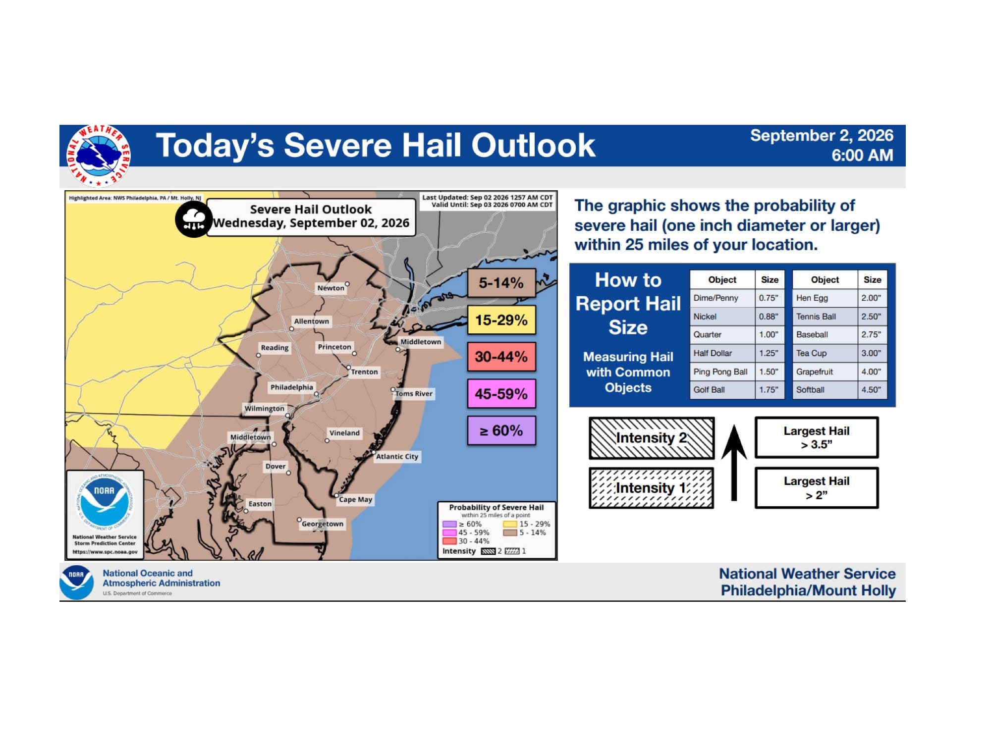
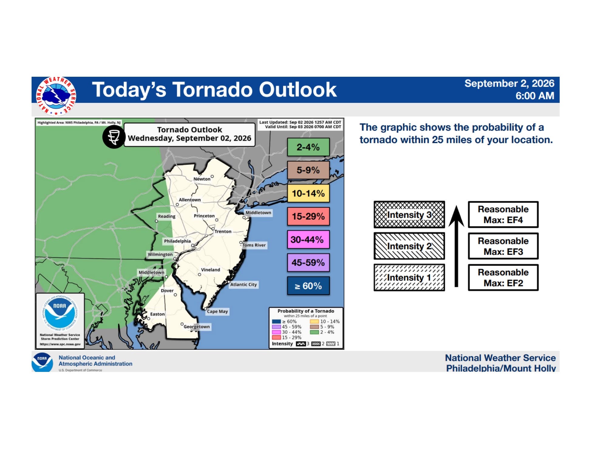
"The severe thunderstorm risk for today into tonight remains highly conditional and uncertain," the NWS said Wednesday morning. "There remains a risk of severe thunderstorms for much of the area on Thursday."
Find out what's happening in Across Pennsylvaniafor free with the latest updates from Patch.
According to the NWS, some severe thunderstorms could be capable of producing damaging winds (58+ MPH), large hail (1-inch or larger) and/or a tornado.
Alongside the risk for severe weather, a Heat Advisory will go into effect from 11 a.m. until 8 p.m. on Thursday, with heat index values of up to 102 degrees expected.
The advisory is in effect in Pennsylvania, Delaware, Eastern Montgomery, Lower Bucks and Philadelphia Counties, as well as parts of Delaware and New Jersey.
The NWS is advising residents to monitor the latest forecasts and make sure they can receive watches and warnings as forecasts develop.
Here's the latest weather forecast from the National Weather Service:
- Wednesday: A slight chance of showers between 2 p.m. and 4 p.m. Mostly cloudy, with a high near 80. East wind around 5 MPH. Chance of precipitation is 20%.
- Wednesday Night: Showers and thunderstorms likely, mainly between 2 a.m. and 3 a.m. Mostly cloudy, with a low around 70. East wind around 5 MPH becoming calm in the evening. Chance of precipitation is 60%. New rainfall amounts of less than a tenth of an inch, except higher amounts possible in thunderstorms.
- Thursday: A chance of showers and thunderstorms, mainly after 3 p.m. Partly sunny, with a high near 92. Light southwest wind increasing to 5-10 MPH in the morning. Chance of precipitation is 30%. New rainfall amounts of less than a tenth of an inch, except higher amounts possible in thunderstorms.
- Thursday Night: A chance of showers and thunderstorms before 2 a.m. Mostly cloudy, with a low around 73. Southwest wind around 5 MPH becoming calm in the evening. Chance of precipitation is 50%. New rainfall amounts of less than a tenth of an inch, except higher amounts possible in thunderstorms.
- Friday: A chance of showers and thunderstorms after 2 p.m. Partly sunny, with a high near 87. Light northwest wind increasing to 5-10 MPH in the morning. Chance of precipitation is 40%. New rainfall amounts between a tenth and quarter of an inch, except higher amounts possible in thunderstorms.
- Friday Night: A chance of showers and thunderstorms before 8 p.m. Partly cloudy, with a low around 66. Chance of precipitation is 30%. New precipitation amounts of less than a tenth of an inch, except higher amounts possible in thunderstorms.
- Saturday: Sunny, with a high near 82.
- Saturday Night: Mostly clear, with a low around 62.
- Sunday: Sunny, with a high near 79.
- Sunday Night: Partly cloudy, with a low around 61.
- Labor Day: Sunny, with a high near 81.
- Monday Night: Partly cloudy, with a low around 63.
Get more local news delivered straight to your inbox. Sign up for free Patch newsletters and alerts.