Weather
Rachel Prompts First Tropical Storm Watch In Southern California Since 2023
The storm is expected to bring heavy rain, strong winds and coastal flooding, with the worst conditions arriving late Saturday into Sunday.


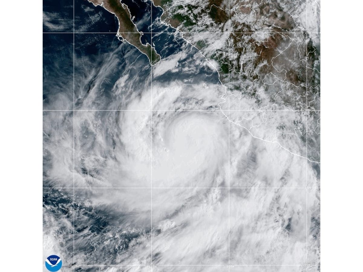
A rare tropical storm watch has been issued for Southern California as Tropical Storm Rachel approaches the U.S.-Mexico border, threatening parts of the region with flash flooding, strong winds, dangerous surf and coastal flooding through the weekend.
San Diego County is expected to experience some of the storm's most significant impacts, particularly in its coastal communities, inland valleys, mountains and deserts. However, Rachel's effects will extend well beyond San Diego to parts of Orange, Riverside, San Bernardino, Los Angeles, Ventura, Santa Barbara and San Luis Obispo counties.
The tropical storm watch covers San Diego County and nearby coastal waters, including areas extending west toward San Clemente Island.
Find out what's happening in Los Angelesfor free with the latest updates from Patch.
The Weather Channel says it is the first tropical storm watch issued anywhere in Southern California since 2023, when Hurricane Hilary brought widespread flooding and damaging conditions to the region. Hilary weakened below tropical storm strength before reaching California.
Farther north, coastal flooding and dangerous surf could affect communities from Orange County through Los Angeles and Ventura counties, including Long Beach, Malibu, Zuma Beach and Catalina Island. Inland areas, particularly mountains and deserts, face heightened risks of heavy rain, flash flooding and strong winds.
Find out what's happening in Los Angelesfor free with the latest updates from Patch.
The National Weather Service said Rachel's most significant impacts are expected late Saturday night through early Sunday afternoon, when the heaviest rain and strongest winds are forecast. Showers could continue through Monday and Tuesday across portions of Southern California, while dangerous surf and coastal flooding may persist into Tuesday.
Where Is Tropical Storm Rachel Now?
As of 8 a.m. PDT Saturday, the National Hurricane Center reported Rachel was about 520 miles south-southwest of San Diego, moving northeast at 22 mph.
The storm had maximum sustained winds of 60 mph and was expected to make landfall in northern Baja California, just south of the U.S.-Mexico border, on Saturday evening.
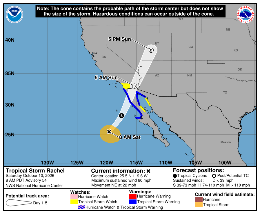
Rachel could maintain tropical storm strength through landfall and potentially into portions of southeastern California early Sunday, The Weather Channel reported.
Tropical storm warnings are in effect for portions of Baja California, where sustained winds of at least 39 mph are expected. A tropical storm watch means those conditions are possible, but not certain, in the affected areas.
Heavy Rain And Flash Flooding
Rain will become more widespread Saturday night, with the heaviest rainfall expected Sunday, particularly in San Diego County's mountains and deserts.
The National Weather Service forecasts 0.5 to 1.25 inches of rain across San Diego County's coastal areas, valleys and deserts, with 1 to 2.5 inches in the mountains. Locally higher amounts are possible.
Rainfall rates could reach 1 inch per hour in mountainous areas, increasing the risk of flash flooding, mudslides and rockslides.
Flooding could affect roads, underpasses, urban neighborhoods, normally dry washes and low-lying areas. Streams and arroyos could rise rapidly, creating dangerous conditions for drivers and hikers.
The Weather Channel warned that Rachel's moisture could produce 1 to 5 inches of rain across the broader Southwest, with locally higher totals possible. Flash flooding could extend into the Los Angeles Basin, Las Vegas and other parts of the region.
Additional showers and isolated thunderstorms could linger through Monday and Tuesday.
Strong Winds And Possible Power Outages
Wind gusts could exceed 40 mph in portions of Southern California on Sunday, with the strongest winds expected in San Diego County's mountains and deserts.
The National Weather Service forecasts gusts of 40 to 55 mph along desert mountain slopes and in desert communities. Isolated gusts could reach 60 mph along mountain ridges, passes and canyons.
Coastal communities, including San Diego, Oceanside, Carlsbad and Chula Vista, could see gusts around 30 mph, although stronger tropical storm-force gusts remain possible.
The winds could bring down tree limbs, damage unsecured outdoor structures, create hazardous driving conditions and cause scattered power outages.
Offshore, seas of 6 to 10 feet and tropical storm-force winds could create dangerous conditions for boaters, with the strongest marine winds most likely before noon Sunday.
Coastal Flooding And Dangerous Surf
Coastal flooding is among the biggest threats, especially along south-facing beaches in Los Angeles, Orange and San Diego counties.
Coastal flood warnings are in effect through Sunday afternoon for portions of Southern California, with the greatest impacts expected Sunday morning as Rachel's swells combine with strong onshore winds and unusually high tides.
In San Diego and Orange counties, waves could reach 6 to 9 feet Sunday. Tides exceeding 7 feet could worsen flooding and accelerate beach erosion.
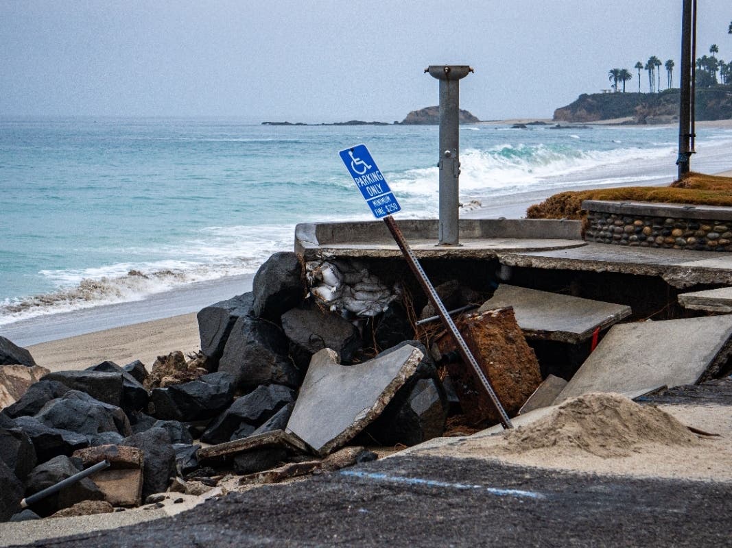
Flooding could affect beachfront homes, businesses, roads and walking paths. Dangerous rip currents and large breaking waves will also make swimming hazardous.
The National Weather Service expects some coastal flooding to continue after the storm passes, with coastal flood advisories extending into Tuesday.
Farther north, forecasters identified Long Beach, Malibu, Zuma Beach and Catalina Island among areas vulnerable to coastal flooding.
Major Cooldown Across Southern California
Rachel's arrival coincides with a major weather pattern change that will bring much cooler temperatures after an extended period of heat.
According to the National Weather Service in Los Angeles, temperatures could fall 6 to 12 degrees below normal Monday, with highs generally in the 60s and 70s.
Los Angeles, which reached 88 degrees Friday, is forecast to cool to 69 degrees Monday. Burbank could drop from 90 degrees Friday to 68 degrees Monday, while Pasadena could fall from 90 to 66 degrees.
Rain showers are possible from Saturday through Tuesday across the Los Angeles region, with the greatest chances Sunday and Monday.
Forecasters expect rainfall totals of 0.25 to 1 inch across much of the region, with locally higher amounts in the San Gabriel Mountains.
What Residents Should Know
Residents in flood-prone areas should prepare for rapidly changing conditions, especially Saturday night and Sunday.
The National Weather Service urges residents to avoid driving through flooded roads, stay away from beaches and rocky shorelines, secure loose outdoor items and monitor local emergency alerts.
People living near streams, steep hillsides or coastal flood zones should be prepared to move to higher ground if conditions worsen.
Although Rachel's exact track could still shift, forecasters emphasized that dangerous flooding, strong winds and coastal hazards can extend well beyond the storm's center.
Get more local news delivered straight to your inbox. Sign up for free Patch newsletters and alerts.