Weather
Summer Refuses To Quit As Minnesota Enters Meteorological Fall
Highs will flirt with 90 degrees this week, and federal forecasters say the warm pattern isn't done yet.


TWIN CITIES, MN — Tuesday marks the start of meteorological fall, but the weather across Minnesota has not gotten the memo.
The National Weather Service forecast calls for a high near 89 degrees today, with showers likely tonight and a 70% chance of precipitation.
Wednesday brings a brief dip to 84 before temperatures climb back into the upper 80s and near 90 for Thursday through Saturday. Nightly thunderstorm chances continue through much of the week, with some storms capable of turning strong to severe.
Find out what's happening in Minneapolisfor free with the latest updates from Patch.
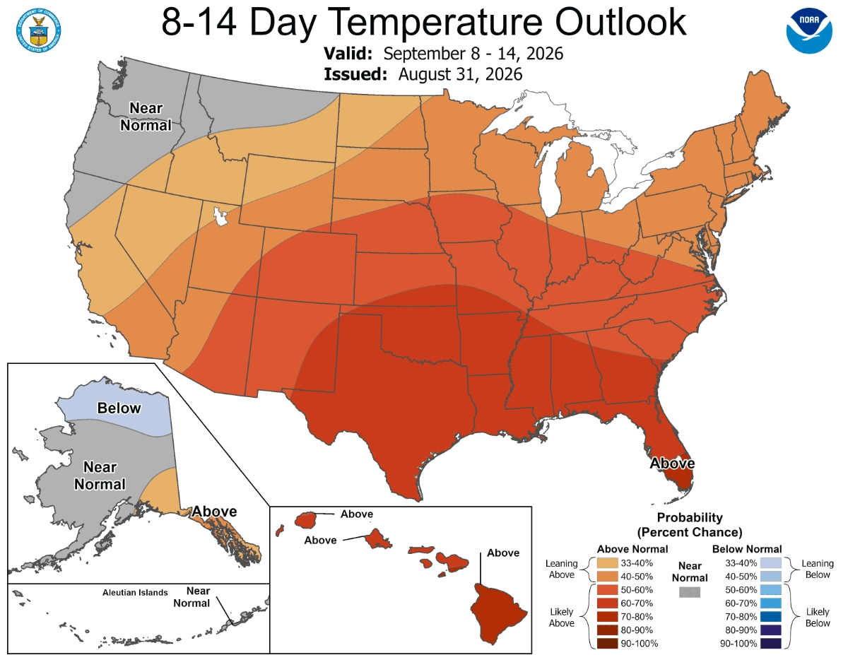
The warmth is not expected to be a one week blip. NOAA's Climate Prediction Center released its 8 to 14 day temperature outlook Monday, showing Minnesota and Wisconsin with a 40 to 50% chance of above normal temperatures for the period spanning September 8 through 14.
The signal strengthens further south, with the Southern Plains and Gulf Coast facing a 70 to 90% likelihood of above normal readings over the same stretch.
Find out what's happening in Minneapolisfor free with the latest updates from Patch.
For now, the forecast points to a stretch of overnight storm chances paired with daytime highs that would not look out of place in July, even as the calendar turns toward autumn.
Get more local news delivered straight to your inbox. Sign up for free Patch newsletters and alerts.