Weather
Extreme Heat Warning, Flood Watch In Effect For Southern Wisconsin
An Extreme Heat Warning is in effect through this evening as a Flood Watch and periodic storm chances loom into the holiday weekend.

MILWAUKEE, WI — An Extreme Heat Warning remains in effect for portions of south central and southeastern Wisconsin through this evening, with heat index values expected to reach 95 to 100 degrees, according to the National Weather Service.
Temperatures reached 87 degrees by early afternoon Thursday at General Mitchell International Airport, with a heat index of 90 degrees and humidity at 53 percent, NWS data show.
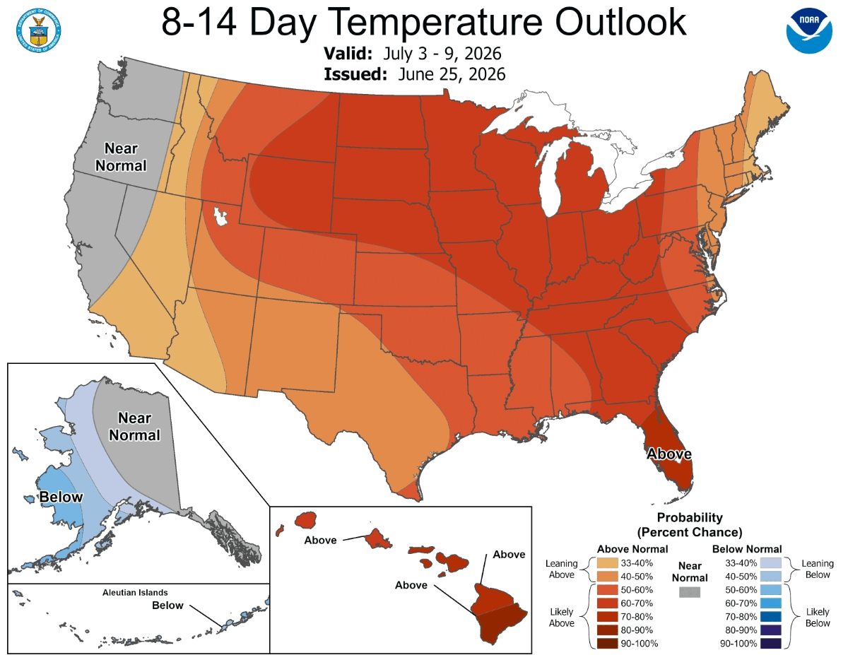
Forecasters say dangerous, record-breaking heat will persist across the central and eastern United States through Friday before the hottest conditions shift east for the Independence Day weekend.
Find out what's happening in Milwaukeefor free with the latest updates from Patch.
The weather service has also issued a Flood Watch for Sauk County through Friday morning, warning that flash flooding caused by excessive rainfall is possible. Chances for thunderstorms are expected this evening and overnight across the region, with all hazards possible before storms weaken late tonight.
Periodic chances for thunderstorms are expected to continue throughout the holiday weekend, forecasters said. Some storms could turn strong to severe with heavy rainfall, though confidence remains low on the exact timing of each round. The weather service noted that storm spotter activation may be needed at times into the weekend.
Find out what's happening in Milwaukeefor free with the latest updates from Patch.
The Milwaukee-area forecast calls for a 30 percent chance of showers and storms this afternoon, mainly after 5 p.m., with a high near 89. Storm chances rise to 50 percent overnight into Friday morning, with a low around 71.
Friday's forecast includes a continued 50 percent chance of showers and thunderstorms, mainly after 8 a.m., with a high near 85.
Rain chances persist into the holiday weekend. The Fourth of July forecast calls for a 60 percent chance of showers and thunderstorms with a high near 76, a sharp drop from the heat earlier in the week. Showers remain likely into Saturday night with a 70 percent chance of precipitation, before conditions gradually clear through Sunday.
Temperatures are expected to moderate into early next week, with highs in the upper 70s to low 80s, according to the National Weather Service.
Get more local news delivered straight to your inbox. Sign up for free Patch newsletters and alerts.