Weather
Tornadoes Possible With Severe Storms Across Metro Detroit Through Tuesday
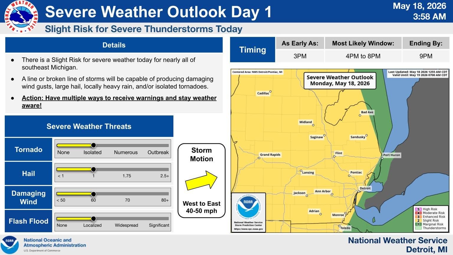
Severe storms are possible across the Detroit area Monday and Tuesday as warm, humid air moves into the region.

Multiple waves of severe storms are possible across the Detroit area Monday and Tuesday as warm, humid air moves into the region, according to the National Weather Service.
The first wave of severe storms will move into the area sometime between 3 and 9 p.m. Monday when highs reach the upper 80s, according to NWS.
Forecasters warned those storms will be capable of producing heavy downpours, large hail, winds up to 60 miles per hour and isolated tornadoes.
Find out what's happening in Detroitfor free with the latest updates from Patch.
Another round of severe storms will be possible again Tuesday with even warmer temperatures across the region, according to NWS.
Highs Tuesday will reach near 90 degrees when the storms move into the Detroit region sometime between 2 and 8 p.m.
Find out what's happening in Detroitfor free with the latest updates from Patch.
The greatest threats from those storms will be isolated tornadoes, damaging winds, large hail and heavy downpours.
All of southeastern Michigan has been placed under a slight risk (level 2/5) for severe weather on Monday and Tuesday.
Wednesday's high will tumble back into the 60s where temperatures will stay for Thursday and Friday as well, according to NWS.
Overnight lows will drop into the 40s, so there is no frost threat across the region, according to NWS.
Warmer temperatures return to the region for the weekend with highs in the 70s, along with a slight chance for rain Saturday, according to NWS.
Here is an extended look at the NWS forecast for the Detroit area:
Monday: Storms; High 87, Low 68
Tuesday: Storms; High 89, Low 55
Wednesday: Sunny; High 67, Low 43
Thursday: Sunny; High 62, Low 49
Friday: Chance for Rain; High 68, Low 55
Get more local news delivered straight to your inbox. Sign up for free Patch newsletters and alerts.