Weather
Potential Tropical Storm Takes Aim At East Coast: See VA Impacts
A developing storm could bring rain and gusty winds to Northern Virginia Sunday into Monday, with the greatest rain chances east of I-95.


Northern Virginia's stretch of unusually warm November weather could take a stormy turn this weekend as a developing coastal system threatens rain, gusty winds and potentially hazardous conditions along the East Coast.
The National Hurricane Center said Thursday that a weather system near Florida and the Bahamas has a 60 percent chance of becoming a tropical or subtropical cyclone within the next seven days.
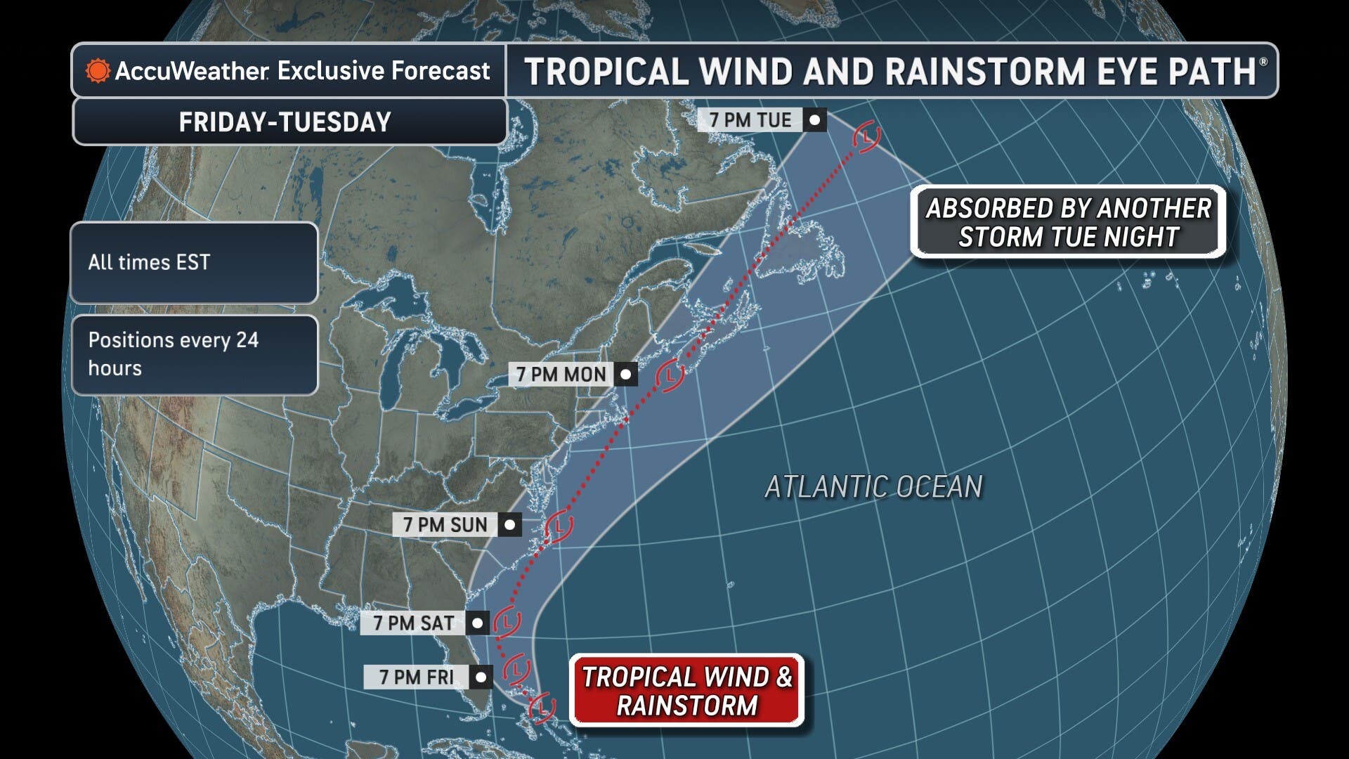
Forecasters expect a low-pressure system to form east of Florida on Friday before moving north or northeast near the East Coast through the weekend.
Find out what's happening in Across Virginiafor free with the latest updates from Patch.
The system has a 30 percent chance of developing into a tropical or subtropical cyclone within 48 hours, according to the hurricane center's 1 p.m. Thursday update.
Whether the storm becomes a named system or not, it could bring disruptive weather to portions of Virginia.
Find out what's happening in Across Virginiafor free with the latest updates from Patch.
The National Hurricane Center warned that strong winds, dangerous surf and coastal flooding are likely along portions of the Southeast and Mid-Atlantic coasts into early next week.
What Could Northern Virginia See?
For communities across Fairfax, Arlington, Alexandria, Loudoun and Prince William counties, the biggest question is how close the storm will track to the coast.
The National Weather Service in Sterling said Thursday afternoon that rain chances are increasing Sunday into Sunday night, particularly east of the Blue Ridge Mountains.
The greatest confidence in rainfall is east of Interstate 95, putting eastern Prince William County and the Alexandria area among the Northern Virginia communities more likely to see rain.
But the difference between a soaking rain and a relatively quiet weekend could come down to the storm's exact path.
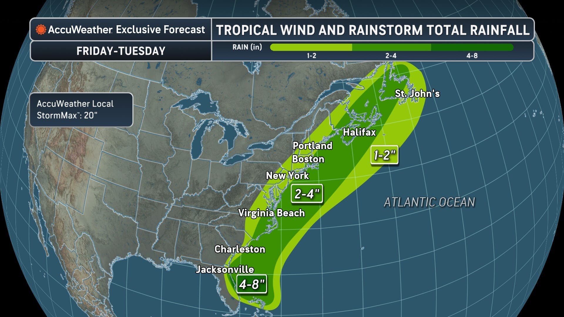
Some forecast models show the potential for 2 to 4 inches of rain in a worst-case scenario, while others suggest much of the region could receive little or no rainfall.
Those higher totals are possibilities, not the official rainfall forecast.
A storm tracking closer to the coast could spread heavier rain and stronger winds inland. If it remains farther offshore, Northern Virginia could escape the worst conditions.
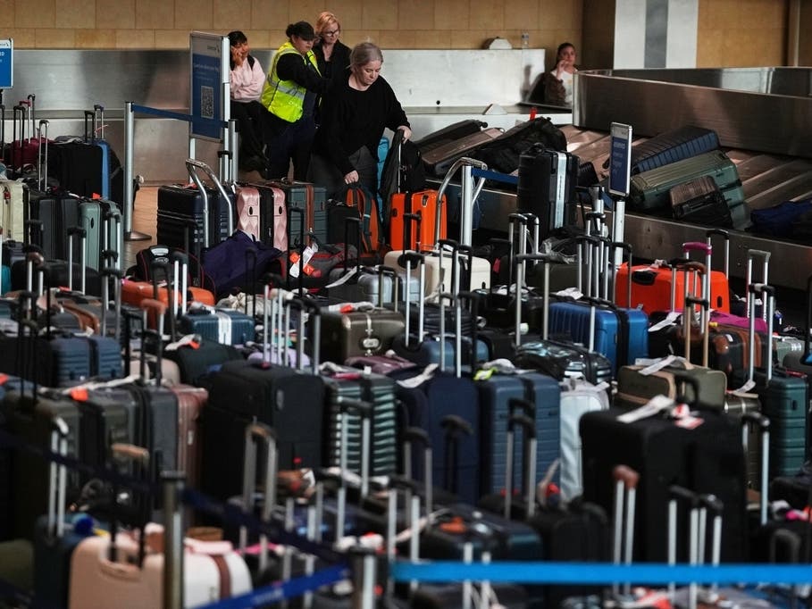
The National Weather Service also said rain and reduced visibility could affect airports Sunday into Monday, although the extent of any disruption remains uncertain.
Coastal Virginia Could Face Bigger Impacts
The storm could pose a greater threat to communities along Virginia's Atlantic coastline and the Chesapeake Bay.
AccuWeather warned that a track close to shore could bring stronger winds, heavy rain, rough surf and coastal flooding to portions of the Mid-Atlantic.
For Northern Virginia, forecasters are also watching the tidal Potomac River and nearby waterways, where changing winds could affect water levels.
The National Weather Service said stronger winds are possible over regional waterways late Sunday into Monday. Gale-force winds cannot be ruled out if the storm tracks closer to shore.
Warm Weather First, Then A Cooldown
Before the storm arrives, Northern Virginia has a few more days of pleasant weather ahead.
Temperatures will remain above average through Friday, with afternoon highs in the 60s and some areas reaching the lower 70s.
Saturday should remain dry, although clouds will begin increasing as the coastal system approaches.
Sunday brings the greatest chance for rain, with unsettled conditions potentially lingering into Monday.
Afterward, a strong Canadian high-pressure system is expected to bring much colder, brisk weather to the region early next week.
Forecasters are also monitoring another possible weather system near Thanksgiving, but its timing and impacts remain highly uncertain.
For now, residents with weekend travel plans should keep an eye on the forecast, especially those heading toward the Virginia coast or traveling along Interstate 95.
Detailed Northern Virginia Forecast
Thursday: Sunny and mild, with a high near 66 degrees. Partly cloudy Thursday night, with a low around 37.
Friday: Sunny and unseasonably warm, with a high near 68 degrees. Mostly clear Friday night, with a low around 38.
Saturday: Mostly sunny, with a high near 65 degrees. Mostly cloudy Saturday night, with a low around 45.
Sunday: Mostly cloudy, with a 40 percent chance of rain, mainly after 1 p.m. Highs near 62 degrees. A slight chance of rain Sunday night, with a low around 48.
Monday: Mostly sunny, with a high near 63 degrees. Mostly clear Monday night, with a low around 35.
Tuesday: Sunny and cooler, with a high near 51 degrees. Partly cloudy Tuesday night, with a low around 29.